

Les conditions naturelles et géographiques favorables de l’Azerbaïdjan ont provoqué l’installation de personnes sur son territoire.
Les anciens écrivains Hérodote (Ve siècle av. J.-C.), Polibey (200 av. J.-C.-120 av. J.-C.), Strabon (64/63 – 23 / 24 av. , régions habitées, tribus, résidant dans le pays, la mer Caspienne dans un certain nombre de leurs œuvres créatives. Plus tard, les scientifiques et voyageurs arabes en géographie Ibn Khordadbeh (820/826-912/913), Abu-Ishaq Isterkhi (env. 820-934), le scientifique azerbaïdjanais Mohamed Nakhchivani (fin XIIIe-milieu XIVe siècles), les scientifiques iraniens Reshidaddin Fazlullah (1247- 1317) a écrit sur l’économie de l’Azerbaïdjan, sa division administrative, ses montagnes et ses rivières, les distances qui les séparent, les routes commerciales, etc. L’historien albanais (Caucase) Musa Kalantarli (7-8e siècle) dans son ouvrage « L’histoire de l’Albanie » a décrit l’Albanie comme un pays de renommée mondiale avec une nature riche et une population dense, des sols fertiles, de beaux jardins et des plaines verdoyantes. La carte du monde (1459) du Vénitien F.Maurov, les cartes d’Alsharif (1601), scientifique et voyageur allemand A. Olear), ainsi que la carte « Transcaucasie orientale et mer Caspienne », dessinée en 1720 et publiée en 1723 par ordre de Pierre Ier comprenait les régions habitées, les lacs et les rivières de l’Azerbaïdjan.
Le géologue azerbaïdjanais Abdurrashid Bakuvi a exprimé son point de vue sur le climat de l’Azerbaïdjan, la nature de Bakou et la production de pétrole dans cette ville, Haji Zeynalabdin Shirvani et Abbasgulu Agha Bakikhanov ont partagé leurs opinions sur les caractéristiques géographiques de notre pays. V. Abikh, I.Figurovsky, A.Zakharov et d’autres ont également apporté une grande contribution à l’exploration du territoire de l’Azerbaïdjan. Une exploration complexe de l’Azerbaïdjan a commencé à l’époque de l’Union soviétique lorsque des cartes à différentes échelles ont été publiées et des atlas géographiques ont été dessinés. L’Académie des sciences d’Azerbaïdjan a joué un rôle important dans une étude approfondie du territoire de notre pays.
La position historique et géographique de la République d’Azerbaïdjan
L’ancien Azerbaïdjan situé en Asie centrale et couvrait la région allant du sud-est du Caucase à la région montagneuse au sud et au sud-est du lac d’Ourmia. Sa superficie dépasse 200 000 km2.
L’ensemble de l’Azerbaïdjan se situe dans l’hémisphère nord à peu près à la même latitude que l’Espagne, la Grèce, la Turquie, la Chine et la Corée. Les routes stratégiquement importantes menant de l’Europe à l’Asie centrale et orientale passaient par l’Azerbaïdjan.
Le territoire de la république s’étend sur 400 km du nord au sud et sur 500 km d’ouest en est, et se situe entre la latitude 38’25 »-41’55 » nord et la longitude 50′-50’51 » est.
La République située à la jonction de l’Europe et de l’Asie a une position géopolitique et géographique unique et n’a pas perdu son importance stratégique pour les relations économiques et culturelles.
Paysage
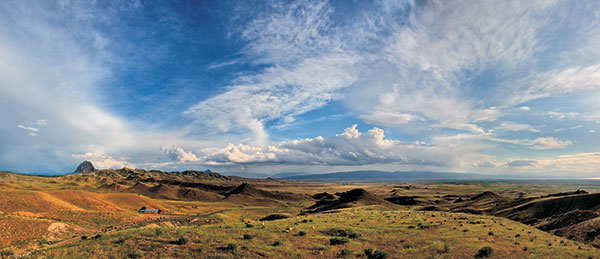
L’Azerbaïdjan se caractérise par un paysage diversifié. Il existe deux formes principales de paysage : les plaines et les montagnes.
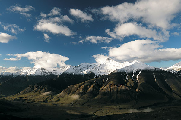
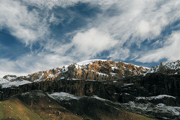
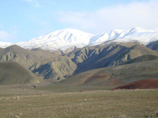
Les montagnes couvrent 60% de la superficie totale de la république d’Azerbaïdjan. Les principales structures géomorphologiques de la République d’Azerbaïdjan : le Caucase majeur, le Caucase mineur (avec le plateau de Garabagh) et les montagnes Talysh entourent la plaine de Kur-Araz au nord, à l’ouest et au sud-est. La République autonome du Nakhitchevan est située à mi-parcours de la rivière Araz et dans les limites des chaînes de montagnes Zengezur et Dereleyez, bordées par la rivière.
L’altitude moyenne du territoire de la République peut atteindre 400 mètres. Mais la plaine de la côte de la mer Caspienne est en dessous du niveau de la mer (actuellement -26,5 mètres) tandis que le plus haut sommet Bazarduzu culmine à 4466 mètres. Ainsi, on peut voir que le dénivelé équivaut à près de 4500 mètres dans le pays.
La partie nord du Grand Caucase est située en Azerbaïdjan. Deux mentons de montagnes se distinguent dans cette partie : la chaîne de Head ou Watershed avec Bazarduzu (4466 mètres) et la chaîne de Great (Side) avec l’alpe Shahdagh (4243). Les chaînes de montagnes descendent à 1000-700 mètres au sud-est. Les chaînes de montagnes du Caucase majeur sont entourées de zones de contreforts: un plateau de steppe au nord-ouest, Gobustan au sud-est, la plaine d’Alazan-Ayrichay au sud-ouest et la plaine en pente de Gusar au nord-est.
Les montagnes sont formées par des roches moins exposées à la dénudation qui coulent des périodes du Crétacé et du Jurassique. Les contreforts sont caractérisés par des badlands (plaines de Jeyranchol et Ajynour) et des volcans de boue (Gobustan et Absheron). La vallée de Gusar et Alazan-Hefteran est composée d’une épaisse couche de sédiments graveleux quaternaires.
Le Caucase mineur entoure le pays au sud-ouest et à l’ouest et est composé d’un certain nombre de chaînes et de plateaux d’une hauteur relativement faible. Murovdag, Shahdagh et Zangazur sont les principales chaînes du Caucase mineur. Le plateau de Garabagh, s’étendant du sud de Murovdagh jusqu’à la rivière Araz, repose sur les cônes de volcans éteints et de lave quaternaire. Le Caucase mineur est formé de roches volcanogènes et sédimentaires du Jurassique et du Crétacé.
Les montagnes Talysh couvrent le sud-est du pays. Ils sont composés principalement de sédiments tertiaires. Les montagnes Talysh sont la chaîne de transition du Caucase mineur aux montagnes d’Elbrouz en Iran. Ils se composent de trois chaînes de montagnes, atteignant 2477 mètres de hauteur et un certain nombre de leurs chaînes.
La plaine de Kur-Araz se situe dans la zone située entre le Caucase majeur et mineur et les montagnes Talysh. En tant que plus grande plaine intermontagnarde de toute la Transcaucasie, elle couvre la partie centrale du pays. Les rivières Kur et Araz divisent la plaine en cinq plaines : les plaines de Shirvan, Garabagh, Mil, Mughan et Salyan.
La plaine de Samur-Devechi, reposant sur la plaine en pente de Gusar au bord de la mer Caspienne, s’étend de la péninsule d’Absheron au nord. La plaine de Lankaran s’étend de la péninsule d’Absheron au sud sur les contreforts des montagnes Talysh. Kur-Araz, Samur-Devechi, les basses terres de Lankaran et la plupart des parties de la péninsule d’Absheron se trouvent sous le niveau de la mer.
Climat
Le climat en Azerbaïdjan est fortement influencé par la position géographique, le paysage et la mer Caspienne. Les types de climat semi-désertique et sec, subtropical, tempéré et glacial dominent le pays. Il a été déterminé que l’Azerbaïdjan représente 8 des 11 zones climatiques existant dans le monde (par V.V.Keppen). Le climat subtropical sec est typique de la plaine de Kur-Araz et d’Absheron. Le climat subtropical humide n’est observé que dans les montagnes, les contreforts et les basses terres de Lankaran. Climat tempéré observé les versants du Caucase majeur et mineur principalement couverts de forêts se divisent en zones sèches, tempérées chaudes sèches, tempérées chaudes humides et tempérées. Le climat glacial est typique des hautes chaînes de montagnes, au sommet du Caucase majeur et mineur, des prairies alpines et subalpines. Les températures annuelles moyennes sont égales à 15°C dans les plaines alors que dans les régions de haute montagne elles tombent même en dessous de zéro. Les températures atteignent 25-27C dans les régions d’Aran et 5C dans les régions montagneuses en juillet. Le maximum absolu est de 43C, tandis que le minimum est inférieur à -30C. Ces températures minimales et maximales ont été enregistrées dans la plaine et les montagnes du Nakhitchevan. Les précipitations ne sont pas non plus égales sur l’ensemble du territoire du pays. La péninsule d’Absheron et la République autonome du Nakhitchevan enregistrent un niveau de précipitations annuel inférieur (200 mètres). Les précipitations sont égales à 200-300 mm dans la plaine de Kur-Araz, 600-800 mm sur les pentes nord-est du Caucase majeur et mineur, 1200-1300 mm sur les pentes sud du Caucase majeur à une hauteur de 2000-2500 mètres. Les précipitations sont les plus élevées (1200-1700 mm) dans le sud des basses terres de Lankaran et les contreforts des montagnes Talysh.
Les vents dominants soufflent vers le nord (la péninsule d’Absheron), le sud-ouest (la plaine de Kur-Araz) et l’ouest (la plaine de Lankaran).
Eaux intérieures
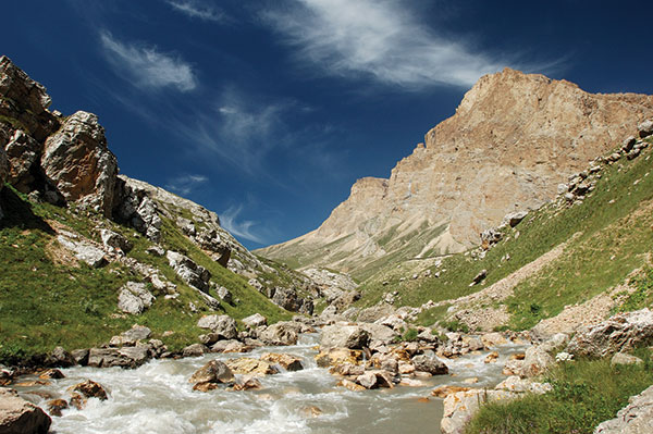
Le système fluvial dense du pays couvre son territoire comme une toile d’araignée bleue. L’Azerbaïdjan compte 8400 petits et grands fleuves, dont 850 sur 5 kilomètres de long. Mais il n’y a que 24 rivières s’étendant sur plus de 100 kilomètres.
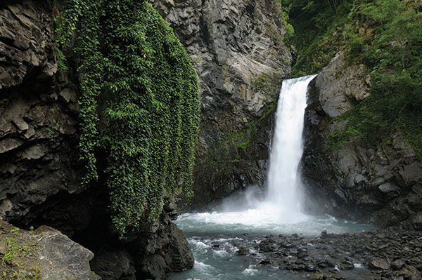
Les fleuves Kur et Araz, les plus grands fleuves du Caucase, sont les principales sources d’énergie hydroélectrique et d’irrigation.
La rivière Kur prend sa source à une hauteur de 2740 mètres sur le versant nord-est du Qyzylgedikdagh en Turquie. Il traverse la Géorgie et entre en Azerbaïdjan, traverse la plaine de Kur-Araz et se jette dans la mer Caspienne. Sa longueur totale est de 1515 km, dont 906 km en Azerbaïdjan. La superficie de son bassin est de 188 mille kilomètres. Les barrages et centrales hydroélectriques de Mingechevir, Shamkir et Yenikend ont été construits et de grands réservoirs d’eau ont été établis sur la rivière Kur. Les réserves de deux canaux, transportant l’eau du réservoir de Minchechevir, des canaux du Haut Garabagh et du Haut Shirvan, sont utilisées pour irriguer les terres de la plaine de Kur-Araz.
La rivière Araz prend sa source dans les montagnes de Bingol (2990) en Turquie et rejoint le Kur à Sabirabad (dans le village de Suqovushan). Il s’étend sur 1072 km et couvre une superficie de 102 000 km2.
Le fleuve Samur est le plus grand fleuve du nord-est de l’Azerbaïdjan. Il prend sa source au Daghestan à 3600 mètres d’altitude et se jette dans la mer Caspienne. Il a une longueur de 216 km et sa superficie totalise 4,4 mille km2. En outre, les rivières Qusarchay, Qudyalchay, Velvelchay, Sumqayitchay, Vileshchay, Lenkeranchay et Astarachay coulent également dans la mer Caspienne.
L’Azerbaïdjan a un grand nombre de rivières de montagne. La plupart des rivières se nourrissent de neige et de pluie. Les rivières Balakenchay, Talachay, Katehchay, Kurnurchay, Kishchay et d’autres rivières, originaires du Caucase majeur, rejoignent les rivières Alazan et Ayrichay dans la vallée Alazan-Ayrichay.
Les rivières, allant du Caucase mineur comme Agstafachay, Tovuzchay, Asrikchay, Zeyemchay, Shamkirchay, Ganjachay, Kurekchay, Terterchay se jettent dans le Kur, tandis que Hekerichay, Okhchuchay et Arpachay, Nakhichevanchay, Alianchay, Gilianchay et Ordubadchay du Nakhitchevan AR entrent dans Araz .
L’Azerbaïdjan compte près de 250 lacs frais et salés, différents par les sources d’alimentation et par l’origine. Il s’agit notamment du lac Tufangolu d’origine glaciaire, du Goygol, du Maralgol, du Qaragol, du Batanat, etc. formés par des glissements de terrain, de l’Aggol, du Sarysu, du Mehman, du Hadjyqabul, prenant leur origine dans les rivières et les plus grands lacs salés Adjinour, Boyukshor, Bineqedi, etc.
Végétation
L’Azerbaïdjan a une flore riche. Presque tous les types de plantes, trouvés dans le monde sont répartis sur le territoire de ce pays relativement petit. Près de 4500 espèces de plantes à fleurs supérieures sporifères appartiennent à 125 types et 920 genres. L’Azerbaïdjan est plus riche que tout autre pays du Caucase par le nombre total d’espèces. La république représente 66% de toutes les espèces végétales trouvées dans le Caucase. Outre les espèces végétales, largement répandues dans le Caucase et d’autres régions, l’Azerbaïdjan se caractérise également par près de 240 espèces de plantes endémiques. La végétation se propage en fonction de la formation physique et géographique de la région, des conditions climatiques modernes, des zones verticales et d’un certain nombre d’autres facteurs. Ainsi, des espèces végétales de végétation désertique et semi-désertique et marécageuse couvrent les plaines jusqu’à une hauteur de 200 mètres.
Des plantes de type désertique se trouvent sur le littoral de la Caspienne, au sud-est de Shirvan, Mil, Mugan et Shirvan. Selon la salinité des sols, des plantes telles que le garasoran, shahsevdi gishotu, sont largement répandues dans ces régions. Les plantes semi-désertiques sont largement répandues dans les steppes de Shirvan, Salyan, Mugan, Mil et Garabagh, ainsi qu’à Djeyranchol, les plaines de Qobustan et les plaines autour de l’Araz. Les semi-déserts d’absinthe en tant que formations zonales dominent les plaines de Kur-Araz, Qobustan et Djeyranchol. Entre autres formations, le garagan (Kur-Araz) et le dengiz (Gobustan, Nakhitchevan) sont typiques de l’Azerbaïdjan. D’autres plantes largement répandues dans les semi-déserts sont le pâturin bulbeux, le brome japonais, le berk guramat, le bozag oriental, le chilingburnu et un certain nombre d’herbes de salinité (cheren, shahsevdi, saltwort, gishotu). Les forêts de Tughai sont particulières à ces régions. les vallées des fleuves Kur, Araz et Qabirri contiennent des arbres tels que le chêne, le saule, le bouleau, le frêne, etc.
Les plaines des contreforts du Caucase majeur et mineur sont principalement couvertes de plantes et d’arbustes xérophytes annuels et vivaces à une hauteur de 200 mètres jusqu’à 600-700 et parfois même 1200 mètres. La zone au-dessus (jusqu’à 1800-2000 mètres) est couverte de forêts.
L’Azerbaïdjan a une superficie de 86,6 millions d’hectares, avec 1213,7 milliers d’hectares de forêts. Ainsi, les forêts représentent 989,5 milliers d’hectares ou 11,4% de la superficie totale du pays. La superficie forestière par habitant équivaut à 0,12 hectare de terre, soit 4 fois moins que l’indicateur mondial moyen (0,48 hectare).
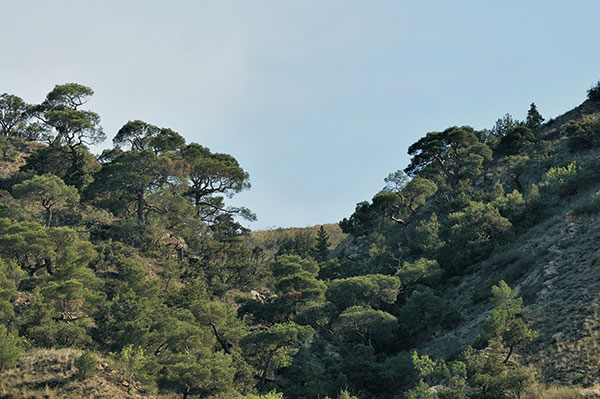
Bien que les forêts de l’Azerbaïdjan occupent une superficie relativement petite, elles sont riches en espèces d’arbres. Il existe 435 espèces d’arbres et d’arbustes dont 70 espèces endémiques. Le pays est caractérisé par des forêts de feuillus. Ces forêts sont largement répandues dans les montagnes du Caucase majeur et mineur et de Talysh. À une hauteur de 600 à 1600 mètres d’altitude, ils forment une seule zone. Dans d’autres régions, ils sont conservés dans des clairières et des bandes étroites.
Les forêts sont formées par trois principaux types d’arbres : le hêtre, le charme et le chêne. Ils constituent 86,2 % des terres boisées. En outre, les forêts contiennent également des arbres à feuilles larges tels que l’érable, l’orme, le tilleul, l’aulne, le peuplier, le yalanyarpag, le saule, etc. Les forêts à aiguilles représentent 1,7% de la superficie totale des forêts. 7 espèces d’arbres à aiguilles sur 107 espèces d’arbres sont naturellement cultivées dans le pays. Ce sont les garajokesi, les pins Eldar, les pins à crochets, les genévriers polycarpes, rouges et uzungovdeli.
L’Azerbaïdjan abrite un certain nombre d’arbres et d’arbustes rares. Garajoke est un arbre relique rare de la période tertiaire. Il est largement répandu dans le sud (Qabala) et le sud-est (régions de Pirqulu et Shamakhy) du Grand Caucase. Bien que le garachohre à croissance lente mais à longue durée de vie ne couvre jamais de grandes surfaces. La vallée Eldar du contrefort de Djeyranchol abrite le panier Eldar. Parmi les arbres relictuels et rares de la période tertiaire, l’arbre de fer, l’acacia de Lenkeran, le chêne à feuilles de châtaignier, le zelkova, le palmier dattier du Caucase, le buis, l’écrou papillon, le figuier de Hirkan, le bouleau de Hirkan, etc. sont des modèles rares de la nature.
Faune
L’Azerbaïdjan se situe à la jonction de plusieurs zones zoogéographiques, caractérisées par une faune spécifique. Les animaux d’Iran, d’Asie centrale et de la mer Méditerranée ont été adaptés à l’Azerbaïdjan, enrichissant ainsi sa nature.
En raison des diverses conditions naturelles, l’Azerbaïdjan a formé un royaume animal coloré.
97 espèces de mammifères, 357 espèces d’oiseaux, 67 espèces d’amphibiens et de reptiles, 1 espèce de vers ronds, 97 espèces de poissons, plus de 15 000 espèces d’invertébrés sont connues dans le pays.
La faune des plaines est représentée par un grand nombre de mammifères, reptiles, amphibiens, et de nombreux oiseaux sédentaires et migrateurs
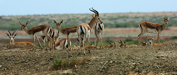
On peut rencontrer des mammifères tels que la gazelle jeyran, le sanglier, le loup, le renard, le blaireau, le chat de canne, le lapin, etc., des reptiles tels que la tortue des marais, la tortue caspienne et méditerranéenne, le lézard rayé, la couleuvre ordinaire et aquatique, la vipère, etc. amphibiens-différentes espèces de tortues, insectes, oiseaux-faisan, perdrix, turaj, différentes sortes de canards et d’oies, oiseaux aquatiques bruyants et sifflants, foulque, aigle, gallinule, héron, cormoran, pélican, etc.
Outre les animaux trouvés dans les plaines et les montagnes, ces zones sont également caractérisées par des espèces animales telles que le bouc du Caucase oriental, le chevreuil du Caucase, le chamois du Caucase, le tétra du Caucase, l’âne du Caucase, etc.
Le Livre rouge de la République d’Azerbaïdjan comprend 108 espèces animales, dont 14 espèces de mammifères, 36 espèces d’oiseaux, 13 espèces de reptiles et d’amphibiens, 5 espèces de poissons et 40 espèces d’incestes.
Les minéraux d’Azerbaïdjan
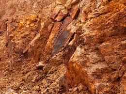
Le pays est riche en trois types de produits minéraux qui sont les produits minéraux métalliques, non métalliques et combustibles.
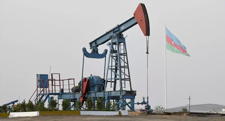
L’Azerbaïdjan est célèbre pour ses gisements de pétrole et de gaz. Les 2/3 de la république sont riches en pétrole et en gaz. La péninsule d’Absheron, le plateau caspien, Bakou et les archipels d’Absheron représentent la majeure partie des gisements. Le sud-est de Shirvan, le centre de l’Aran, le Gobustan, le Jeyranchol, l’Ajinour et le Siyezen sont riches en pétrole.
L’huile de renommée mondiale de Naftalan guérit un certain nombre de maladies.
Des gisements de gaz se trouvent à Gatadagh, sur le plateau caspien, à Bakou et dans l’archipel d’Absheron. La région du Caucase mineur compte pour la plupart des minéraux métalliques : fer, manganèse, titane, chrome, cuivre, cobalt, minerai complexe, antimoine, or, argent, molybdène, etc. Le plus grand gisement de fer a été trouvé à Dashkesen.
Parmi les minéraux non métalliques calcaires de Gobustan, Absheron, Tovuz, pierres de travertin de Kelbadjar et Shahtakhty (Nakhitchevan AR), marbre de Dashkesan, gypse du Haut Aghjakend, aluns de Hajyveli, et d’une grande importance industrielle.
Le pays est également riche en eaux minérales, avec différents ingrédients chimiques. C’est pourquoi l’Azerbaïdjan est appelé le musée des eaux minérales. Istisu (à Kelbedjar), Badamly et Sirab (à Nakhitchevan AR) sont des eaux minérales réputées.
Surakhany et Shykh de la péninsule d’Absheron, Qalaalty, du district de Devechi, Turshsu du district de Julfa sont utilisés comme traitement d’un certain nombre de maladies. Les eaux thermales dominent les montagnes Talysh et les pentes sud et nord-est du Caucase majeur

La mer Caspienne
La mer Caspienne, le plus grand bassin d’eau fermé du monde, est d’une grande importance pour le peuple azerbaïdjanais. Il a des propriétés physiques et géographiques uniques, Il convient de noter que la flore et la faune de la mer Caspienne sont riches en espèces endémiques. Par exemple, 90% des réserves totales d’esturgeons, qui se distinguent des autres poissons par leur ancienneté, se trouvent dans cette mer.
Le paysage géographique spécifique a créé des conditions récréatives favorables.
La mer s’étend le long d’un méridien en forme de lettre latine « S » et se situe entre la latitude 47’17 » nord et la longitude 36’33 » est. La mer à travers le méridien s’étend sur près de 1200 km, sa largeur moyenne est de 310 la largeur maximale et minimale id 435 et 195 en conséquence. Comme le niveau de la mer Caspienne change périodiquement, le volume d’eau et ses limites sont également variables. À l’heure actuelle, le niveau de la mer est de 26,75 mètres sous le niveau de la mer. A ce niveau la superficie de la mer est de 392600 km2, le volume d’eau est de 78648 km3. Ce volume représente 44% des réserves totales d’eau de tous les lacs du monde. Sa profondeur maximale est de 1025 mètres et pour cette raison, la mer rivalise avec la mer Noire, la mer Baltique et la mer Jaune et elle est encore plus profonde que la mer Adriatique, la mer Égée, la mer de Tiren et la mer de Sulu.
Le secteur Caspian Azeri occupe les parties centrale et méridionale de la mer. L’eau de la mer Caspienne diffère de celle de l’océan mondial par sa salinité. La salinité totalise 5-6 ppm au nord et 12,6-13,5 ppm au sud. 170 des 300 volcans de boue en Azerbaïdjan sont situés dans le secteur caspien azéri. Le nombre de volcans est plus élevé dans le sud de la mer Caspienne.
Le caractère unique et les couleurs des conditions naturelles ont favorisé la préservation d’un certain nombre d’espèces rares de flore et de faune dans la mer Caspienne jusqu’à nos jours.

Le secteur caspien azéri compte 171 espèces de phytoplancton, 40 espèces de plancton animal, 258 espèces de fitdentos, 91 espèces de macrozoobenthos et 80 espèces et sous-espèces de poissons appartenant à 14 familles.
Les poissons ressemblant à la carpe sont les espèces les plus nombreuses – 42 espèces, ils sont suivis par les goujons – 31, les harengs – 17, les saumons – 2, les esturgeons – 5 espèces. La faune piscicole de la mer Caspienne comprend 4 genres, 31 espèces et 45 sous-espèces de fiches endémiques. La plupart des poissons endémiques sont enregistrés dans la partie centrale de la mer Caspienne.
Environ 40 espèces et sous-espèces de poissons jouent un rôle important dans la pêche. Le troupeau représente la plus grande partie de la faune piscicole totale (80%), le reste comprend le hareng, le mulet gris, le moine, l’argentin et le goujon. Le Livre rouge de la République d’Azerbaïdjan comprend les espèces suivantes d’espèces rares et menacées: anguille de pierre, sig, œil blanc de la Caspienne du Sud, chekhon, sandre de mer. Au cours des dernières années, le nombre d’esturgeons de toutes sortes (béluga, épine, esturgeon à long nez), saumon de la Caspienne, saumon blanc, khramulya, poisson shamai, shibrit, garasol, a rapidement diminué et ces poissons sont sur le point de extinction. Le phoque est le seul mammifère présent dans la mer Caspienne. C’est le plus petit type de tous les joints existants. Le nombre de phoques de la Caspienne est passé de 1,5 million au début du XXe siècle à 360-400 000 en 1980. Le sceau de la Caspienne a été inclus dans le Livre rouge en 1993.
302 espèces d’oiseaux ont été enregistrées sur la mer Caspienne et ses régions côtières : parmi elles, 37 espèces d’oiseaux aquatiques, 109 espèces d’oiseaux peuplant les zones autour des bassins versants et 156 oiseaux terranes.
OROGRAPHIE ET ZONAGE VERTICAL DES MONTAGNES
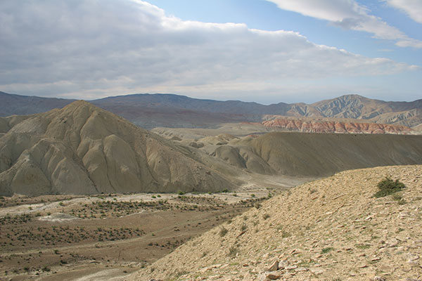
La République d’Azerbaïdjan se caractérise par des reliefs de différents types et complexités. Plus de la moitié de la superficie du pays est constituée de crêtes montagneuses, de crêtes, de plateaux s’élevant jusqu’à des niveaux hypsométriques de 400 à 500 m (ou jusqu’à 800 à 1 000 m dans les basses terres de l’Araz moyen et inférieur), à certains endroits (Talis, Jeyranchol -Ajinohur et Langabiz-Alat pour les gammes) jusqu’à 100-120 m, ainsi que 0-50 m (Gobustan, Absheron) dont le reste est constitué de plaines et de basses terres.
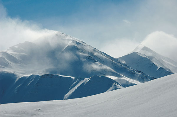
Les marques hypsométriques dans la région du Grand Caucase varient d’environ -28 m sur le littoral de la mer Caspienne jusqu’à 4 466 m (pic du Bazarduzu). La répartition quantitative des zones en fonction de leurs niveaux hypsométriques est la suivante : 18 % de la zone est située sous le niveau de l’océan, 24 % a des marques hypsométriques allant de 0 à 200 m, 15,5 % sont couvertes par des zones dont l’altitude varie de 200 à 500 m. m, 15,5 % supplémentaires sont couverts par des zones dont l’altitude varie de 500 à 1 000 m, 19,5 % sont couverts par des zones dont l’altitude varie de 1 000 à 2 000 m, 6,5 % sont couverts par des zones dont l’altitude varie de 2 000 à 3 000 m, et seulement 1% correspond aux zones dont les repères altimétriques dépassent 3000 m de haut. L’altitude moyenne est de 384 m. Les principales unités orographiques de la République d’Azerbaïdjan comprennent le système montagneux du Grand Caucase, la plaine Samur-Davachi (en conjonction avec la plaine inclinée Gusar), la plaine de la rivière Kur, le Caucase mineur et les systèmes montagneux Talish.
La seule partie sud-est de la région montagneuse du Grand Caucase est située dans la République d’Azerbaïdjan. Les éléments orographiques de base de cette partie du système du Grand Caucase sont le système du Caucase majeur (ou crête du bassin versant) et la crête latérale. La crête majeure du Caucase constitue une grande partie du système du Grand Caucase et s’étend au sud-est de l’altitude de Tinov-Rosso (3385 m) est située à la frontière de l’État d’Azerbaïdjan avec la Géorgie et le Daghestan AR. Le seul flanc sud de la crête entre Tinov-Rosso et Bazar-Duzu (le flanc nord de la crête appartient au Daghestan AR), où les deux flancs de cette partie appartiennent à l’Azerbaïdjan. La crête du bassin versant du Caucase majeur n’est traversée par aucune vallée fluviale (et est donc également appelée crête du bassin versant). La majeure partie de l’élévation de la crête dépasse 3000 m de haut, et seulement dans sa partie centrale, elle dépasse 4000 m de hauteur (Bazar-Dyuzu – 4466 m, Tufandagh-4191 m, Bazaryurd – 4126 m). À partir du pic de Babadagh (3629 m), la même élévation de crête descend progressivement et s’élargit. À partir de l’altitude de Dubrar (2205 m), la crête majeure du Caucase plonge vers le nord-est en direction de la mer Caspienne comme un éventail élargi ayant été coupé par les vallées fluviales en crêtes séparées comme Gadi-Kurkachidagh, Aladagh, Kemchi et autres. Les mêmes crêtes sont ensuite divisées en crêtes plus petites et plus basses pour passer dans la région montagneuse de basse altitude appelée Gobustan, et plus loin dans la péninsule d’Absheron. Au nord et parallèlement à la crête du Grand Caucase, il y a une crête orientée sud-est appelée latérale, dont la section azerbaïdjanaise part du Shahdagh (4243) s’étendant et s’abaissant vers le sud-est et se termine au sommet de Beshbarmag (546 m). La crête latérale est divisée en blocs autonomes-plateaux (Shahdagh, Gizilgaya, Budugh, etc.) par des vallées fluviales qui partent de la crête du Grand Caucase. Au nord-est et parallèlement à la crête latérale, il y a l’altitude de Talabi-Gaynarja (dont l’altitude varie de 1000-1100 m à l’ouest jusqu’à 150-200 m à l’est). Les crêtes et les élévations sont séparées les unes des autres par des vallées et des creux intermontagnards (Shahnabad, Khinalig, Erphee, Gonagcand, Kaltan, Gilgilchay, Tigchay, Rustov, Perebedil, etc.). Le flanc sud de la crête du Grand Caucase est descendu dans la vallée d’Alazan-Ayrichay (dans certaines sources, la vallée d’Alazan-Haftaran, alors que dans d’autres, elle est considérée comme l’une des parties de la vallée de la rivière Kur) qui, à certains endroits, est parallèle à la crête mentionnée. Ladite vallée ci-dessus commence à partir de la République de Géorgie et mesure 210 km de long et 30 km de large en Azerbaïdjan. La crête de Nialdagh dont l’altitude atteint jusqu’à 2100 m de haut s’étend parallèlement au Grand Caucase à part à travers la vallée de Lahij
La plaine de Samur-Davachi s’étend le long de la côte caspienne de la rivière Samur à Sumgayit-chay. Sa partie située entre Atachay et Sumgayit-chay est appelée plaine de Boghaz. Cette plaine au nord-ouest (à 200-250m de niveau hypsométrique) passe dans la plaine inclinée de Gusaz par un banc de 10-25 m de haut. Les plaines inclinées de Gusar au sud-ouest atteignent la crête latérale où sa marque d’élévation s’élève à 19000 m (Boyuk Suval) Le niveau hypsométrique des basses terres au niveau du littoral de la Caspienne est de 28 m sous le niveau de l’océan.
La partie azerbaïdjanaise du Caucase mineur se compose principalement de plusieurs crêtes aux tendances diverses qui ne sont pas les principaux bassins versants, notamment Murovdagh, Karabakh, Michtocan, systèmes, partiellement Shahdagh, Shargi-Goycha (Shargi Sevan), Zangazur, systèmes montagneux de Daralayaz, plateau volcanique (la plupart du plateau du Karabakh) et les basses terres de Bashcand-Dastafur, etc. (dans certaines publications, les systèmes Zangazur et Daralayaz, ainsi que le plateau du Karabakh, ne font pas référence au Caucase mineur). La crête de Shahdagh s’étend de la même altitude (2901 m) au nord-ouest et vers l’altitude de Hinaldagh (3367 m) au sud-est. La crête de Murovdagh s’étend au nord de l’altitude de Hinaldagh jusqu’à l’altitude de Gamishdagh (3724 m). Au nord de ces crêtes, il y a la plaine de Bashcand-Dastafur et encore plus au nord, il y a l’élévation de la voûte de Shamkir. La crête de Pant et l’élévation autonome de Kapaz (3030 m) séparent la plaine de Bashcand-Dastafur au nord de la plaine d’Aghjacand. Les crêtes du flanc nord du Caucase mineur s’abaissent vers le nord et passent brusquement dans la plaine de Ganja-Gazah dans la vallée de la rivière Middle Kur à travers des flancs fortement plongeants. La crête East Goycha (East Sevan) sert de bassin versant pour les systèmes de drainage de la rivière Tartar et du lac Sevan. Son altitude la plus élevée est Ketidagh (3437 m). La terminaison sud-est du Caucase mineur connue sous le nom de crête du Karabakh s’abaisse vers la vallée de la rivière Araz et passe dans la plaine inclinée des contreforts. Sa plus haute altitude Gizgala (2843 m) Girhgiz (2830 m) Boyuk Kirs (2725 m) à partir d’élévations rocheuses autonomes sur fond de bassin versant large et lisse dans la partie nord de la crête. Sur le flanc nord de la crête, il y a des crêtes et des dépressions transversales. La crête du Karabakh s’avançait avec la crête Mikhtocan à tendance latitudinale (Dalidagh, 3613 m) au nord-ouest. Les flancs sud-ouest et sud des crêtes de Zangazuz et de Daralayaz appartiennent respectivement à la République d’Azerbaïdjan (au sein de la République de Nakhitchevan). La crête de Zangazyr s’étend jusqu’à la vallée de la rivière Araz.
Cette crête est la plus haute du système montagneux du Caucase mineur dont la hauteur moyenne est de 3200 m. Les plus hautes altitudes de la crête (Gapijik, 3906 m, Gazandoldagh, 3814 m, etc.) sont situées dans sa partie sud. Un grand nombre de crêtes transversales s’étendent vers le sud-ouest au large de la crête. Différents types d’extrusions autonomes et de corps de laccolithes sont typiques pour leur partie d’avant-gamme (Ispandagh-2410m, Khanaga-1910m, Alinja-1810m).
À l’ouest de la crête de Zangazur, il y a la crête de Daralayaz (Kukudagh-3210 m, Kechaldagh-3115 m) qui descend progressivement vers la vallée de la rivière Araz. Au sud de la crête, dans sa partie avant, il y a principalement des plateaux et des crêtes (Givrag, Duzdagh, etc.).
Les contreforts sud et sud-ouest des deux crêtes passent dans des plaines étendues le long de la rive gauche de la rivière Araz et séparées les unes des autres par des élévations et des crêtes (Sadarak, Sharur, Boyukdyuz, Nakhchivan, Julfa, Yayji, etc.). Les plateaux du Karabakh occupent une zone relativement large où de grands cols volcaniques éteints font saillie entre les crêtes du Zangazur et du Karabakh sur la surface de roulement (Gizilboghaz-3581 m, Boyuk Ishigly-3552 m, Ala Gollar-3175 m, etc.) entre les crêtes du Zangazur et du Karabakh. .
Ici, l’altitude moyenne varie entre 2000 et 2500 m. Le plateau devient plus étroit et sa hauteur descend vers le sud et se termine finalement au point d’interflux des rivières Bazarchay et Hakarachay.
Le système de montagnes Talish est situé au sud-est de la vallée de la rivière Lower Araz (certains explorateurs considèrent que les montagnes Talish sont suggérées comme étant l’extension nord-ouest du système Alborz). Ce système montagneux se compose de crêtes Talish, Peshtasar et Burovar presque parallèles et étendues du nord-ouest au sud-est. La plus longue d’entre elles (environ 100 km de long) dont l’altitude atteint 2500 m d’altitude est la crête de Talish qui longe la frontière d’État avec la République islamique d’Iran. À certains endroits, ces crêtes se rejoignent par des crêtes transversales qui forment des creux intermontagnards autonomes (Yardimly, Zuvand, etc.). La plaine de Lankaran est située entre la montagne Talish et la mer Caspienne.
La vallée de la rivière Kur occupe la partie centrale de la République d’Azerbaïdjan. Son relief est constitué de vastes zones de terrane de plaine et de contreforts. La principale caractéristique orographique de la vallée qui se situe entre les systèmes du Grand et du Petit Caucase est le terrane de plaine de Kur-Araz, le plus grand de la région du sud du Caucase. Le terrane des basses terres est divisé par les rivières Kur et Araz en plaines Mil-Karabakh, Shirvan et Mughan-Saliyan. Les parties ouest et centrale du terrane de plaine de Kur-Araz se trouvent à environ 28 m sous le niveau de l’océan. L’élévation de la zone de ses contreforts varie de 100 à 250 m et, à certains endroits, jusqu’à 400 à 500 m de haut. Les plaines inclinées d’Anja-Gazah au nord-ouest s’étendent le long de la rive droite de la rivière Kur tandis que les plaines inclinées d’Anaghy-Arazboyu au sud-ouest s’étendent le long de la rive gauche de la rivière Araz. Au nord de la plaine inclinée de Ganja-Gazah et de la plaine de Kur-Araz se trouvent les terranes des contreforts de Jeyranchol, Ajinohur et Langabiz-Alat. Le terrane des contreforts d’Ajinohur, dont l’altitude atteint jusqu’à 1100 m de haut, se compose de plusieurs crêtes, crêtes, ainsi que de basses terres et de vallées les séparant les unes des autres s’étend le long de la marge sud de la plus grande d’entre elles la vallée d’Alazan-Ayrichay.
Classement des terranes d’altitude
La complexité du relief de la République d’Azerbaïdjan offre l’opportunité d’effectuer son classement vertical comme suit: le terrane de haute montagne, le terrane de montagne de niveau intermédiaire, le terrane de montagne de bas niveau et les terranes de plaine-bas.
Le terrane de haute montagne englobe des zones de plus de 2500, de haut. Dans ce contexte, le système du Grand Caucase se compose du Caucase majeur et des crêtes latérales. Le terrane de haute montagne du Caucase mineur comprend essentiellement des parties latérales des crêtes de Zangazur, Mishovdagh et Shahdagh qui, à de nombreux endroits, ressemblent à des zones étroites. En raison d’un couvert végétal peu développé, ce terrane se caractérise par une topographie escarpée et rocheuse. Ici, il y a de nombreuses élévations scotchées et pectinales. En outre, il existe des vestiges du relief glaciaire (vallées en creux, cirques et cirques). De plus, il existe de petits glaciers contemporains. Les pentes des montagnes sont recouvertes d’épais cônes de débris clastiques.
Les terranes de montagne de niveau intermédiaire occupent la plupart des systèmes montagneux dont l’altitude varie entre 1000 et 2500 m de haut et sont disséqués par de profondes gorges fluviales. Dans les zones où les gorges fluviales s’élargissent, en particulier dans les vallées intermontagneuses, il existe de nombreuses terrasses et les plaines de nivellement échelonnées sont omniprésentes. À certains endroits, des glissements de terrain et des chutes de pierres se produisent.
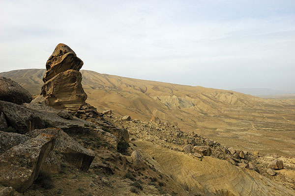
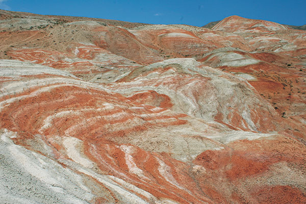
Le terrane de montagne de bas niveau comprend des zones d’une altitude d’environ 200 m (Gobustan et Ajinohur) et d’environ 50 à 100 m dans les zones de contreforts. Dans ce terrane, les coteaux sont doux et les bassins versants sont lisses. Dans certaines régions (contreforts de Gobustan, Jeyranchol et Ajinohur et contreforts de Nakhchivan AR), le manque d’humidité favorise l’évolution des processus de dénudation aride qui a entraîné le développement de paysages de badlands, de fonte d’argile et d’autres formes de relief.
Le terrane des plaines et des basses terres comprend des zones dont l’altitude varie de 100 à 200 m, à certains endroits de 400 à 500 m (et de 800 à 1 000 m dans la République du Nakhitchevan). Ce terrane comprend la plupart des zones de plaine de la rivière Kur et de la rivière Samur, la vallée d’Alazan-Ayrichay, les plaines voisines de la rivière Araz, etc. Les terrasses d’aggradation sont répandues ici. Les principales formes de relief dans les zones de contreforts sont les cônes alluviaux et les dunes de la zone côtière de la Caspienne.
LES ATTRIBUTS DE LA FORMATION DE RELIEF
Les principales composantes contemporaines du relief et les principales caractéristiques géomorphologiques ont été générées au cours de l’activité tectonique du stade récent (Pligocène-Anthropogénique) et ont subi une histoire d’évolution délicate. Au cours de cette phase d’évolution, les zones montagneuses se sont élevées jusqu’à 2,5-4,5 km d’altitude (étant donné que la dénudation n’a pas été prise en compte), tandis que les zones de plaine se sont affaissées entre 2,5-3,0 et 8-11,5 km. Dans les zones où le taux de mouvement ascendant a dépassé celui de la dénudation, des terranes de montagne ont émergé, alors que dans les zones affaissées (étant donné que le taux de subsidence est égal à celui de la sédimentation marine et terrestre), des terranes de plaine ont été générés. Bien que l’architecture structurelle et l’évolution géologique dans l’histoire de ces régions soient différentes, leurs processus de formation du relief avaient quelque chose en commun. L’un d’eux est le fait que le niveau de la mer Caspienne a servi de base commune à l’érosion. La fluctuation du niveau de la mer Caspienne a eu un impact énorme et récurrent sur l’évolution du relief des terranes de montagne et de plaine par l’activation des processus d’érosion, l’atténuation et le rythme de l’affaissement, et dans ce contexte, les processus de pénéplanation du relief étaient communs. Cependant, certaines zones discrètes avaient leurs propres caractéristiques de formation de relief spécifiques (processus magmatiques dans le Caucase mineur, activité de volcanisme de boue dans la terminaison sud-est du Grand Caucase). L’évolution des processus exogènes de formation de relief diffère également en fonction de la composition de la roche, du climat et du type de caractéristiques de la zone d’élévation.
Au cours de l’évolution des formations de relief néotectoniques au sein de la République d’Azerbaïdjan, des processus tels que les changements de régime tectonique et l’augmentation du taux d’élévation ont joué un rôle important qui a entraîné l’élargissement de systèmes tels que le Grand Caucase, le Caucase mineur et les montagnes Talysh.
Depuis le début de ce stade d’évolution, les dépressions intermontagnardes avaient accumulé des sédiments de sable fin et d’argile, ainsi que des dépôts de grès et de galets à gros grains pendant la fin du stade. Le contraste des mouvements tectoniques a augmenté au cours de la période Oligocène-Miocène inférieur. Le niveau de base du système fluvial avait été établi juste à ce moment-là. Les avions de pénéplanation sont sortis pendant les périodes de repos de l’activité tectonique. Au cours du Miocène moyen et tardif, la formation des terranes de relief reste la même qu’au début du Miocène, cependant, son développement était en cours dans des circonstances tectoniques plus durables. Pendant cette période, de vastes avions de pénéplanation avaient évolué.
Au cours de la fin du Miocène supérieur, le taux d’élévation tectonique avait brusquement augmenté dans les systèmes intermontagnards du Grand et du Petit Caucase. Le contraste du relief a augmenté et l’élévation de la montagne a également augmenté. L’érosion de relief et le transport des matériaux de lessivage ont augmenté, ce qui a entraîné un changement du niveau de base de la zone de drainage. Au cours du Pliocène précoce et moyen, le processus d’élévation des montagnes a également augmenté parallèlement à l’augmentation continue de la différenciation du mouvement tectonique. On suppose que le zonage vertical du paysage a été établi pour la première fois à cette époque. Dans ce contexte, les processus exogènes s’étaient déroulés selon un mode quelque peu différent. Le relief récent du territoire azerbaïdjanais s’est formé à la fin du Pliocène-Anthropogène. À cet égard, cette période a été caractérisée par le développement du relief et la fluctuation du niveau de la mer Caspienne qui ont conduit à la transgression et au développement de la régression marine, ainsi qu’à l’activité volcanique. Parallèlement à chaque régression, la mer d’aménagement reculait pour augmenter les surfaces terrestres tandis que les lits des rivières s’étendaient pour réaliser un recul du littoral. La baisse du niveau de base de l’érosion a entraîné l’approfondissement des lits des rivières et l’activation des processus d’érosion au sein de leur zone de drainage et du réseau de drainage lui-même a subi des changements spatiaux importants. Les terrasses marines s’étaient développées en raison de la fluctuation récurrente du niveau de la mer Caspienne, tandis que le relief magmatique (Caucase mineur) et le volcanisme de boue (Grand Caucase) s’étaient développés en raison des deux types d’activité volcanique.
PRINCIPAUX TYPES DE SECOURS
La diversité des reliefs sur le territoire de l’Azerbaïdjan se caractérise par leur origine. Les types de relief suivants peuvent être trouvés générés dans la zone tectonique, volcanique, pseudo-volcanique, nival-glacier, gravitaire, fluvial, dénudation aride, éolien, karst, talus, etc.
Un relief tectonique s’est formé dans chaque région de la République. La plupart des contextes généraux et des terranes profonds (systèmes montagneux du Grand Caucase, du Caucase mineur et de Talish, plaine de la rivière Kur) ont résulté de mouvements tectoniques récents. Il est suggéré que dans les zones de plis récents (zones avant de Jeyranchol et Ajinohur, Gobustan, péninsule d’Absheron), toutes les caractéristiques du relief sont associées aux mouvements tectoniques. Le relief volcanique est plus typique du terrane du plateau de Garabagh. Les formes de relief dans ces zones sont dominées par des cônes de lave et de scories, des plateaux de lave échelonnés et des coulées volcaniques. Des affaissements de lac et des tourbières suspendues se sont formés dans les zones où les coulées de lave se sont croisées avec les lits des rivières. Les éruptions volcaniques qui se sont produites dans l’environnement climatique froid de haute montagne ont conduit à la formation de dépôts de galets par refroidissement et fractionnement brusques de la lave.
La formation de relief pseudo-volcanique s’est formée à la suite de l’activité des volcans de boue. De telles caractéristiques de relief dans Gobustan, la péninsule d’Absheron, la plaine du sud-est de Shirvan et d’autres zones telles que l’archipel de Bakou au large sont typiques et se produisent comme des cônes et des collines coniformes, la plupart des îles de l’archipel de Bakou ont été générées en raison de l’activité des volcans de boue.
Le relief du glacier Nival s’est formé en raison de l’abrasion et de l’accumulation de glaciers anciens et récents, et apparaît comme un creux glaciaire, des corries, une moraine de décharge et une moraine poussée. Ce type de relief glaciaire est répandu dans la zone de relief de haute montagne du Grand Caucase (crête du Caucase majeur, crête latérale) et des systèmes du Caucase mineur (Murovdagh, Shahdagh, Zangazur, plateau de Garabagh).
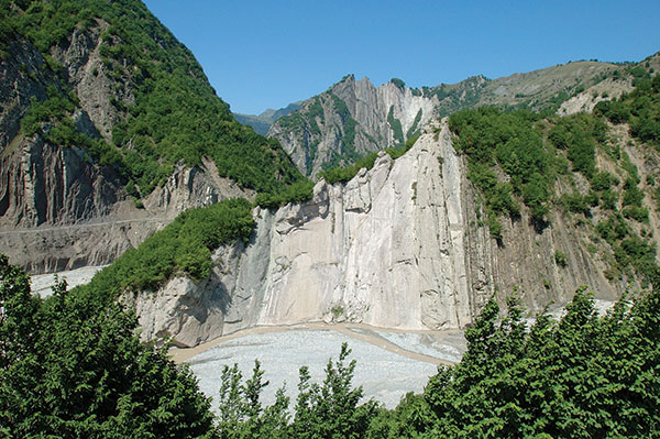
Les éléments de relief entraînés par la gravité consistent en des terranes de glissement de terrain et d’éboulement. Les chutes de pierres de montagne évoluent principalement dans les plateaux du Grand Caucase Shahdagh et Gizilgaya, dans le Caucase mineur Shargi Goycha, les crêtes de Murovdagh et de Garabagh et le terrane de la montagne Kapaz. Plusieurs lacs de montagne en Azerbaïdjan (Goygol, Maralgol, Ganligol, etc.) se sont formés à la suite de chutes de pierres de montagne. Les glissements de terrain sont principalement omniprésents dans les zones présentant des conditions lithologiques et hydrogéologiques propices dans le sud-est du Grand Caucase (Girdiman-chay, Aghsu) et son secteur nord-est (Valvala-chay, Gilgilchay, Atachay).
Le type de relief le plus répandu en Azerbaïdjan est fluvial. Le lac Goygol a été créé à la suite de l’activité des eaux de surface. Ces types de caractéristiques de relief comprennent les lits de rivières, les terrasses, les gorges, les cônes de lessivage (cônes de débris), les deltas et d’autres formes de relief d’érosion et d’accumulation.
La dénudation aride a poussé le relief à évoluer dans les régions arides où les dépôts de sable / argile lâches sont répandus: Gobustan, partie ouest de la péninsule d’Absheron, flanc nord-est de la crête du Caucase majeur (la zone entre Gilgilchay et Sumgayit-chay), chaînes avant de Jeyranchol-Ajinohur , systèmes d’avant-gamme Nakhchivan AR, etc. Ces terranes de relief sont principalement attribués à la formation de pseudokystes de badlands et d’argile.
Les reliefs éoliens englobent les dunes, les bancs de sable et les cônes et coïncident avec les basses terres de Samur-Davachi, la péninsule d’Absheron et les zones côtières du sud-est de Shirvan. Ces formes de relief ont évolué en raison de l’environnement climatique aride et de la richesse des dépôts de sable.
Des reliefs karstiques peuvent être observés dans les systèmes montagneux du Grand et du Petit Caucase où des dépôts de carbonate affleurent à la surface. Leur formation a été stipulée avec l’impact chimique et mécanique des eaux de surface et souterraines. La diversité du relief karstique comprend des gouffres, des grottes, des ponors, etc. La grotte d’Azikh, connue en raison des célèbres découvertes archéologiques d’Alm Paleolit, est considérée comme l’une des formes de relief karstiques importantes.
Le relief d’éboulis a évolué en raison de l’activité d’abrasion et d’accumulation de la mer Caspienne. La zone côtière qui a subi la transgression du Quaternaire présente des reliefs tels que des barrières de plage, des terrasses, des falaises, des bancs et autres.
Des formes de relief polygénétiques (principalement des plans de pénéplanation) sont générées en raison des effets combinés des processus de formation de relief qui peuvent être observés dans les régions montagneuses.
Les formes de relief anthropiques (technogènes) dues aux systèmes d’irrigation (arrosage et drainage), à la construction civile et militaire (barrages, digues, etc.) et aux activités d’autres personnes sont surtout répandues dans la plaine de la rivière Kur-Araz.
Régions géomorphologiques
Le territoire de l’Azerbaïdjan a une structure géomorphologique complexe. Il existe des caractéristiques morphologiques qui ont subi des impacts tectoniques insignifiants tels que les montagnes à structure de dénudation et celles qui ont subi son fort impact, ou les montagnes à structure d’érosion, les montagnes volcaniques, les plateaux et les plaines d’accumulation-dénudation, ainsi que les plaines d’accumulation. L’origine du relief, son âge de formation, ses caractéristiques morphologiques, son contexte géologique et leur relation avec les mouvements tectoniques récents ont permis de diviser le territoire de la République d’Azerbaïdjan en deux pays géomorphologiques (Crémie-Caucase, Asie Mineure et quatre provinces -Caucase Foothill, Grand Caucase, Dépression du Caucase du Sud, Caucase mineur) qui comprend six régions géomorphologiques : Samur-Davachi, le Grand Caucase oriental, la plaine de la rivière Kur, le Caucase mineur extérieur, le Caucase mineur interne et la région de Talish qui, à leur tour, englobent la sous-région et les districts.
Parfois, les basses terres du Moyen-Araz, les crêtes du Zangazur et du Daralayaz, ainsi que les basses terres de la montagne Talish et du Lankaran sont incluses dans la région du Caucase mineur en tant que districts géomorphologiques composants, tandis que les districts géomorphologiques de la plaine inclinée Gusar et de la vallée Alazan-Ayrichay sont appelés la région du Grand Caucase. .
La région géomorphologique de Samur-Davachi en termes de classement structurel est suggérée comme étant l’extension sud-est et la partie constitutive de l’avant-fosse de Gusar-Davachi qui a pris forme au cours de la récente phase d’évolution tectonique et est située dans les contreforts nord-est du Grand Caucase. Ses attributs géomorphologiques de surface et de base récents ont été formés en raison des processus d’accumulation marins et terrestres du Pliocène supérieur et anthropiques. Il y a des terrasses marines, des cônes diluviaux dont les dépôts ont été versés des flancs nord-est du Grand Caucase ainsi que des affaissements de plaine entre les cônes mentionnés. Les zones côtières sont principalement couvertes de sable. Sa surface est inclinée (environ de 0 à 1900 m d’altitude) et se caractérise par un aspect décalé et roulant. Son inclinaison de surface et son érosion augmentent avec l’augmentation de l’élévation. L’incision d’érosion atteint 850-950 m dans ses zones de contreforts. Cette région est divisée en districts géomorphologiques Samur-Davachi et Gusar.
La région géomorphologique du Grand Caucase oriental se distingue des autres régions géomorphologiques par un relief glaciaire nival et glaciaire d’explosion plus répandu. Les reliques de la glaciation du Pliocène tardif-anthropogénique sont restées ici sous forme de vallées creuses, de corries, de moraine de décharge et de petits cafards. Il existe également des volcans de boue répandus, des glissements de terrain, des badlands et des terranes de karst argileux. Les caractéristiques du plan de pénéplanation sont également observées ici. Ces plans de pénéplanation faisaient apparaître des plaines inclinées en quinconce. Les processus exogènes contemporains les plus répandus sont l’érosion et ceux induits par la gravité. La région est divisée en sous-régions géomorphologiques du flanc sud de la crête du Caucase majeur et du sud-est du Caucase :
1. La sous-région du flanc sud de la dorsale majeure du Caucase est située entre l’interfluve Mazimchay et Girdimanchay et est sévèrement disséquée par les vallées fluviales (la profondeur d’incision varie de 300 à 150 m). Les bassins versants sont généralement étroits, en dents de scie et les élévations sont effilées. À certains endroits, il y a des pentes relativement raides (40-70 C et plus), avec des lits de rivière généralement extrêmement étroits. Les ravins d’entrée de rivière sont généralement disséqués et compliqués par des glissements de terrain. Au fur et à mesure que les ravins s’élargissent, des terrasses apparaissent. Des coulées de boue s’y produisent fréquemment. Les chutes de pierres et les détritus y sont également très répandus. Les districts géomorphologiques de Zagatala, Shaki et Lahij sont définis dans cette sous-région ;
2. La sous-région du Caucase du Sud-Est comprend des crêtes montagneuses sévèrement disséquées. La dorsale majeure du Caucase est une partie constitutive de cette sous-région et se compose d’une partie latérale étroite et de flancs principalement nus abrupts (50-70°C). Le bassin versant vers l’ouest de la crête latérale est divisé les uns des autres ravins en forme de canyon en grands plateaux synclinaux lissés (le plus grand est le plateau de Shahdagh). La crête latérale de Niyaldagh, sévèrement disséquée, est située au sud. Il y a plusieurs creux entre les crêtes. Ces flancs sont constitués de terrasses. Les glissements de terrain et les chutes de pierres sont typiques de ce terrane. La sous-région à l’est comprend sa région natale de Shamakhy, ainsi que la péninsule de Gobustan et d’Absheron. Ses plateaux au relief discret embrassent la péninsule d’Absheron. Gizmaydan Shamakhy, Maraza, etc. sont caractérisés par des plateaux au relief modéré. Leur ligne de partage des eaux et leurs flancs sont maîtrisés. Les lits des rivières sont généralement étroits, mais à certains endroits, ils passent dans des dépressions en terrasses relativement grandes. La partie nord-ouest de la sous-région est caractérisée par des glissements de terrain et des chutes de pierres, tandis que dans sa partie sud-est, il y a des volcans de boue, des badlands et du karst argileux comme des reliefs arides, et les dunes de sable sont omniprésentes dans la zone côtière d’Absheron. Il existe également des dépressions fermées à fond salé et des lacs salés dans la région. Des districts géomorphologiques tels que Bazarduzu, Shahnabad-Khizi, Shahdagh, Tengi-Beshbarmag, Dubrar, Shamakhy, Gobustan et Absheron ont été délimités ici.
Les mouvements tectoniques récents et le relief exogène formant des processus complexes ont abouti à la diversité des formes de relief observées dans la région géomorphologique des basses terres de la rivière Kur. Il se compose de quatre sous-régions géomorphologiques: la vallée d’Alazan-Ayrichay, la chaîne avant de Jeyranchol-Ajinohur, les basses terres des rivières Kur-Araz et la plaine inclinée des contreforts du Caucase mineur.
1. La sous-région de la vallée de l’Alazan-Ayrichay, en termes de contexte morphologique, comprend une plaine de contrefort incliné isolée et affaissée. Sa surface est recouverte de dépôts alluviaux-proluviaux. Les cônes alluvionnaires et les dépôts concentrés entre ces cônes sont partiellement enlisés. Le processus prédominant est l’accumulation de dépôts. Les cônes alluviaux sont constitués de matériaux grossiers, tandis que les dépôts situés entre eux sont fins. Les districts géomorphologiques d’Alazan et d’Ismayilly sont délimités dans la sous-région ;
2. La sous-région de l’avant-chaîne Jeyranchol-Ajinohur est située au nord de la vallée de la rivière Kur. Les chaînes avant de Jeyranchol et Ajinohur situées au sud de la vallée d’Alazan-Ayrichay, ainsi que la chaîne avant de Langabiz-Alat située dans la vallée nord-est de la rivière Kur sont également inclinées dans cette sous-région. Son relief se compose de crêtes, de crêtes et d’élévations, ainsi que de vallées et de creux entre les anticlinaux et les synclinaux reflétant respectivement. Les crêtes et les flancs de crête sont asymétriques (constitués de dépôts du Pliocène supérieur dans ses parties ouest et est et de dépôts anthropiques en son centre). Leurs flancs sud sont très escarpés et les flancs nord sont doux. À certains endroits (plateau de Gurjuvan) à une altitude de 600 à 1000 m, il y a des plans de pénéplanation. La sous-région est divisée avec des vallées antérieures des rivières de transit à écoulement transversal. La profondeur d’incision varie entre 250 et 700 m. La dissection est plus dense dans les flancs sud où des ravins et des gorges d’érosion de type badland sont en cours. Des volcans de boue sont observés dans la partie est. La sous-région est divisée en districts géomorphologiques d’Ajinohur, Langabiz-Alat et Harami ;
3. La sous-région des basses terres de Kur-Araz est la plus grande partie de la vallée de la rivière Kur. Sa partie centrale est recouverte de dépôts argileux, tandis que des dépôts terrestres et marins d’argile, de sable et de galets de l’Anthropogénie tardive et de l’Holocène recouvrent ses parties marginales. Ayant été jeune et en pente douce, la surface relique de la sous-région est juste légèrement disséquée. Partie est de la région considérée des crêtes et des élévations (Kurovdagh, Babazanan, Mishovdah, Galmas, Bozdagh, Khidirly, Bandovan) causées par le plissement récent et le volcanisme de boue. Les lits des rivières sont peu profonds, sinueux avec des processus d’accumulation en cours. Les cônes diluviens sont rencontrés dans la plaine de Shirvan Shirvan. La partie centrale de la plaine, ainsi que les plaines de Mughan et de Salyan, sont caractérisées par d’anciennes digues de lit de rivière, des dépressions sans drain, un delta sous-aérien, tandis que dans le sud-est de Shirvan, il existe des reliques de dépôts lagunaires de la Caspienne récente, des ravins de déflation, des dunes coniques, barrières de plage anciennes et récentes. L’arrosage artificiel et l’impact de l’irrigation sur le relief des basses terres. Les processus de dissection de relief, de lessivage (érosion) et de salinisation du sol deviennent plus actifs dans des conditions anthropiques. La sous-région comprend les districts géomorphologiques de Shirvan, du sud-est de Sirvan, des rives de la rivière Kur, de Mughan et de Salyan ;
4. La sous-région des plaines inclinées des contreforts du Caucase mineur englobe principalement les contreforts du nord-est étendus entre les rivières Khrami et Araz. Il mesure 350 km de long et 12 à 30 km de large. Sa surface est recouverte de dépôts de galets à matrice argileuse terrestre Pliocène supérieur-anthropogénique. Des crêtes basses et des collines ne sont observées que dans l’interfluve des rivières Kurak et Tartar (Naftalan, Gedakboz, Duzdagh). La frontière entre les zones de plaine et de montagne est prolongée le long de la faille normale. La transition vers la plaine des rivières Kur-Araz passe progressivement. La surface commence à partir de la région montagneuse du Caucase mineur et est disséquée par les affluents du côté droit de la rivière Kur. La profondeur d’incision varie entre 10-15 m et 100-220 m, et dans certains (vallée de la rivière Tartar) atteint jusqu’à 220-250 m de profondeur. Les formes de relief les plus typiques sont les cônes diluviens et les dépôts flanquants entre eux. Il existe des réseaux de ravins-ravins dans le secteur de la plaine Naftalan-Gazanbulag et les flancs de la vallée de la rivière Kur (interfluve des rivières Aghstafa-Shamkir). La sous-région comprend les districts géomorphologiques de Ganja-Gazakh, Karabakh et Mil.
En dehors de la région géomorphologique du Caucase mineur se trouve une zone où les processus de dénudation dominent actuellement. Les zones d’accumulation sont rarement rencontrées. Les crêtes des montagnes ici sont séparées les unes des autres par des creux. En raison de caractéristiques géomorphologiques particulières, les processus dominants ici sont ceux de l’érosion. Cette région est divisée en trois sous-régions géomorphologiques (pentes nord-est, nord et sud-ouest).
1. La sous-région du versant nord-est comprend les crêtes de Shahdagh et de Murovdagh, l’élévation de la voûte de Shamkir, la dépression de Bashcand-Dastafur, etc. La sous-région subit une érosion sévère et est donc attribuée à une topographie accidentée. Les processus basés sur la gravité étaient également omniprésents ici. Dans certains endroits, il y a des terranes de chutes de pierres (Kapaz) Dans les endroits où les chutes de pierres ont formé des barrages sur la rivière, les dépôts lacustres se sont déposés (Goygol, Maralgol, Garagol, etc.). À travers les vallées et les cirques observés au niveau de 2400 m dans les flancs nord de Murovdagh et Shahdagh, des preuves des caractéristiques de la glaciation au cours de la période anthropique. Les plans de pénéplanation sont répandus dans les zones montagneuses intermédiaires. Les vallées fluviales sont également répandues dans la région. Il existe d’anciennes reliques de la vallée fluviale. Les zones marginales sont entourées de zones de basse montagne. Les creux intermontagnards sont remplis de dépôts de galets (Alibayli, Chaycand, Garachinar, etc.). Les avions de Penenlanation sont également fréquemment rencontrés ici. Certains endroits sont caractérisés par des terranes de glissement de terrain. La sous-région est divisée en districts géomorphologiques Aghstafa, Shamkir, Dashcasan-Aghjacand, Shahdagh et Murovdagh.
2. La sous-région du versant est se compose essentiellement de la crête du Garabagh. La zone du bassin versant de la crête à environ 1800-2000 m de hauteur est principalement dépourvue de couverture végétale et très accidentée. Il existe également des éléments de relief entraînés par la gravité. Des reliques d’anciennes vallées fluviales avec des plans de pénéplanation peuvent être observées à des niveaux de 1600 à 2000 m. Les crêtes et les crêtes d’origine structurelle et de dénudation structurelle sont situées à une position un peu plus basse. Ces crêtes et crêtes sont entourées de creux intermontagnards (Khachinchay, Dovshanly, Hasanabad, etc.). Les processus sismo-tectoniques qui se produisent le long de la faille croissante favorisent le développement de la formation de trains de rochers à grande échelle dans la région, où le creux de Hasanabad (Khachinchay) borde la crête de Baghirkhan (Boghurkhan). Les terrains montagneux intrusifs et les élévations (Galaychi, Bozdag, Gazanchi) sont typiques de la zone de basse montagne. La crête s’abaisse progressivement vers le sud-est et passe dans la plaine inclinée du cours inférieur de la rivière Araz. Le district géomorphologique du cours inférieur du fleuve Araz a été délimité dans la sous-région.
3. La sous-région du flanc sud-ouest comprend les zones de drainage de la rivière Hakari et partiellement de la rivière Tartar. Son relief avait été sévèrement disséqué, et à certains endroits est recouvert de nappes de lave et de dépôts volcano-proluviaux.
La zone est caractérisée par des crêtes et des crêtes tectoniques-érosives et litho-structurales, des corps intrusifs (Dalidagh, etc.) et des creux intermontagnards (Pirjan, Lachin, etc.). Des plans de pénéplanation dans la zone du bassin versant et les flancs (Mikhtocan), des placers de roche solide dans les flancs de la crête de Kalbajar et de magnifiques terrasses peuvent être observés dans la région de Lachin. Des formes de relief karstiques ont également évolué ici. La sous-région comprend les districts géomorphologiques de Kalbajar, Mikhtocan et Hakari.
Le Caucase mineur interne comprend des zones qui ont subi une activité volcanique pliocène et anthropique, ainsi que des zones montagneuses et intermontagnardes dans lesquelles le relief s’est développé dans des conditions climatiques arides. Les reliefs de type volcanique et anthropiques induits par les glaciers sont très répandus ici. Actuellement, des processus clés de formation de relief tels que ceux de dénudation aride sont en cours. Cette région est divisée en sous-régions géomorphologiques du plateau volcanique du Garabagh, de la zone montagneuse adjacente à la rivière Araz et de la dépression du Nakhchivan (Middle Araz).
1. La majeure partie de la sous-région du plateau volcanique du Garabagh est constituée de nappes de lave du Pliocène supérieur-anthropique, de coulées de lave et de cônes volcaniques. Sa partie centrale au niveau 3000-3500 m a une surface roulante. Les principaux centres d’éruption tels que Boyuk Ishigly, Gizilboghaz et Kechaldagh témoignent des formes de relief nival-volcaniques anciennes et récentes. Des coulées de lave intactes et plates couvrent des surfaces en relief décalées. Des nappes de lave effusives finales se sont glissées sur la pente comme des langues d’écoulement de 25 à 30 km de long depuis leur centre d’éruption vers les rivières Tartar, Hakari, Bazarchay et Arpachay. Les processus d’érosion ont un impact sur les nappes de lave réparties autour de Girmizidagh, Ayichingily et Parichingily qui ont favorisé la formation de dépôts de galets. Les lits des rivières ont creusé des gorges profondes aux marges du plateau. Le réseau fluvial est peu développé dans la zone du plateau. Les zones sans drain contiennent les lacs. La sous-région comprend les districts géomorphologiques de Gizilboghaz-Ishigly, Alagollar-Kalbajar, Boyuk Goycha et Yazi ;
2. La zone montagneuse adjacente à la sous-région de la rivière Araz comprend des crêtes telles que Daralayaz, Zangazur et Bargushad. Les formes de relief anciennes induites par le volcanisme sont dominantes ici. La zone de haute montagne est caractérisée par un relief rocheux et disséqué et des matériaux volcaniques explosifs répandus. Il existe également des motifs de relief tels que les anciennes formes glaciaires (corries, vallées à fond plat). La profondeur d’incision de l’érosion dépasse 1200 m. Au-dessous du niveau de 2400 m, des plans de pénéplanation ont évolué. Ici, il y a des dépressions entourées de montagnes (Badamly, Tirshak, Aylis, etc). Les crêtes et les crêtes monoclinales ainsi que les plateaux synclinaux dominent à proximité immédiate de la vallée de la rivière Araz. Les flancs des structures mentionnées ci-dessus sont attribués à des éléments de badland et de pseudokarst. La sous-région comprend les régions géomorphologiques de Daralayaz, Zangazur et Bargushad.
3. La sous-région des basses terres du Nakhitchevan (moyen Araz) englobe essentiellement les environs de la plaine autour de la rivière Araz. Le processus dominant ici est celui de l’accumulation. Des corps intrusifs s’avançaient le long de la frontière entre la plaine et la zone montagneuse (Nahajir, Alinja, Alandagh), à certains endroits comme des élévations isolées. Dans les environs proches le long de la rivière Araz, il y a des crêtes monoclinales (Nakhitchevan AR, Daridagh) et des plateaux synclinaux. Les flancs desdites structures sont caractérisés par des formes de relief de badland et de pseudokarst. Les sous-régions géomorphologiques suivantes comme Sharur, Nehram et Ordubad ont été délimitées ici.
La région géomorphologique de Talish comprend les montagnes de Talish (crêtes de Talish, Pestashar et Boruvar) et les basses terres de Lankaran. L’un des reliefs typiques est constitué de crêtes et de larges creux intermontagnards (Yardimly, Zuvard, etc.). En raison de l’inversion du paysage, la zone de haute montagne principalement de Talish est attribuée à des processus de dénudation aride et des formes de relief pertinentes ont été générées par des conditions de steppe aride-semi-désertique et sèche. La zone montagneuse a subi une dissection sévère causée par la densité du réseau de drainage transversal par rapport à l’extension de la crête. Des terrasses marines se sont développées dans les cours d’eau des vallées fluviales en direction des basses terres de Lankaran. Des plans de pénéplanation peuvent également être observés ici. Les crêtes des bassins versants sont relativement lissées, tandis que les flancs des vallées fluviales sont doux. Des glissements de terrain sont observés sur les flancs nord. L’ouest de la région est bordé par une étroite marge de contreforts inclinés de plaine alluviale-pluviale, et partiellement marine (plaine lankaise). Les districts géomorphologiques suivants ont été délimités dans la région : Lankaran, Burovar, Yardimly, Peshtasar, Zuvard, et particulièrement Talish (crête).
Geologically, the territory of the Republic of Azerbaijan belongs to the alpine fold belt. It includes the southeastern parts of the Greater and Lesser Caucasus and the Kura intermontane depression separating them, as well as various belts covering the Middle Caspian and South Caspian basins.
In the Republic of Azerbaijan, the thickness of the earth’s crust varies between 38-55 km. The maximum thickness was noted on the territory of the Greater Caucasus, the minimum — on the slopes of the Talysh mountains. The geological structure of the territory contains complexes of deposits of all geological periods, formed from sedimentary, volcanic-sedimentary, volcanic, and continental rocks, starting from the Precambrian and including deposits of the modern period. Eugeosynclinal, myogeosynclinal, and molasse deposits of the Mesozoic and Cenozoic ages are mainly widespread in the republic. A small part contains Paleozoic sub-platform deposits and metaphorical rocks of the Precambrian period.
The main structural units of the Republic of Azerbaijan are the mega-anticlinorium of the Greater and Lesser Caucasus, the Kura intermontane depression. The meganticlinorium of the Greater Caucasus is a complex structure; along with the ancients, young structures are also located in it.
All the described structures of the Greater Caucasus anticlines, abruptly disappearing in the Girdman River, are closed in a periclinal manner on the shores of the Caspian Sea in the east. In the area of the Shemakha-Gobustan syncline, the continuation of the Vandam anticlines is considered the maximum gravity of the Yavanlydag-Sangachal. Here, between the rivers Agsu and Girdman, on the Maikop deposits, there is a thick (1500 meters) cover of chalk deposits (the amplitude of horizontal movement is 10 km), which is called the Baskal cover. In the west, between the Mazym and Girdman rivers, a significant southern part of the Vandam anticline is covered with stones.
The Kura intermontane depression was formed over a long geological period. However, it received its modern configuration only in the fourth period — Oliocene. Along the length of the basement of the depression, there is a stepped descent from west to east, as well as from north to south, and in the opposite direction. Being a derivative structure, located on the surface of stratal deposits, in an unusual way covers the underlying structural complex. There are two depressions of the transverse uplift: Sredne-Kura (the Upper Kura depression is located in the Georgian Republic) and Nizhne-Kura.
The front depression to the Lesser Caucasus stretches in a southeastern direction, parallel to the Somkheti-Agdam zone of the Lesser Caucasus. It is formed from sediments of the Paleogene flysch type and sediments of the Neogene-anthropogenic formation; clearly visible in the northeast along the Kursk gorge to Yevlakh, the Kura fault is limited by a flexural deviation passing along the Barda-Beylagan line. Despite the restriction in the west of the fault depression in front of the Lesser Caucasus, the southwestern boundary has an entrance and an exit.
The area of the Talysh fault is directly a conditional continuation of the central part of the Lesser Caucasus. It is located on a pre-Alpine basement that has risen in the transverse direction. The fineness of the Upper Cretaceous is formed from carbonate, deposits of the Paleogene-lower flysch of the Eocene, and the Middle Eocene trachybasalts. Small intrusive masses of the site are located in the Paleogene and, being related to alkaline-basaltic, gabbro, diabase-diorite and gabbro-monzonite-syenic formations, together with volcanic rocks form a single magmatic complex.
Talysh megastructure consists of synclinal tectonic blocks of Jalilabad and Yardimly, as well as Burovarsky and Astara anticlinal tectonic blocks.
Azerbaijan is famous for its oil and gas fields. 2/3 of the territory of the republic is rich in hydrocarbons. The largest number of oil and gas fields is located on the Absheron Peninsula, in the shelf zone of the Caspian Sea, in the archipelago of Baku and Absheron. In addition, southeastern Shirvan, central Aran, Gobustan, Jeyranchol, Ajynour, Siyazan are rich in oil.
Naftalan oil is known all over the world for its medicinal properties.
The largest number of natural gas fields are located in Garadagh, the shelf zone of the Caspian Sea, the archipelago of Baku and Absheron. The Lesser Caucasus is rich in ore deposits. There are deposits of iron, titanium, gold, silver, copper, cobalt, chromite, poly metals, molybdenum, etc.
Of the nonmetallic deposits, Gobustan, Apsheron, and Tovuz limestone, Shakhtakhtinsky travertine (Nakhichevan AR), Dashkesan marble, Verkhne-Adjikend gypsum, and Hajiveli quartz sands are of great economic importance.
There are mineral springs with different chemical compositions in the territory of Azerbaijan. Due to the richness of their composition, the territory of Azerbaijan is called the « museum of mineral waters ». Istisu in Kalbajar region, and Badamli Sirab — in Nakhchivan AR is known far beyond the borders of Azerbaijan.
Districts such as Surakhany and Zykh of the Apsheron peninsula, Galaalty in the Divichinsky region, Turshsu in the Julfinsky region are famous for their medicinal waters. On the Talysh Mountains, on the southern and northeastern slopes of the Greater Caucasus, the advantage is made up of thermal waters.
Combustible minerals
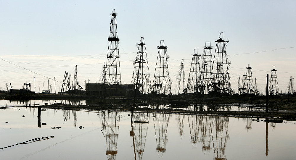
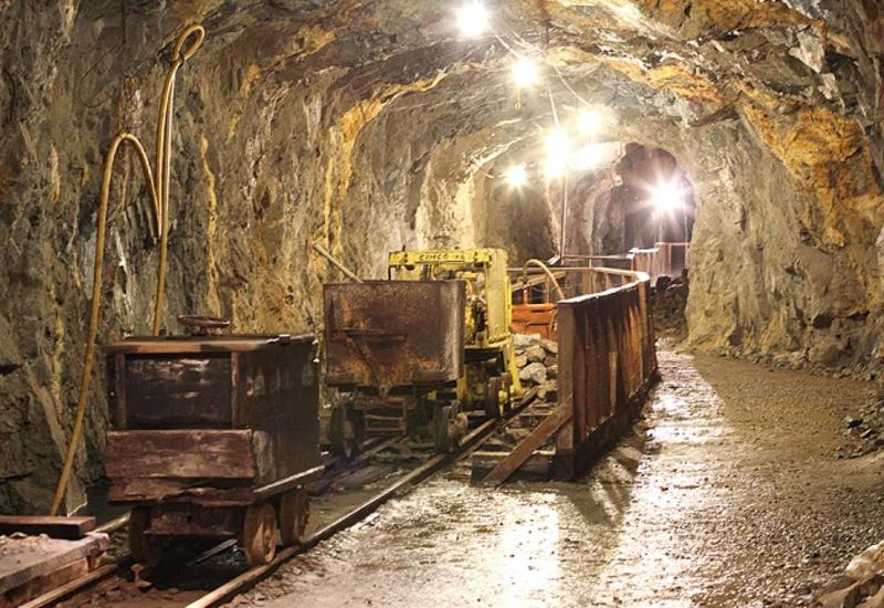
The combustible minerals of the Azerbaijan Republic are oil, gas, shale, peat, etc. Of these, oil and gas are of industrial importance. Oil is produced onshore and in the Caspian Sea. The Republic of Azerbaijan (region of the Absheron Peninsula) is one of the first oil countries in the world. Back in the 7th-6th centuries BC, oil was extracted and delivered to many countries of the world in Absheron. Until 1985, Azerbaijan produced approximately 1.2 billion tons of oil (25% — from offshore oil fields). The oil of the Azerbaijan Republic is low-sulfur and is a high-quality product. The density varies in a wide range (780-940 kg m3 ).
In Naftalan, from the Maikop and Akchagil deposits, oil, the only one in the world for its healing properties, is produced. The gases produced in the republic have a hydrocarbon composition. They are in the composition of oil, free (« gas cap »), in the form of pure gas. Over the past 30-35 years, many gas condensate fields have been explored and commissioned. At the moment, there are 8 oil and gas regions in the Republic (Apsheron, Shemakha — Gobustan, lower — Kura, Baku archipelago, Ganja, Yevlakh, Caspian and Kura interfluve — Gabyrry) and 2 promisings (Ajinour and Jalilabad) regions. In the Absheron, Shemakha-Gobustan, Nizhnekurinsky districts, as well as in the area of the Baku archipelago, the main oil and gas group is a productive stratum. The thickness of this layer, consisting of the sequence of sand, sandstone, and clayey interlayers, reaches 4000 m (in some places even more).
Oil shale and brown coal of the Maikop-Apsheron age were found on the territory of the republic.
Ore minerals
These minerals (iron, aluminum, chromite, gold, silver, lead, zinc, cobalt, molybdenum ores, etc.) form various deposits in the mountainous parts of the republic.
Iron ores (magnetite, hematite) in the Republic of Azerbaijan are found in four sources: segrational-magmatic, skarn-magnetite (contact-metasomatic), hydrothermal-metasomatic, and sediments. Of these, only the deposits of the skarn-magnetite type — Dashkesan, South Dashkesan, and Demir — are of industrial importance. These deposits are formed from volcanic, piclastic. and volcanic-sedimentary rocks of Callovian, Kimmeridgian. Oxford ages. Crossing the Dashkesan syncline along the arrow, the granitoid of the same name is in close contact with the intrusion and is related to it by origin. The industrial reserve of Dashkesan iron ore deposits (category A + B + S) is 250 million tons.
Industrially significant cobalt ores (cobaltin, glaukodot) are known in the Dashkesan ore region. Here cobalt ores were formed both independently (Verkhne-Dashkesan deposit) and together with skrnovo-magnetite ores.
Gold deposits are most common in the Lesser Caucasus and the Nakhichevan Autonomous Republic. The appraisal work of the gold deposits discovered in the basins of the Alinjachai and Kurekchay rivers was carried out, the initial reserves were calculated and the industrial significance was determined.
Chromite deposits (Goydarya, Kazymbinasy, Ipek, Khataveng) are mainly located in the Lachin and Kalbajar regions.
Manganese ore occurrences are located on the northeastern slope of the Lesser Caucasus (Mollajalilli, Dash Salakhli, etc.) and within the Nakhichevan Autonomous Republic (Bichenak, Alyagi).
Copper ores in the Azerbaijan Republic in the formations of copper pyrite and copper-porphyry. The mineral composition of the copper-pyrite ores consists mainly of pyrite and chalcopyrite. In many cases, sphalerite and galena are found in the composition of the ore. In the composition of the copper-porphyry formation, in addition to copper, there are molybdenum and precious metals in small quantities. Ores of both formations are found in daughter quartzites in the Gadabay copper region. The most widespread is the porphyry copper formation. In addition to the Karabakh and Kharkhar deposits (Gadabay copper region), there are large manifestations of porphyry copper formation in this region. Stocks of stock have been exhausted in the Gadabay region; the eponymous copper pyrite deposit is known. Copper-porphyry occurrences (Damirli and Khachinchay) are noticeable in the copper region of Mehman.
Copper-zinc deposits and occurrences (Dzhikh-Sagator, Mazymchay, Karabchay) are represented on the southern slopes of the Greater Caucasus in terrigenous deposits of the Lower Jurassic period.
On the territory of the Nakhichevan Autonomous Republic, ore mineralization of the copper-porphyry type is located mainly on the Meghri-Ordubad granitoid batholith (Diakhchay, Goygel, Heydag, etc.).
In the Balakan-Zakatala zone, there are industrially important deposits of lead and zinc (Filizchay, Katekh, Katsdag, etc.), as well as copper, cadmium, gold, silver, etc. elements.
Deposits and manifestations of molybdenum of the vein-like type are found in the Delidag (Teimuruchandag, Bagyrsag, etc.) and Ordubad (Paragachay, Diakhchay) copper regions.
The largest deposit of aluminum ore (alunite) is located in the Dashkesan region (alunite deposit in Zaglik). Alunite manifestations are known in Shamkir and Ordubad regions. The alunite deposit in Zaglik has been in operation since 1960. This deposit is the largest in Europe. At the Ganja aluminum plant, potassium fertilizers and soda are obtained from this ore.
In the Nakhichevan Autonomous Republic, in the Permian deposits, manifestations of bauxite (Sadarak, Sharur) are known — the best raw material for aluminum.
Deposits and manifestations of mercury are widespread in the central part of the Lesser Caucasus (Kalbajar-Lachin zone). The reserves of the largest deposits have been calculated — Aghyatag, Shorbulag, Levchay (Kelbajar), Gilyazchay, and Narzanli (Lachin). Mercury (kinofar) is found in areas of acidic igneous rocks of various ages and compositions, most of all in volcanic deposits and volcanic rocks of the Upper Cretaceous period. Cinnabar is associated with pyrite, chalcopyrite, antimonite, magnetite, hematite, sphalerite, and other minerals.
Antimony does not form independent deposits. Antimony in the form of antimonite mineral in the Levchay mercury deposit forms deposits in the form of an ore mass.
The largest arsenic deposit in the Azerbaijan Republic is known as Gedabek (Bitdibulag energetic deposit) and Julfa (Daridag orpiment-realgar deposit). This deposit was operated until 1941. The ore is in the form of stock. The composition of the ore consists of orpiment, realgar, antimonite, arsenopyrite.
Small manifestations of tungsten in the form of scheelite are observed at the border of the Meghri-Ordubad granitoid plutons in the Ordubad and Lachin regions.
Non-metallic minerals
Nonmetallic minerals in the Republic of Azerbaijan play an important role in the overall balance of mineral resources. This group includes rock salt, gypsum, anhydrite, bentonite clay, building materials, pyrite, barite, semi-valuable and colored stones, dolomite, Icelandic spar, etc.
Rock salt deposits are located in the Nakhichevan Autonomous Republic (Nekhram, Duzdag, Pusyan). The deposits are located in Miocene sandstones, clay, limestone, and marl deposits. The balance reserve of the Nekhramovskoye field in the B + C1 category is 73,600 thousand tons, in the C2 category — 64,200 thousand tons. Potential resources are estimated at 2-2.5 billion tons. Commercial reserves of the Duzdag field in the A + B + C1 category are equal to 94,517 thousand tons, in the C2 category — 37,810 thousand tons.
Deposits of gypsum and anhydrite are formed in chalk deposits in the villages of Upper Agjakend and Manash of the Gadabay region. Commercial reserves of deposits located 120 km southeast of the city of Nakhichevan (Araz; gypsum) and around the city of Ganja (Gyadzh) in the category A + B + C1 amount to 40,632 thousand tons Many deposits and manifestations of bentonite clays are known (Gobustan, Goranboy, Sheki, etc.).
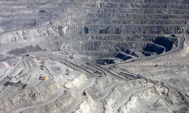
The largest deposit was discovered in the Gazakh region (Dash Salakhli). The deposit was formed from the impact of hydrothermal solutions with volcanic rocks of the Santonian age; industrial reserves amount to 84,553 thousand tons.
There are many building materials on the territory of the Republic of Azerbaijan. Industrial reserves of stone-cubic deposits (Guzdek, Dovlyatyarly, Dilagarda, Shakhbulag, Naftalan, Mardakyan, Dash Salakhli, Zayyam, Ayydag) in category A + B + C1 are equal to 295,836 thousand tons of facing stone (Gyulbyakht, Dashkesanlab, Shakhlytakhty) – 23951 thousand tons.
In Karadag there are deposits of raw materials suitable for the production of cement (limestone, clay, etc.). Clays used in the production of bricks are mined in many places. Limestone deposits are suitable for the production of flux and carbide with reserves of 8.3 thousand m 3 that have been identified in the Siyazan region. Volcanic tuff is a zeolite raw material and is located, and its deposit (Aydag) is located 7 km north-west of Tovuz. The prospective reserves of tuffs at the Ayydag deposit are 20 million tons.
There are almost 20 barite deposits and occurrences in the Azerbaijan Republic (Chovdar, Bashgishlag, Gushchu, Tonashen, Zailik, Azad, Chaikend). Deposits of the vein-like type.
Half-value and colored stones were found in the Dashkesan and Ordubad regions of the Lesser Caucasus (granite, amethyst), in Kedabek (tourmaline), and Santonian volcanic (chalcedony, agate, heliotrope). Agate collections are found in the Adjikend and Gazakh deposits, in the Upper Cretaceous volcanic in the form of secretions, nests, almonds, veins, and lenses. There are jewelry and technical types. Industrial reserves of the Adjikend group of agates are 286.8 tons. Of these, 65.8 tons are suitable for the jewelry industry.
Near the village of Nekhram (Nakhichevan AR) and in Boyanata Mountain (Gobustan) there are large reserves of dolomite. Quartz sands for the glass industry were found in Gobustan, the Absheron Peninsula, and the Guba region.
Displays of Icelandic spar (Nagorno-Karabakh) and large reserves of lithographic stone (Mirikend deposit, Nagorno-Karabakh) were discovered.
In Shemakhi, Kalbajar, and Khanlar regions there are manifestations of chemical paints.
Healing mud is located on the Absheron Peninsula, Lake Masazir, Gobustan, and the Lower Kura depression, in the areas of the eruption of mud volcanoes.
Underground water is considered to be one of the most important natural resources in Azerbaijan. Due to the differences in chemical composition, they fall into several types, such as service water, drinkable, medical waters, and waters used in various industrial sectors.
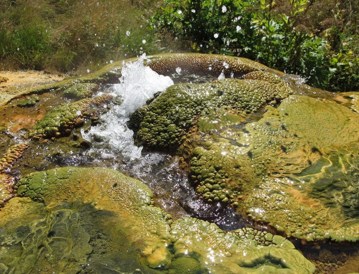
High heat energy underground waters which temperature varies in the range from 60 to 115 C have been discovered in our country. Different types of natural environments have caused the various origin of water type and their spatial distribution. Mesozoic-Quaternary sedimentary deposits of various lithology, pervasive within the plain areas contain tremendous resources of artesian and ground waters used for everyday needs and drinking. Groundwaters are usually met within Quaternary deposits throughout the country. Due to active water exchange observed within the foothill areas, those waters occur at relatively deeper ranges. That water mineralization measures 1gr/l. and their chemical composition is referred to as the calcium-hydro carbonate type. Waterhead artesian basins have been discovered under inclined plain areas encased within Quaternary, Absheron, and Akchagil deposits within Ganja, Gazakh, Guba-Khachmaz, Garabagh, Shirvan zones, as well as within Sarmatian deposits in Nakhchivan AR. Those water mineralization measures about 1gr/l and chemical composition are referred to as calcium-hydro carbonate, and therefore they are used to supply people’s needs in towns and villages, and for service purposes.
Over 1000 cold and thermal springs have been discovered in the Azerbaijan Republic. Several sanatoriums (Istisu, Galaalty, Shih spit, Surakhany) and mineral water plants (Istisu, Sirab, Badamly, Vayhir, etc) have been built up around those water springs. Mineral water’s gas composition in Republic varies from carbon dioxide to hydrogen sulfide, to methane, to nitrogen and radon. Mineral waters distribution due to their gas composition is as follows: mineral waters with carbon dioxide gases were encountered within both Minor Caucasus (Msimsu, Shirlan, Turshsu) and Nakhchivan AR (Sirab, Badamly, etc), with hydrogen sulfide gases within Absheron Peninsula (Surakhany, Shih spit), Talish zone (Istisu) as well as within Great Caucasus southeast foothills (Chukhuryurd, Altyaghaj), nitrogen waters have been discovered within Astara-Lankaran (Meshasu), Salyan (Babazanan), and Masally (Arkivan) regions. Mineral waters containing radon gases have been discovered within Kalbajar (Baghirsag) and in Nakhchivan AR (Gahab). The mineral composition of those waters contains basically potassium, sodium, calcium, and hydrocarbonate, sulfur, chlorine anions. Those waters’ temperature varies in the range from 4 to 65 C.
Mud volcanoes are pervasive within the Republic of Azerbaijan. In local language, mud volcanoes are also known as « pilpila », « yanardagh », « bozdagh », « akhtarma », « gaynarja » etc. There are over 220 mud volcanoes in Azerbaijan (Absheron Peninsula, Gobustan, southeast Shirvan plain, Samur-Davachi plain terrane, both Absheron, and Baku Archipelago. The biggest are Galmas, Toraghay, Big Kanizadag, etc. Most of them have a cone shape. Their height varies in the range from 20 to 400 m, whereas base diameter may vary from 100 to 4500 m.
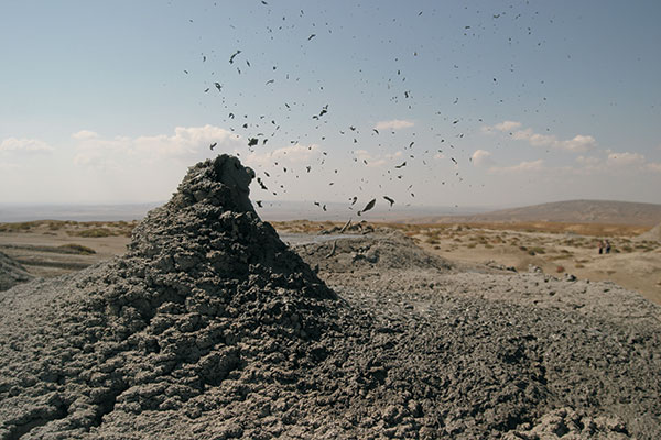
Besides onshore mud volcanoes, there are buried volcanoes and offshore mud volcanoes. There are over 140 offshore mud volcanoes within the Caspian Sea. Eight Islands within the Baku archipelago were generated by mud volcanic eruptions (Khara-Zira, Zanbil, Garasu, Gil, Sangi-Mughan, Chigmil, etc). Buried mud volcanoes have been encountered by exploration wells. Ancient activities of mud volcanoes were identified among various age stratigraphic units. It is suggested that mud volcanoes activity within the Republic of Azerbaijan about 25,000 years ago. Usually, mud volcanoes eruption begins with a subsurface rumble followed by a strong burst. Gases coming out to the surface from deeply buried formations get ignited and blaze up. Flame tongues may at times reach up to 1000m high (Garasu mud volcano).
Observations indicate that 50 mud volcanoes have burst about 200 times since 1810 in Azerbaijan. Lock-Batan mud volcano erupted 19 times during that period. Mud volcanoes erupt mud, solid rock fragments, gas, and water. Mud volcanoes outbursts contain over 100 minerals and up to 30 chemical microelements (such as barite, mercury, manganese, copper, barium, strontium, lithium, etc). The origin of mud volcanoes is associated with buried hydrocarbon deposits. Prolific oil and gas -condensate fields have been discovered in areas characterized by mud volcanoes development (Lock-Batan, Neft Dashlary, Garadagh, Mishovdagh, etc). Mud volcanoes outbursts are used as the medical row material.
In 2007, 52 mud volcanoes were granted the status of state nature reserves by establishing the Baku and Absheron Peninsula Group’s State Nature Reserve.
Azerbaijan saw devastating earthquakes since ancient times. The first report on « an overall devastating event that destroyed all towns and villages » is dated back to 427 AD. In 1139 AD, a devastating earthquake with the magnitude of IX took place in Azerbaijan. The town of Ganja was destroyed completely and gross casualties were reported. It is noteworthy that Goygol Lake had been generated as a result of that same earthquake. In the 19th century, Shamakhy town suffered several devastating earthquakes. Several of them that occurred in 1856, 1861, 1872, and 1902 that are considered to be the strongest and devastating were estimated as strong as VIII and IX points of magnitude.
The first seismic station on the territory of Azerbaijan was founded by E. Nobel in 1902 in Baku after the Shamakhy earthquake. Afterward, seismic stations were set in different areas in Azerbaijan (Balakhany, Zurnabad, Shamakhy, Ganja, Nakhchivan, Lankaran, Chilov Island, and Mingechevir). 14 analog seismic stations were monitored by earthquakes in Azerbaijan. Starting from 2003 earthquakes in Azerbaijan have been monitored and still continued by means of a digital « Kinemetrix » system (that includes 14 stations) set according to the nation-wide leader Heydar Aliyev’s decree. Acquired data is transmitted through the satellite communication system operating in the real-time domain.
Seismic event monitoring by means of installed equipment has been carried out since last century’s 50-s. Since the beginning, such kinds of observations applied analog equipment using the photo-recording system. Those systems were replaced by a proprietary made magnetometer Mobile ACC station designed at Design Laboratory established at the Institute of Geology, ANAS. Since 1996 precision seismology observations have been carried out using a digital ISS telemetric system (manufactured in South Africa). In 2003 Institute of geology, ANAS established Seismic Monitoring and Geodynamic Center supported by Civil Investigations and Development Fond. The Center was equipped with eight modified mobile digital ISS stations.
Tangible earthquake seismic effects have studied by R. Aghamirzayev, S. Aliyeva, A. Hasanav, E. Gul, R. Jafarov, V. Kuznetsov, R. Shafadiyayev et al that enables to identify of earthquakes key parameters and to study their activity attenuation.
Earthquake triggering mechanism studies carried out by A. Aghalarova and S. Aghayeva within onshore and offshore Azerbaijan areas have subjected to severe and intricate strain. It was recognized that earthquake focuses are located within the earth’s crust and about 90% of them are associated with sedimentary rocks.
Seismicity quantitative and recurrence frequency analysis demonstrates significant seismic activity throughout Azerbaijan territory. Moreover, future earthquake events are expected to be moderate in terms of released energy.
Maps of Azerbaijan territory seismicity ranking on a scale of 1:500,000 have been compiled since 1937. State seismicity ranking maps have been compiled and approved by the Institute of Geology, ANAS in 1963, 1967, 1979, and 1989. Background seismicity rate shown on 1989 seismicity map is accepted as much as VII point of magnitude. IX point magnitude earthquake areas cover the Great Caucasus Balakan-Shamahy zone including both Ganja and Nakhchivan areasa and actually cover the Minor Caucasus too. Seismicity ranking maps bear overview features and therefore cannot be used as a reference guide for earthquake-durable building construction projects.
Azerbaijan is situated on the northern extremity of the subtropical zone, south-eastern Caucasus, and north-western part of Iran plateau. Its climatic diversity is caused by the complicated geographical location and landscape, the proximity of the Caspian Sea, the effect of the sun’s radiation, air masses of different origins, etc.
Landscape
As a predominantly mountainous country, Azerbaijan is surrounded by the Major Caucasus, Minor Caucasus, Talysh, and North Iranian Mountains. The Kur lowland between the Major and Minor Caucasus stretches to the Caspian Sea in the eastern part of the country. The Major Caucasus, situated in the north of the country and stretching from the north-west to the south-east, protects the country from direct influences of cold air masses, coming from the north. That leads to the formation of subtropical climate on most foothills and plains of the country. Other mountain chains, surrounding the country also have a great impact on air circulation. The complexity of a landscape causes the nonuniform formation of climatic zones and creates vertical climate zones, etc.
Solar Radiation
Plains and foothills are characterized by high solar radiation rates. The sun shines for 2200-2400 hours a year on the Kur-Araz lowland, Apsheron peninsula, and other plains and foothills, while the indicator totals 2600-2800 in the plains around Araz in the Nakhichevan Autonomous Republic. Due to increased cloudiness in the mountainous regions, only 1900-2200 hours per year are the sun shining. The sun is bright during 2200-2500 hours a year at an altitude of over 3,000 meters. The total annual radiation equals 128-132 kcal per 1 sq. cm. It declines towards the mountains (down to 120-124 kcal-cm2, at a height of 500-600 meters above sea level), then gradually increases and reaches 140-150 kcal-cm2 at a height above 3000 meters of Major and Minor Caucasus. The total amount of solar radiation affecting Araz plains in Nakhichevan totals 148-150 kcal-cm2, it increases in mountains and reaches 152-160 kcal-cm2. The radiation on the country’s plains and foothills amounts to 40-50 kcal-cm2 (in Lankaran -50-60 kcal-cm2, in mountains-15-25 kcal-cm2).
Circulation of air masses
The formation of climate in Azerbaijan is influenced by cold air masses of arctic (Kara and Scandinavian anticyclones) and temperate (Siberian anticyclones) and maritime (Azores maximum), hot air masses of tropical zones (subtropical anticyclone and southern cyclones), Central Asian anticyclones and local weather conditions. Regarding landscape diversity in Azerbaijan, air masses have different ways to enter the country. Thus, cold continental and maritime air masses though not preventing the hot masses from entering the country from the south yet cause changes in some properties of hot air masses and influence the dynamics of atmospheric conditions.
Temperature
The temperature regime and its distribution throughout Azerbaijan is regular and depends on the features of air masses, entering to the country, the regional landscape and proximity to the Caspian Sea. The Caspian Sea causes temperatures in the maritime areas (20 km away from the sea) to decline in the summer and raises it in the winter. At the same time, it relatively softens the influence of hot and dry air masses coming from Central Asia. The average annual temperature totals 14-15 C in the Kur-Araz lowland, the coastal regions south to the Absheron peninsula and in Lankaran lowland. The temperature declines in the direction to mountains and amounts to 4-5 C at a height of 2000 meters and 1-2 C at 3000 meters height.
The temperature does not fall below zero even in the coldest month of the year (January) in plains and foothills. It even totals 3-4 C on the Absheron peninsula and areas and islands south of it. Temperature decreases with altitude and makes up -5-6 C -7 C in the Nakhichevan Autonomous Republic) at a height of 2000 meters above sea level, while at a height of 3000 meters it amounts to nearly -12-13 C. In the hottest month of a year (July) the average temperature mainly equals 26-27 C in the Kur-Araz lowland, while in other plains and foothills it does not fall below 24 C. At a height of 2000 meters in the mountains, the temperatures total 14-16 C and at a height above 3000 meters they do not fall below 8-10 C., The absolute temperature maximum (46 C) and minimum (-32 C) are registers on the plains around Araz in the Nakhichevan Autonomous Republic, characterized by its continental climate.
Precipitation
Precipitations are mainly connected with the entry of air masses to Azerbaijan. The interaction between the air masses and landscape and the Caspian Sea predetermines the volume of precipitations and their annual distribution. Average annual precipitation is lowest (below 150-200 mm) in Southeastern Gobustan and on the south coast of the Absheron peninsula. Annual precipitation is lower than 300 mm in the centre and east of the Kur-Araz lowland, on the plains around the Araz in the Nakhichevan Autonomous Republic, Qobustan and Absheron. The level of precipitation gradually increases from the Caspian Seashore to the west, from plains to mountains. Precipitation increases with altitude till a definite height in mountains (2600-2800 meters in Major and Minor Caucasus, 2600-3000 meters in Nakhichevan, 200-600 meters in Talysh) then gradually declines. In this region maximum annual precipitation maximum on southern slopes of Major Caucasus totals 1400-1600 mm, northeastern slope-800 mm, Minor Caucasus and Nakhichevan AR-800-900 mm, in Talysh mountains-1700-1800 mm.
Unlike other mountain areas, in the Talysh Mountains, the volume of precipitation declines with altitude and at high altitudes, it is even lower than 250-300 mm. Though precipitation mainly falls in the hot part of the year (April-October), summer months are dry and at that period precipitations make up 5-15% of the annual norm even in the Lankaran-Astara zone, notable for the highest level of precipitations. The number of days of precipitation falling does not exceed 60-70 days per year in the Kur-Araz lowland and plains around the Araz in the Nakhichevan Autonomous Republic, while at the central part of the southern slope of Major Caucasus the number reaches 170 days. The highest daily maximum of precipitations has been registered at the southern slope of Major Caucasus (148 mm, Alibey) and in Talysh mountains (334 mm, Belser). The intensity of rainfalls reaches 1-2 and even 3 mm per minute. On the plains, rains make up the 4/5 part of precipitation, while in mountains they account for 1/3 of its part. The snow blanket is short-lived and sometimes it does not fall for several years in the plains. The areas, accounting for the highest level of snow, are at the southern slope of Major Caucasus. The days when snow fully covers the ground total 80-120 in middle highlands and reaches 250 days in the mountains. The snow is eternal on the highest alp of Major Caucasus.
Humidity
Absolute annual humidity totals 11-12 lb in the Kur-Araz lowland and 14-15 lb on the Caspian Sea coast. In mountains, it declines with altitude and equals 9 lb at a height of 1000 m and 7 lb at a height of 2000 meters. Absolute humidity is relatively low in the Nakhichevan Autonomous Republic and at definite altitudes, it is by 1-1.5 lb lower from other regions of Azerbaijan. Absolute humidity is the highest in the hottest period of a year (July-August). It totals 20-24 lb at the coastal regions and the Ganikh-Ayrichay valley and 8-10 lb at a height of 3000 meters. In January the level of humidity on plains equals 6 lb, at a height of 1500 meters it’s approximately 3 lb. At that period the lowest level of humidity is registered in the Nakhichevan Autonomous Republic and on plains (4lb) while in the mountains the level is even lower.
Annual Relative Humidity is the highest on the Caspian Sea shore (75-80%) and it reaches its minimum in of Nakhichevan AR and Major and Minor Caucasus (55-65%). In summer the relative humidity is the lowest in Nakhichevan AR (35-50%), at the highest altitudes of Talysh mountains (50-55%) and in the Kur-Araz lowland (50-60%). Relative humidity reaches its top on the seashore and highest altitudes of Major and Minor Caucasus (60-85%). Through winter months relative humidity is maximal on the seashore and minimal in the highlands.
Evaporation
The highest annual evaporation is typical of the Nakhichevan AR, plains around the Araz (over 1200-1400 mm) and the Kur-Araz plain (1000-1200 mm). It ranges from 800 to 1000 mm on other plains and lowlands of Azerbaijan. In mountains, evaporation decreases with altitude. On middle uplands, possible evaporation falls down to 300-400 mm in mountains-to 200 mm.
Cloudiness. The regime and allocation of cloudiness are connected with air circulation and the orography of the area. The cloudiness is maximal in high mountains (over 2000 meters, in summer and spring), mid highlands and at foothills (2000-500 meters).
Winds
Fions (hot and dry winds) are typical for mountain areas in cold months of the year, while winds are observed in plains and foothills in hot months. Average annual wind speed equals 5 m/s in the country. However, it ranges from 6 to 8 m/s on the coastal areas of Absheron peninsula. The days when the wind blows with a speed of 15 m/s and more total 100-145 in this region. Ganja-Kazakh plain is characterized by strong winds (25-70 days) Strong winds are less frequent in other regions of Azerbaijan.
Taking into consideration distribution and features of the regime of weather temperature and atmosphere precipitations, as well humidity circumstance in the Azerbaijan Republic, 8 of 11 climate patterns of the Earth (according to V.V.Keppen) are determined here. Many of these patterns are divided into semi-types.
1. Semi-desert and dry steppe climate covers mainly Central lowland districts (fields in Kur concavity, the height of which is up to 400 m), Caspian zone from end of Samur River to Gizilaghaj gulf, plains of Nakhchivan AR along the Araz river, closed mountainous concavities of Talish Mountains (from 1000 m). Annual precipitations make 15-50% of possible evaporation. Winter is mostly hot (cold in plains along the Araz River and closed mountainous concavities of Talish Mountains). Summer is red-hot, some days temperature is higher than 40 degrees.
2. Mild-hot climate, winter if which is dry, covers lower mountainous zone (in height up to 1000 m) of south hills of Great Caucasus, Ganikh-Eyrichay concavity (200-500 m), north and east hills of Small Caucasus (in height of 400-1500 m). Annual precipitations make 50-100% of possible evaporation. Winter is mild, with low precipitations, summer is mild-hot.
3. Mild-hot climate with dry summer. Mostly covers the Lankaran-Astara region. Annual precipitations make 100-150% and more of possible evaporation. Winter is mild, summer is mild-hot and dry, autumn with high precipitations. It rains less from May till mid-August and this season is dry often, artificial irrigation is applied.
4. Cold climate with dry winter covers south-east hills of Great Caucasus (1000-2700 m) and middle and high mountainous parts of Small Caucasus (1400-2700 m). Annual precipitations make 75-100% of possible evaporation. Summer is cool, winter is mild.
5. Cold climate with dry summer. Covers middle and high mountainous area of Nakhchivan AR (1000-3000 m). Annual precipitations make 50-100% of possible evaporation. Winter is cold and snowy, summer is cool.
6. Mild-hot climate with equal distribution of precipitations covers mountainous forestlands in the south (600-1500 m) and north-east (200-500 m) hills of Great Caucasus. Annual precipitations make 75-100% of possible evaporation in south hills and 50-100% in northeast hills. Winter is mild, summer is mild-hot.
7. Cold climate with rich precipitations in all seasons is characteristic for south hills of Great Caucasus only (1500-2700 m). Covers upper forest, sub-alpine, and alpine zones. Annual precipitations are more than 150-200% of possible evaporation. Winter is cold, summer is cool.
8. Mountainous tundra climate covers the areas of Great and Small Caucasus higher than 2700 m and of Nakhchivan AR higher than 3200 m. Annual precipitations are more than 100-200% of possible evaporation. Winter and summer are cold. In some places, snow does not melt till the next winter.
In terms of the total number of species, the flora of Azerbaijan is much richer, in contrast to other republics of the South Caucasus. The plant species found in the republic make up 66% of the total number growing in the Caucasus.
The richness of the flora and the diversity of the vegetation cover of the Republic of Azerbaijan is associated with its physical-geographical and natural-historical conditions, as well as a complex history formed under the influence of remote floristic areas.
The Republic of Azerbaijan is also rich in relict rocks dating back to the Tertiary period, which can be found in all zones, especially in the Talish zone. These include the iron tree, Lankaran acacia, chestnut oak, Caucasian persimmon, butcher, boxwood, etc. The republic has 240 species of endemic (local) plants.
All types of habitats are found in the flora of Azerbaijan — ancient forest, boreal, steppe, xerophilous, desert, adventive plant species. Samples of the ancient forest area are widespread in Talysh, the boreal type — in the highlands of the Greater and Lesser Caucasus, in smaller numbers — in the lower mountain belt. The xerophytic, Caucasian, steppe, and desert types became widespread in the Kura-Araz lowland and in other lowland and foothill regions of the republic. The adventive areal type is quite rare. In the Kura-Araz lowland, the Caspian zone, and in other lacustrine, wetland, swampy areas of the plains, there is varied and variegated vegetation.
Along rivers and canals, in swampy areas, locally on the plains, there are reed thickets of a cosmopolitan composition. There are many such plants as tall (grass), foxtail, cattail, millet, broom. You can also find thickets of a tall species of savanna type eriantus.
In the Kura-Araz lowland, in areas with chal-meadow-like vegetation, chayyr, licorice and tuberkamysh are widespread. In the Karabakh lowland, thickets of kermek, buckwheat, chisel, loosestrife, and iris are more common, which form both separate thickets and are found in other phytocenoses.
In stagnant waters and in the coastal strip (especially in Agzybirdzhala), reeds, cattails, pondweed, and others predominate. Reed thickets are also characteristic of the plains.
In the marshy areas of the Lankaran lowland, the wetland formations of the pond, iris, uruti, and hornwort are especially widespread. Dried bogs are characterized by plants of mint, chastuha, buttercup, butcher’s broom.
Wetland vegetation is found in bogs, lakes, and ponds of the lower, middle, and high-mountain zones. Especially in the subalpine zones, wetland vegetation is widespread (there are over 100 swamps and lakes).
In the Kura-Araks lowland, in the Caspian zone, and other plains, desert and semi-desert types of vegetation prevail. Desert saltwort vegetation is widespread in the vicinity of Lokbatan, in Eastern Shirvan, on Mugan. On pastures in the coastal part of the Caspian Sea, and especially on the Kura-Araks lowland, there are sarsazanniks, forming a shallow desert.
Deserts with salt grates are widespread here, where 5-6 types of ephemerals are found. On the plains of Eastern Shirvan and in the foothill parts of the republic, territories with sveda occupy a large place. Three types of saltwort in wide areas of the Kura-Araz lowland form productive semi-deserts. Especially the mountain hodgepodge at the foot of the mountains, both separately and with wormwood, form hodgepodge-wormwood deserts, and in the most developed lands — semi-deserts. Woody hodgepodge is found on not very saline lands; the composition of the season is rich in dozens of different ephemera and ephemeroid plants. The woody hodgepodge forms semi-desert thickets mainly with wormwood, camel thorns, and malt. In general, there are 22 species of saltwort in the republic, many of which form specific formations. Solyanka can be found in the not very saline Sheki meadows. Wormwoods are characteristic of one of the most widespread semi-desert vegetation, developing on slightly saline soils and sierozem soils. Often, wormwood, mixing with saltwort and perennial grasses, forms mixed semi-desert formations. In all places overgrown with wormwood, there are 30-35 and sometimes 50-55 ephemeral and ephemeroids. For example, bulbous bluegrass, Japanese bonfire, oriental mortuk, hard chaff, sagittarius, small alfalfa, alfalfa blue, etc. are constant components of wormwood. In wormwood, you can sometimes find shrubs. In the coastal zone and on the sands that emerged from the sea waters, psammophytic-littoral species of wormwood, astragalus, Persian bindweed, Caspian melilot, as well as hundreds of ephemerals and ephemeroids, grow. Although many valuable and rare plant species on the sandstones of Apsheron are short-lived, they actively develop in spring and wither quickly. In steppe and dry steppe phytocenoses, xerophytic grasses predominate. Highland xerophytic plants often combine with steppe species to form specific formations.
In the arid regions of the Lesser Caucasus (Nakhichevan AR, Jebrail, Zangilan), in the steppes of the Greater Caucasus, xerophytes are found, i.e. freegan, shiblyak, astragalus, acantholimons, sometimes junipers and juniper — pistachio groups. Freegans in the Nakhichevan Autonomous Republic at an altitude of 1000-1500 meters above sea level create independent formations (thickets). More than 300 plant species are found in these formations. In arid regions, species of thyme create formations. Here grows mint, buckthorn, curl. You can also find plants such as euphorbia, yarrow, barberry. Shiblyak is widespread in the republic in the form of meadows — hold a tree, buckthorn, cotoneaster, almonds, pyracantha, wild pear. Here, the specific formations are created by the vesicle, participating in the formation of upland xerophytic vegetation. Mastic pistachio, juniper, and stone tree form the formations characteristic of the republic.
In the northwestern part of the republic, on the steppe plateau and in the forests of the Eldar plain, the Eldar pine, an endemic relic of the Tertiary period, has preserved its naturalness. The presence of juniper, pistachio, grip-tree, and another 30-35 higher spore species here suggests that these places can be attributed to mountain-xerophytic vegetation.
The basis of the preserved tugai forests growing along the coastal strips of the Kura, Araz, Ganikh, and Gabyrry rivers is poplar, willow, elm, elm, here, tamarisk, and pomegranate.
In the mixed forests of the valleys of some mountain rivers, sea buckthorn, oak, willow, sumac, scumpia, comb, here, barnyard, pomegranate, dog rose, blackberry is widespread. Sea buckthorn is most common on the right and left banks of the Shin, Kish, Demiraparan, Turian, Goychay, Agsu, Velveli, and Terter rivers. On Talysh, in river valleys, lapina and alder form thickets. Another type of alder, Alnus barbata, is most typical for the swampy forests of Talysh. In the forests, the local endemic — the Girkan figs form characteristic formations together with ivy, elderberry, heartwood, bluegrass, iris, hedgehog, and swamp.
In the Guba-Khachmaz and Karabakh zones, as well as in the Alazan-Ayrichai depression, flat forest areas of a local form are widespread. The basis of these forests is downy oak, elm, hawthorn, medlar, etc. Along with them, linden trees, ash trees are widespread in the forests of the Alazan-Airichay depression, and among climbing plants, windweed, ivy, and wild grapes. In lowland forests, there are about a dozen different forms of fluffy oak.
In the Talysh low-lying forests, such valuable relict species as ironwood and chestnut-leaved oak grow. In addition to them, there are Caucasian hornbeam, 2 species of zelkova, elm, poplar, and forests of the Hyrcanian type. In the lower tier of these forests, there are evergreen shrubs — butcher and dana. Caucasian persimmon on damp hills creates special thickets. On Talysh, Caspian gleditsia predominates. Here Lankaran acacia, ironwood, linden, and other species form mixed forests. At a certain height from the level of the Caspian Sea, maple, together with beech oriental species, forms dense tall forests. In the lower tier of forests of this type, yew, boxwood, and, in part, dana, form specific formations.
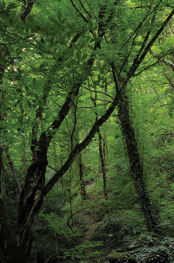
In the Greater and Lesser Caucasus, at an altitude of 600-1800 meters above sea level, deciduous forests are widespread. These forests are dominated by Georgian oak, oriental beech, oriental oak, and others. Beech forests in this zone form highly productive, diverse mixed forests. Along with beech and oak, in these forests there are linden, hornbeam, 5-6 species of maple, especially along with oriental oak, the trautfetter linden also grows. In dense beech forests, the herbaceous cover is absent. In the case of a more scattered type of beetles, a herbaceous cover develops here together with shrubs. In the undergrowth, there are yellow rhododendron, blackberry, elderberry, shrimp, and various types of cereals. There are forest parks in the alpine zones (1800-2000 meters). Together with subalpine meadows and tall grasses, they form subalpine woodlands.
The highlands are characterized by the eastern oak, on the northern slopes there are birch forests with twisted trees due to avalanches, and on the mountain slopes of the Greater Caucasus, rhododendron and occasionally the Caucasian mountain ash. Coniferous forests have slightly spread on the territory of the republic: in the Eldar grove — Eldar pine, in the Greater and Lesser Caucasus — forests of hooked pine. The hooked pine forms small forests in the Bulanygchay basin and in the vicinity of Lake Goygel (1600 m above sea level). On Lake Goygol, on large rocky cliffs, together with birch, it forms a mixed forest. Of the conifers, the yew and juniper species have spread in the mountain-forest zones. In the subalpine belt of the northwestern part of the Greater Caucasus, especially in the Zagatala-Balakan zone, the Caucasian rhododendron is widespread.
At an altitude of 1800-3200 meters above sea level, in multi-species alpine and subalpine meadows, steppe and meadow plants prevail. Depending on the features of the relief of highlands, mountain slopes, and other factors, various formations develop here. In the subalpine belt, tall grasses form specific formations. There are especially many flowering plants such as cow parsnip, yarrow, hedgehog, meadowsweet, reed grass, sorrel, groundwort, nettle, sweet clover. In the subalpine belt, moderately humid, mesophilic, steppe, xerophytic meadows, which are very diverse, are widespread. The basis of subalpine meadows is a white-grass and red bonfire, Caucasian thin-legged, purple barley, alpine bluegrass, and a number of three-leafed clover species, geranium, cuff, elecampane, feverfew, veronica, bedstraw, goatgrass, primrose, plantain, and dozens of other species. About one thousand plant species are widespread in subalpine meadows.
Alpine meadows are widespread on the slopes of high mountains, peaks, cliffs. Despite the fact that the species composition here is relatively less represented than in subalpine meadows, they are distinguished by the biodiversity of low-growing plants. On alpine meadows with fine earthy substrates, alpine plantain grows, and on stony substrates, alpine carpets consist of sibbaldia, bellflower and macrotomy.
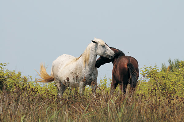
The diversity of various types of animals, which inhabit and populate a defined ground or water area, is the animal kingdom. The first reports on the richness and diversity of animal life in Azerbaijan can be found in travel notes of Eastern travelers.
Animal carvings on architectural monuments, ancient rocks, and stones survived up to the present times. The first information on the animal kingdom of Azerbaijan was collected during the visits of naturalists to Azerbaijan in the 17th century.
Unlike fauna, the concept of animal kingdom covers not only the types of animals but also the number of individual species. The animal kingdom of Azerbaijan is very rich, partly due to the diversity of its natural complexes. There are 97 species of mammals, 357 species of birds, 67 species of reptiles and amphibians, 97 species of fish, and over 15 thousand species of invertebrates in Azerbaijan.
The natural habitat of various types of animals is very different within the country. Some species populate special restricted areas (lakes, parts of mountainous areas) while others are spread throughout the country. For example, passerines can be found anywhere in the territory of Azerbaijan.
The Red Book of the Azerbaijan Republic includes 108 species of animals, including 14 species of mammals, 36 species of birds, 13 species of reptiles and amphibians, 5 species of birds, and 40 species of insects.
A number of natural preserves have been created and the hunting rules were brought into effect for the protection of fur and hoofed animals in Azerbaijan.
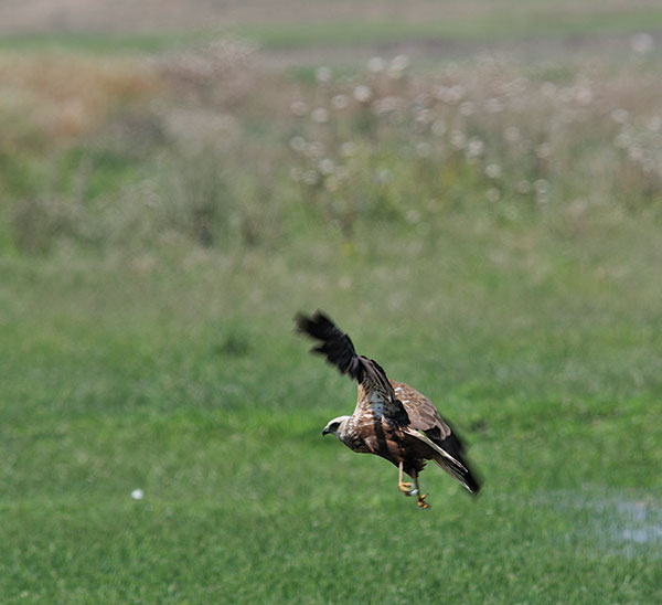
The golden eagle inhabits mainly mountainous areas. The Caucasus tetra occupies the sub-Alpine areas of the Major and Minor Caucasus, while the green head duck populates the Caspian Sea coast and inland water reservoirs. Goats and West Caucasus moufflons inhabit Nakhichevan, jeyran gazelles can only be found in Shirvan natural preserve, Bendovan, and Korchay regions of Azerbaijan. The Caucasus goat populates the western slopes of the Major Caucasus in Balakan, Gabala, Zakatala, and Ismayilly regions.
The country’s freshwater basins and the Caspian Sea account for 30 species of fish. They are fished in the Kur River, surrounding lakes, as well as in the Mingechevir reservoir. Most of the fish are anadromous or semi-anadromous (the young grow up in saltwater and migrate to freshwater to breed after they reach maturity). The most valuable of anadromous fish are salmon, sturgeon, stellate sturgeon, and beluga. Aspius, Chalcalburnus, and eel are also anadromous fish. Sturgeon meat and caviar are highly valuable.
Besides, the water basins of Azerbaijan contain such valuable fish species as bream, sazan, Rutilus kutum, and others. Such fish species as herring are fished in the Caspian Sea. Due to the construction of a number of hydro-technical plants on the Kur river after 1959, the regulation of the river water flow, as well as the Caspian water pollution led to a significant reduction in the number of valuable fish species. Three hatcheries (Kuragzi, Shirvan, and Kur experimental sturgeon hatchery) for melioration and fish-farming purposes were launched to restore the fish reserves and to increase the number of fish in species. Azerbaijan’s fish-farming establishments and hatcheries account for the breeding of 20 million sturgeons, 600 thousand salmons, over 800 thousand. A new hatchery with the capacity of 20 million sturgeons was put in commission in Khyly in 2000.
« BIG FIVE »
At the initiative of Leyla Aliyeva, the founder and head of the IDEA public association, in 2012, five endangered animal species were identified in our region and the concept of the “Big Five” of the Caucasus was developed. Since then, the Public Association IDEA has been taking practical measures to protect and increase the number of endangered species of fauna.
Jeyran / Gazella subgutturosa
Order: Cetaceans
Family: Bovids
Category and status: VU A2ad; II.1., II.4.
Distribution: Shirvan MP, Korchay reserve and a very small group live on the plains of Gobustan and Achinogur.
Habitat and lifestyle: wormwood, saline deserts, and semi-desert landscapes. The periods of mating (November, December), gestation (January-May), and birth (from late April to mid-June) are their reproductive characteristics. The gestation period is about 5-5.5 months. Sexual maturity in females is 7-19 months, in males 1.5-2.5 months. The main components of the diet are grasses, grains, salt marshes, and perennial shrubs. When there are problems with fresh water, they also use snow and saltwater.
Quantity: On average, up to 7000 gazelles.
Restrictive factors: Poaching, grazing of domestic animals in their habitats, mowing of pastures and occupation of habitats, arson
Protection Measures Taken: As part of the landmark IDEA project « Reintroduction of Gazelles to Historic Places in the Caucasus », 150 gazelles were released into their historical habitats in Azerbaijan and Georgia. Note that the project was launched by the Heydar Aliyev Foundation in 2010 and was successfully continued by the latter after the creation of IDEA. The goal of the project was to increase the number of gazelles in the region and return them to the areas where they used to live, but for some reason left them. The public union IDEA and its project partners — the Ministry of Ecology and Natural Resources and the World Wildlife Fund (WWF) — regularly monitor the adaptation of gazelles released into the wild. Measures to protect gazelles have led to the restoration of the population of this species and even an increase in its number from 2,000 to 7,000.
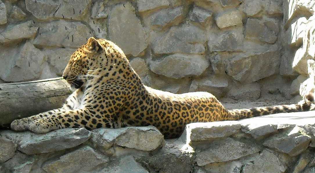
Leopard / Panthera pardus ciscaucasica
Order: Predatory
Family: Felines
Category and status: NT; II.3.
Distribution: Studies over the past 10 years have shown that leopards live in the forests of Hirkan, Zangezur Range, Daridag, Nehramdag, and Darasham, as well as the Akhar-Bahar range north of the Mingachevir reservoir.
Number of individuals: About 17 individuals live on the territory of the Republic
Limiting factors: Direct oppression by people and a sharp reduction in the number of basic components of the diet.
Measures taken by IDEA to protect: As part of the protection of the leopard, the IDEA Public Association, together with its international and local partners, annually organizes a number of public awareness events, including summer camps for schoolchildren, scientific seminars, and master classes for students, competitions for young people, etc. In addition, in order to raise the international community’s attention to Caucasian leopards and mobilize efforts to protect them, the Caucasian Cats Summit was organized in Baku in May 2014 at the initiative of the IDEA public association. The summit on the protection of Caucasian leopards, in addition to the world’s leading experts in the protection of cats, was also attended by representatives of such international organizations like the United Nations Environment Organization (UNEP), representatives of the World Wildlife Fund (WWF), Panther organization, representatives of the Smithsonian Institution, London Zoological Society and Harvard University, as well as scientists from Azerbaijan. Experts and representatives of influential international organizations delivered lectures and held discussions on this topic. The summit was the first significant step and starting point for the protection of Caucasian leopards. Following the summit, the Zoological Society of London (ZSL) prepared a report on the protection and growth of the leopard population in Azerbaijan and made a number of valuable recommendations in this regard. Also, the Public Union IDEA created a working group consisting of specialists from the Ministry of Ecology and Natural Resources and the WWF representative office in Azerbaijan. Based on the above-mentioned NLB report, the working group developed an Action Plan and a corresponding roadmap for the project “Restoring Leopard Numbers in Azerbaijan”. Currently, international experts are analyzing the possible directions of the project. It should be noted that leopards are listed in Appendix 1 of the CITES Convention.
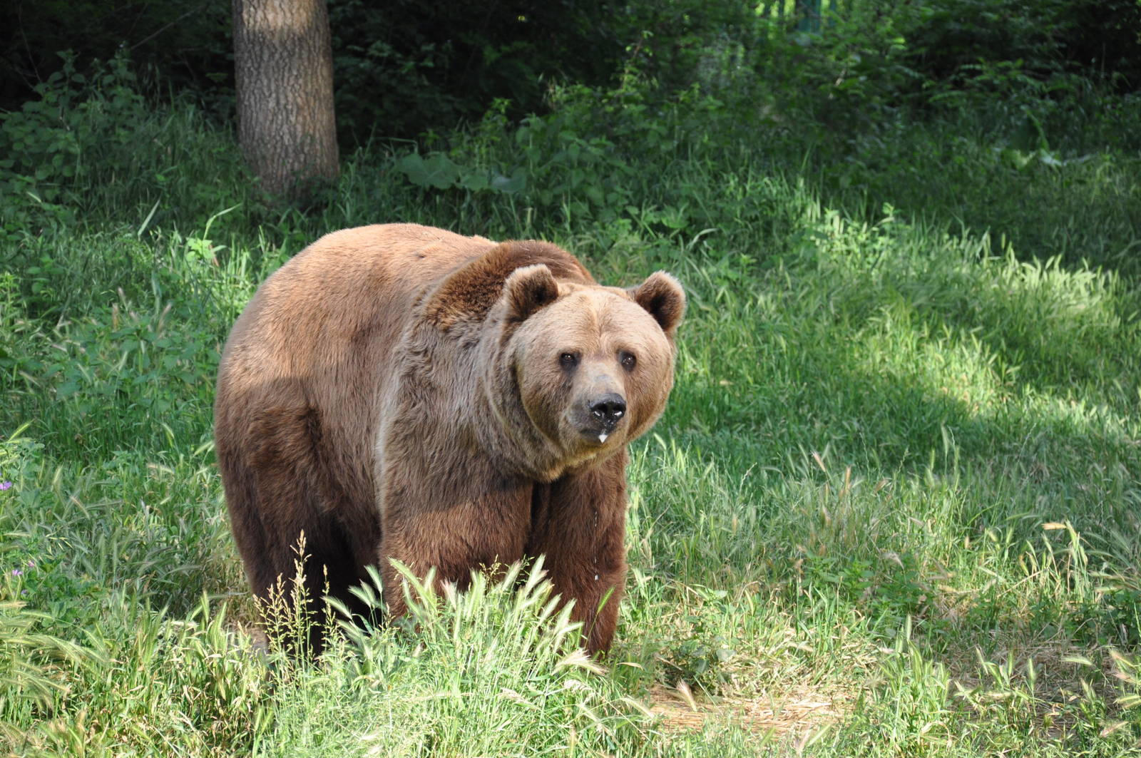
Brown Bear / Ursus arctos
Order: Carnivores – Carnivores
Family: Bearish
Category and status: LC; II.3.
Distribution: Greater and Lesser Caucasus, Talysh mountains, foothills.
Habitat and Lifestyle: The habitat encompasses both forested and rocky mountainous areas.
Its food is of vegetable and animal origin, depending on the season. The mating season is in May-July. The gestation period lasts 6-8 months, including the latency phase. Babies are born in January-March during hibernation. They can usually give birth to 2-3 and sometimes 5 puppies. The lactation period can last 18-30 months, while the mother is involved in the growth and learning of the babies.
Quantity: There are about 500-700 individuals.
Limiting factors: Poaching and habitat loss.
Safeguards: Included in CITES Appendix 2.
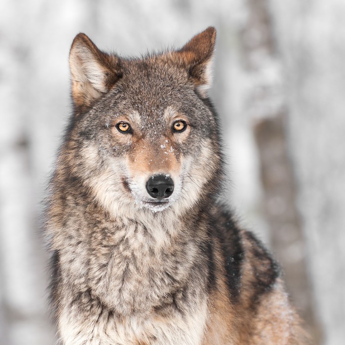
Gray Wolf / Canis lupus
Order: Predatory
Family: Canids
Category and status: At present, the number is satisfactory.
Distribution: Gray wolves predominate in the less temperate regions of Europe and Asia. It is found in all regions of our country, but most of all wolves are found on the Kursk plain, on the shores of the Red Tree Bay, in the Zagatala-Lagodekhi nature reserve.
Habitat and lifestyle: Wolves are monogamous animals. Mating takes place in winter. The gestation period is about 65 days. In April-May, the she-wolf gives birth to 4-8 cubs. Six-month-old wolves can already feed themselves. The entire herd participates in the feeding and rearing process. Wolves are mammals. They hunt artiodactyls, rodents, and rabbits. In summer, they feed on birds, as well as berries and eggs.
Quantity: In 2001, the number of wolves in Azerbaijan was about 988 individuals. In 2010, 5,109 people were registered. According to the results of last year, about 150,055 wolves live in Azerbaijan.
Limiting factors: Poaching
Safeguards: Included in CITES Appendix 2.
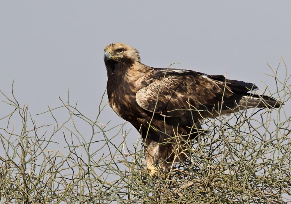
Eagle Imperial Eagle / Aquila heliaca
Order: Hawk-shaped
Family: Hawk
Category and status: VU A2ad; II.1., II.4.
Distribution: Nests in the foothills, and inhabits the steppe part of Azerbaijan
Habitat and way of life: Does not breed and gives birth in places with rocks, ravines, and rare trees. Arranges nests in April, lays 2-3 eggs per year, incubation lasts about 43 days. At the age of 55-60 days, the chicks rise on the wing but do not leave the nest. The male carries food, the mother feeds the chicks. They mainly feed on carrion, but at the same time, they get their own food by hunting small mammals and birds, even predatory ones.
Quantity: According to the Red Book, only 12 pairs of birds were recorded until the end of the twentieth century, which were numerous in the mid-twentieth century and rare after 1970. The risk of extinction has increased over the past 10 years. During the breeding season (May-July), only 5 pairs of birds were recorded: Turyanchay State Nature Reserve 1, a town in the foothills of the Caucasus 2, Zuvand 2 Reserve.
Limiting factors: For many years it was considered a harmful predator and therefore a purposeful hunt for extermination was carried out, the loss of places suitable for nesting due to deforestation, a decrease in the amount of food supply.
Protective Measures Taken: Hunting prohibited. Listed in the Red Book of the Republic. Listed in CITES, Berne, and Bonn conventions. Protected internationally.
The largest lake in the world — the Caspian Sea, is located on the mainland depression, on the border of two major parts of the Eurasian continent. It is also the largest indoor water system on our planet.
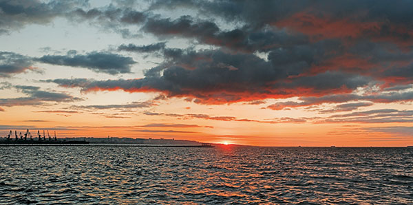
The most ancient inscriptions related to the Caspian Sea were encountered upon an Assyrian ceramic pot, mentioned as the Southern Sea. The Hekatey of Milet’s historical and geographic books (VI BC) mentioned this sea as Kaspi and Hirkan. The first ethnic name is associated with the name of the Kaspi people who were dwelling in the southwest coastal areas of the current territory of Azerbaijan. Its second name was originated from Hircan country, which was located in the southeast coastal areas (translated from Persian as « the country of wolves »). These two names of the Caspian Sea were also mentioned by Herodotus (5th century BC). Other ancient authors were also using such names as Alban (in association with the Albanian ethnic name), Stormy and Hirkan names of the sea. Ancient Russian manuscript sources named the Caspian Sea as Goy (that means Blue in Mongolian-Turk languages), Kharezm (in association with the Kharezm power located within the area extended from Amu-Darya River lower intercourse up to the Caspian Sea, Khvalin, Darband, etc. People that had dwelt around the Caspian Sea called it with different names, for example, the Russians Khvalin, the Tartars — Agh Deniz (White Sea), the Turk people — Kichik Deniz (Small Sea), the Chinese people — Si Hay, and the New west Sea. Venice Ambassador to Iran (1474-1477) A. Kontarini named it as Baku Sea. The Russians used to call the sea Caspian since the 16th century. Other countries around the Caspian Sea called this basin as follows: Caspian (Khazar) in Azerbaijan, (Khazar -Turk speaking people that dwelt within the northwest coastal areas during V-X centuries), Mazandaran — in Iran, as well as Caspian — in Kazakhstan and Turkmenistan. All in all, over 70 names were given to the Caspian Sea by various people who dwelt around the basin at various times.
Formation
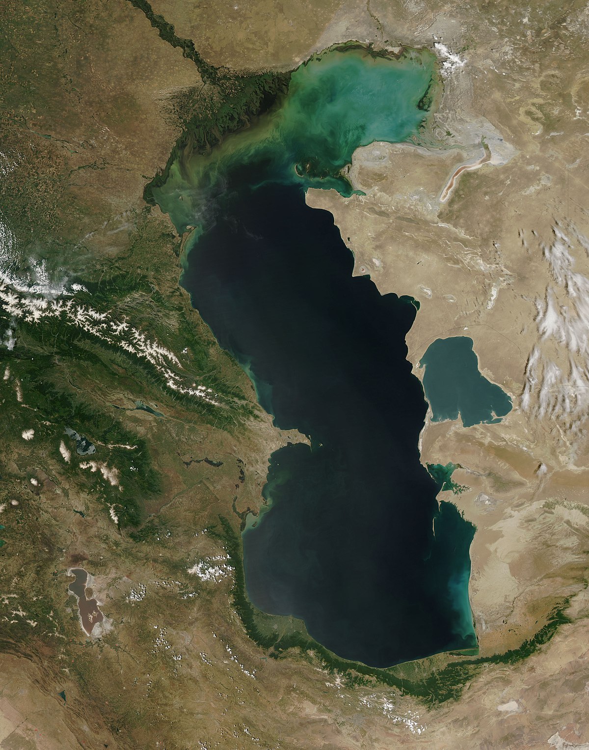
The formation of the Caspian Sea began 10 M years ago, and during this period of time several changes of the seawater level, as well as the recurring transgressions and regressions, took place. During the Tertiary period (which began about 70M years ago) the Ponto-Caspian basin was isolated from the Tethys Ocean and its southern seas and gradually transformed into a stand-alone inland basin. At the Late Pontian and Middle Pliocene time (10 M years ago), the vast inland Sarmatian basin, which extended from the Black Sea to the Caspian Sea, was divided into several parts with the stand-alone Caspian Sea. During the Quaternary period (500 years ago), the Caspian Sea was linked to the Black Sea by the Kuma-Manich depression. The fluctuation of the Caspian Sea water level ranged about 300 m during the last geological period of time. Sometimes, sea bottom in the entire North Caspian and partially Middle Caspian sectors underwent subaerial exposure, whereas South Caspian-Lankaran basins remained submerged under the water surface.
Physiography
The five littoral states have a shoreline of 6,500-6,700 km (7,000 km with Islands) shoreline. The shoreline length in each of the littoral states is as follows: Republic of Azerbaijan — 955 km, Kazakhstan — 2320 km, Islamic Republic of Iran — 724 km, Russian Federation — 695 km, and Turkmenistan — 1200 km.
Caspian Sea is a latitudinally extended basin similar to the Latin letter « S » that is located in the area limited by 47 17 North latitude and 36 33 southern latitude coordinates. Its latitudinal length approximates 1200 km, average width measures 310 km with maximum and minimum width values 435 km and 195 km respectively. Due to recurrent sea-level fluctuation, its offshore area and the number of water masses are also variable. Currently Caspian Sea level measures 26.75 m below the world ocean level. Caspian offshore area at its current sea-level position amounts to 392,600 sq km with the amount of water volume measured 78,648 km, and this volume covers 44% of the overall amount of lacustrine water all over the world. Caspian Sea maximum depth measures 1025 m and, in this context, it is comparable with such ones as the Black Sea, Baltic Sea, and Yellow sea, and deeper than Adriatic, Eagan Sea, Tirren, Sulu, and other seas.
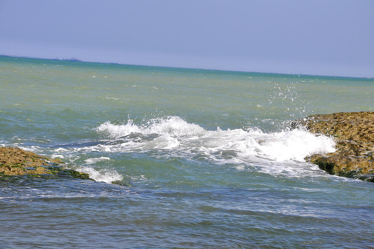
Caspian Sea drainage area amounts to 3.1-3.5th. sq km extending over 2500 km from the north to the south and up to 1000 km from east to west that covers 10% of the world’s closed drainage areas. The following 9 country areas entirely or partially are included in its drainage area: Azerbaijan, Kazakhstan, Armenia, Iran, Georgia, Uzbekistan, Russia, Turkey, and Turkmenistan. Due to the tremendously large and closed type drainage area, the Caspian Sea could be referred to as a Global-scale climate identifier.
Due to geomorphology setting and physiographic conditions, the Caspian Sea is divided into three different sectors: the North, Middle, and the South sectors. Both imaginable lines extended across the Caspian Sea from Chechen Peninsula to the Tub-Karagan spit, and another one extended from Chilov Island to Hasangulu spit, is referred to as the borderlines between its northern and middle, as well as between its middle and southern sectors, respectively. Both Gulali shoal that begins from Tub-Karagan Peninsula and further on the Mangishlag sill extended through the shallow water (10 m deep) from Chechen Peninsula serve as the natural border dividing the North and Middle Caspian offshore areas. Middle and South Caspian sectors are divided from each other through submarine elevation extended between the Absheron Peninsula and Cheleken Peninsula, known as Absheron sill. The spatial coverage proportion of the North, Middle, and South Caspian sectors amounts to 25%, 36%, and 39%, respectively. Water column maximum depths within the North, Middle, and South Caspian sectors amount to 25 m, 788 m, and 1025 m, which averages as 4.4 m, 192 m, and 345 m, respectively.
THE COASTS AND ISLANDS OF THE CASPIAN SEA
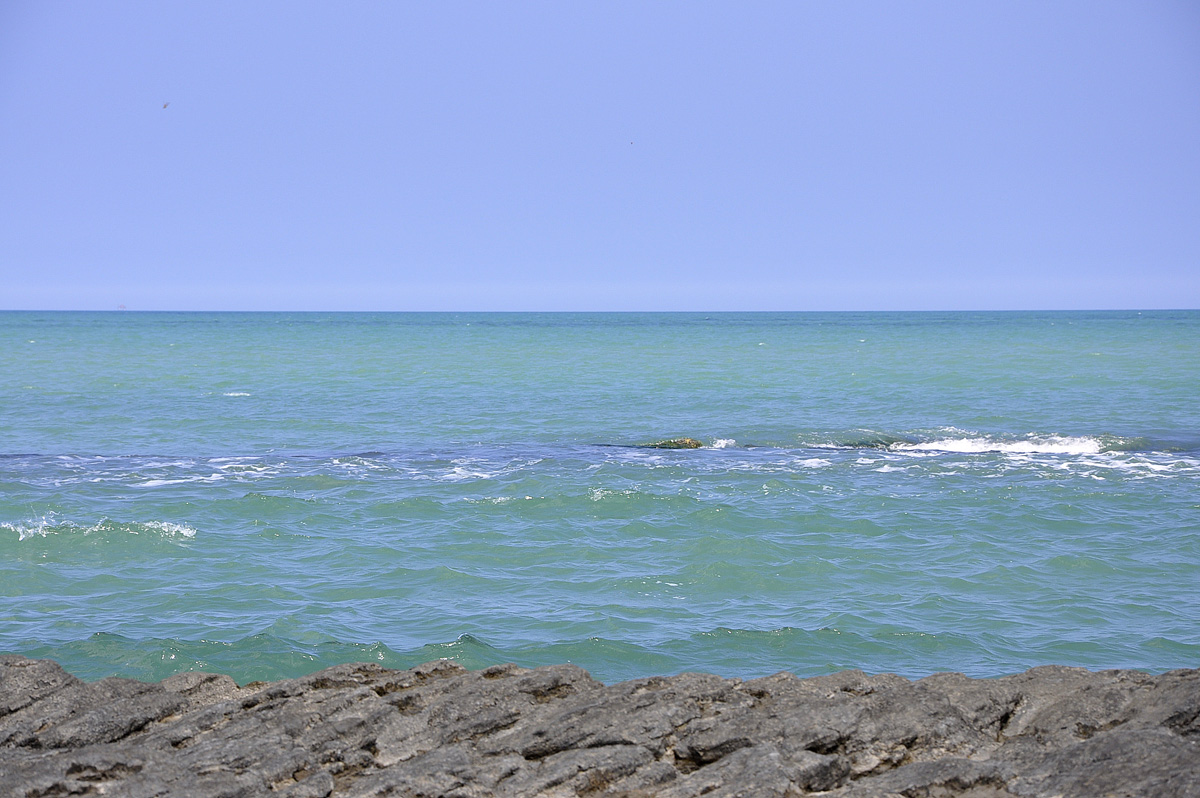
Caspian Sea coastal area consists of the Quaternary deposits, while its shoreline configuration varies in different places. The coasts are smooth and invariable in some places whereas in other places they are tortuous. There are such gulfs as Gizlar, Astrakhan, and Mangishlag, as well as a variety of bays. The peninsula of Agrakhan, Buzachi, Tub-Karagan, and Mangishlag is very interesting. Both Volga and Ural Rivers’s mouth shorelines are variable and consist of numerous small islands and distributary channels. Caspian middle sector shoreline configuration is characterized by a smooth outline. The Absheron Peninsula is located on the western margin of the Caspian Sea, right where the middle and the southern sectors are bordering each other. To the west of the Absheron Peninsula, there are several islands and shoals of the Absheron archipelago. The largest Pirallahi and Chilov Islands. To the south of the Absheron Peninsula, there are islands of the Baku archipelago as Hara Zira, Gum, Chigil, Gil, Garasu, Zanbil, Sangi-Mughan, Dash Zira, Kur Dashy, etc. Middle Caspian east shoreline is more tortuous. The most profound feature here is Kazakh gulf with Kandarly bay, as well as Peschany, Rakushechny, and Sue spit. The biggest gulf of the sea east margin is Gara-Boghaz-Gol gulf. The origin of the listed islands and some shoals located within the Caspian south sector (Livanovo etc) is associated with the bottom-sea mud-volcanoes activity.
The Caspian Sea has about 50 small and large islands that embrace a 350sq km area. Some of them have been mentioned above. South off, at the entrance into the Hirkan gulf, there are large Ashur and several other small islands. At the beginning of the last century, these islands belonged to Tsar Russia that later on February 26, 1921, were transferred to the possession of Iran by the Soviet Government. Due to the sea-level fluctuation, Ashur-Ada Island recurrently joins to the mainland through a narrow bar and became an isolated island.
Azerbaijan coastal areas in most places consist of accumulative lowland — Samur-Davachi in the north, the southeast part of Kur-Araz Rivers lowland, and Salyan plain within its central part, as well as Lankaran lowland in the south. The shoreline between the Samur River mouth and the Absheron Peninsula is almost not tortuous. In this shoreline sector, only the Samur River delta and Gilazi cape come forward insignificantly. South off Gilazi cape shoreline gradually turns eastward and beginning from the close vicinity of Sarigayabashi spit up to Kohna Bilgah (Amburan) spit and passes into north Absheron Peninsula shoreline.
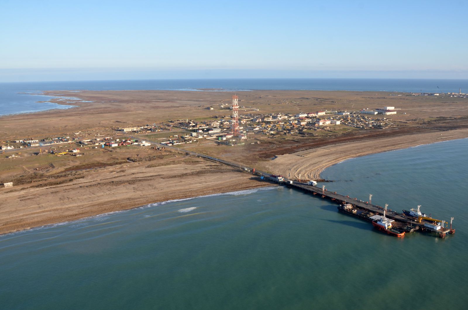
The Absheron Peninsula forms the southeast termination of the Major Caucasus and represents the largest peninsula within the west coastal area (its length exceeds 60 km, and its width is about 30 km). Its shoreline configuration is tortuous. There are accumulative bays and spits formed by solid rock cropped out to the surface (Kohna Bilgah, Shuvalan, Gurgan, etc).
Coastal areas around the spits consist of sands that form excellent beaches. The embankment road was built up between the Absheron Peninsula and Pirallahi Island (1941) that transformed the former Absheron strait into north and south Absheron bays. 12 km long Shah spit is located on the Absheron Peninsula southeast termination.
South off the Absheron Peninsula and up to Kur River delta shoreline is tortuous. Within this shoreline section, there are Puta, Sangachal, Alat, and Pirsagat capes formed with solid rocks exposed to the surface, and in addition, there is Bandovan cape formed with mud volcanoes solid outbursts, as well as several embayments located between them. The coastal area between Shih and Alat spits consists of hills and elevations up to 400 m high. Most of them were originated due to mud-volcanoes activity.
Kur river delta is the largest one within the Caspian west coastal area. Gizilaghaj gulf and the same name sanctuary is located between Kur River delta and Sari Peninsula.
Gulfs
The Caspian Sea has 10 large gulfs: Comsomolets, Mangishlag, Kazakh, Gara-Boghaz-Gol, Turkmenbashi (former Krasnovodsk), Turkman, Gizilaghage, Astrakhan, and Gizlar. Iranian Caspian sector has two large gulfs: Hirkan (former Astrabad) and Anzali (former Pahlavi).
The most notable and large Caspian gulf is Gara-Boghaz-Gol. Having been controlled by the Caspian Sea level fluctuation the gulf area varies recurrently. Nowadays its surface embraces 25,000 sq km. The gulf area is connected to the Caspian Sea through the new 10-10.5 km long narrow channel which width varies from 110 to 300 m. Gara-Boghaz-Gol water level has always been lower than the Caspian one. The discrepancy between the gulf’s water level and that of the sea depends on the latter and varies in the range from 2 to 6 m. Water continuously flows through the channel, however, it entirely evaporates from the gulf surface. Every year approximately 8-103 km of water flows into the gulf that is 20-3003 m of water per second (recently acquired data indicates even greater values). This water brings some 150,000 tons of dissolved salts into the gulf from the sea. During 1980-1984 the gulf remained isolated from the sea via a built-up dam. About 1500 mm of waters evaporates every year from its surface, whereas the amount of precipitation does not exceed 70 mm/yr. Therefore the gulf’s water actually resembles salt-saturated solution (strong solution) which salinity reaches up to 300 ppm and it represents a single basin with the marine evaporates. Gara-Boghaz-Gol gulf is rich with such mineral salts as mirabilite, halite, astrakhanite etc. Currently, sulphite, bisulfite, epsomite, glauberite, medical and marine salts as well as chlorous magnesium production is underway there.
Rivers
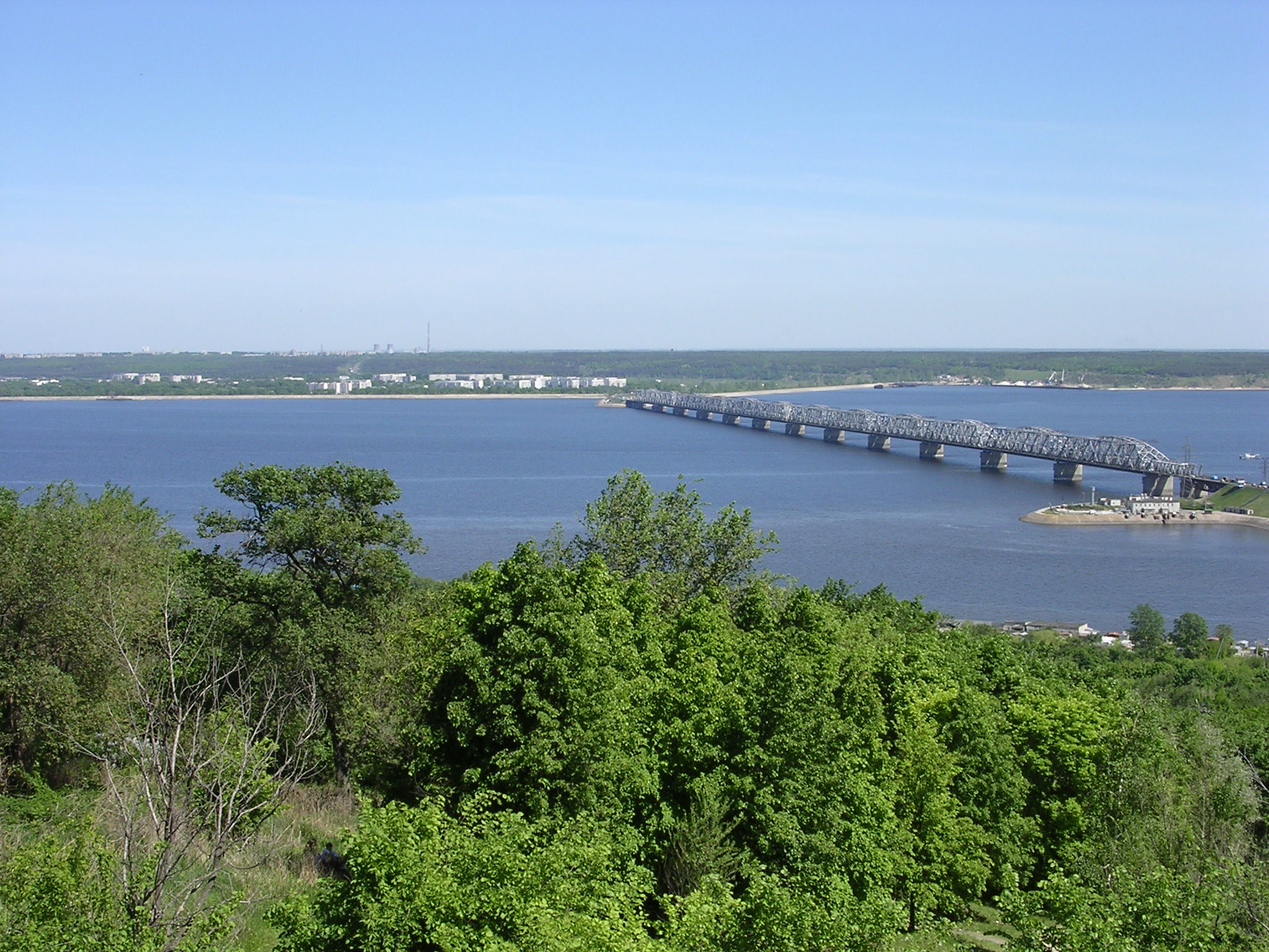
Over 130-rivers flow into the Caspian Sea and just 9 of their mouths are referred to as deltas. The biggest of these rivers is 3531 km long Volga River which average run-off approximates 251-254 km3 Another large river flowing into the Caspian Sea from Russia drainage area is Terek River (with average run-off varies from 8.5 to 11.4 km3).
The largest rivers flowing into the Caspian Sea from Azerbaijan territory are as follows: Rur River (average annual run-off measures 16 km3; Lankaranchay, Sumgayitchay, Valvalachay, Gudialchay, Astarachay (bordering river between Azerbaijan and Iran), and Samur River bordering Azerbaijan and Russia (2.7 km).
River drainage is almost absent along the Caspian eastern margin. Both Ural (run-off – 8.1 km3) and Emba Rivers flow into the Caspian Sea from Kazakhstan territory. In the 1920s, the Emba River had a vast delta with several distributary channels. Sea level drop that took place during the 1930s caused Emba river to disappear among the coastal sands. Nowadays, this river reaches the Caspian Sea only during years prone to atmospheric precipitation.
A single river flowing continuously in Turkmenistan is a 635 km long Atrek River, of which 500 km falls into Iran territory. Its drainage area measures 26.7 km2 Atrek River average annual run-off within Turkmenistan area amounts to 240 M km3. Frequently river is dried in its lower watercourse and reaches the Caspian Sea only during spring seasons. The Caspian Sea embraces only 12% of the total Iranian drainage area and captures only 5% of its run-off. Relatively large rivers are as follows: Safidrud 720 km long (Agh-chay), Haraz, Polerud, Babol, Calus, Hirkan, Techan and Talar. Of 1040km long Araz River, just 300 km serves as a borderline between Azerbaijan and Iran. The river changes its watercourse direction from the northernmost Iran bordering point to interflow with Kur River watercourse.
Harbours
The major harbours within the Caspian Sea are as follows: Baku harbour (the largest one), Turkmenbashi, Astrakhan, Mahachgala, Aktau, Atiran, Bandar-Anzali, Noushahar.
CLIMATE
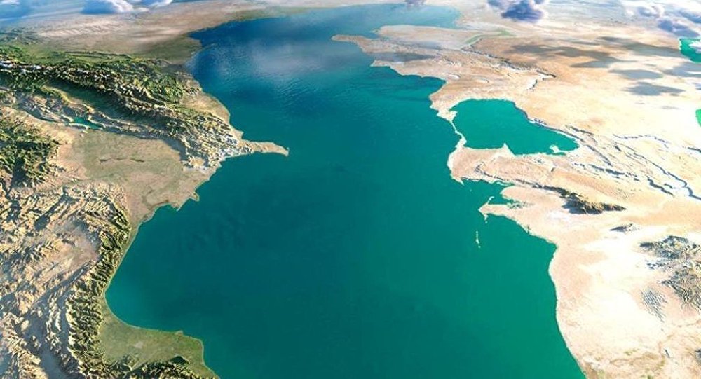
Both meteorological conditions and climate over the Caspian Sea and adjacent regions are determined by air circulation over the Eurasian continent, as well as by the coastal area relief and sea-level fluctuation. Cold Arctic air masses come over the sea during the winter seasons. At the same time, air masses come down during the winter seasons over the sea from mountainous areas of Iran. Both of these high-pressure convergent air masses drive cyclones over the central part of the sea. Moreover, cyclones generated over the Black and Mediterranean Seas also have their impact on the Caspian weather. Siberian and Mediterranean anticyclones are capable of moving to the east and northwest in the summertime, and by doing so, causing frequent changes in the distribution of air masses. The temperature contrast became balanced during summer times that attenuates circulation between atmospheric lower and upper strata. During this season synoptic processes over the Caspian Sea go through the dominant impact of Azor maximum pressure. Close to the middle of the fall Azor maximum impact diminishes and finally, continental atmospheric masses invade the area to cause westward atmospheric movement activation.
Due to the relatively lower latitudinal position of Caspian Sea surface subjects to extensive solar radiation resulted in a positive radiation balance that estimated value measures 60 kcal/sq cm.
Middle and South Caspian offshore regions fall into moderate and subtropical climate zones, whereas its northern part falls into continental one.
Air temperature
Due to the vast latitudinal extension of the Caspian Sea (1300 km) itself and its drainage area (3000 m) and because of its deep inland position its climate has strong continental climate characteristics. During winter seasons the average monthly temperature within the northern Caspian varies in the range from -8 C to -10 C, whereas its value is positive and varies in the range from 8 C to 10 C within its southern part. During summer seasons air temperature discrepancy between its north and south sectors gets relatively smaller (24-25 C and 26-27 C in the south).
The winds
The most typical hydrometeorological feature of the Caspian Sea is the winds. The winds dominantly blow from the north, and they sometimes appear like a hurricane which speed reaches 35-40m/sec. The second trend of the winds due to recurrence frequency is the eastern one. Most frequently windy days are observed within the Absheron Peninsula and Mahagegala-Darband regions. Moderate and strong winds are frequently observed during the fall and winter seasons. Absheron Peninsula is characterized by the north wind that is called « Khazri ».
Atmospheric precipitation
Atmospheric precipitation does not equally distribute over the Caspian offshore area. Average annual atmospheric precipitation measures as much as 100 mm. Atmospheric precipitation spatial annual distribution is defined dominantly by coastal relief and actually represented as follows: 300 mm in the north, from about 300-400 mm to 600 mm in the west, 1600 mm within the southwest Caspian area, whereas only nearly 90 mm within its eastern area. Approximately 200 mm of atmospheric precipitation is observed within the Absheron Peninsula.
Water temperature
The average yearly Caspian water temperature during winter seasons within its northern and southern parts approximates to 0 C and 10 C. During summer seasons these discrepancy value decreases and its temperature values reaches up to 25 C and 26 C, respectively. The average annual water temperature within the middle Caspian offshore areas measures 14-15 C, whereas, its winter and summer temperatures measure 6-7 C and 23-24 C, respectively. Deep in the seawater column, its temperature measures 5-6 C and is suggested to remain unchanged. During the spring season positive temperature anomalies are observed within the Caspian eastern shelf areas, nearby Bekdash town shelf area.
Water salinity
Caspian water salinity in the northern sector within the Volga River vicinity amounts to 0.3 ppm and therefore it referred to the typical freshwater basins.
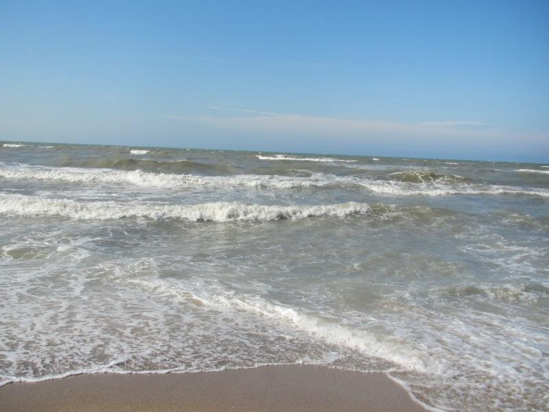
However, its salinity dramatically increases, and at a 100 km distance off it reaches 10 ppm. The average annual salinity increases up to 12.5 ppm and 13.0 ppm in the west and east margins, respectively. In some cases, in the southeast, its salinity measures 13.5 ppm, whereas within Gara-Boghaz-Gol gulf its value exceeds 300 ppm. Caspian water salinity increases in winter seasons and decreases in summer seasons. The reason for this is the fact that during the winter seasons Caspian water density increases due to the shortage of the Volga River run-off caused by its freezing.
The marine currents
Caspian water keeps moving continuously. Generally speaking, its water movement resembles a counter-clockwise rotation of a cyclone. At the same time, some emphasis should be given to its particular features. North Caspian currents trending southward are dominantly caused by the Volga River water flowing inertia. As a whole, the main reason that causes the Caspian Sea currents is thought to be the winds, that is, currents here are classified as a drifter type. The temperature discrepancy that existed between the north and the south Caspian sectors cause density discrepancy. The latter one, in its turn, causes density gradient flow. Density gradient flow basically comes into effect during the winter seasons. The reason for this is the temperature discrepancy increment between the north and south Caspian sectors. Surface currents within the middle and south Caspian sectors cause cyclonic whirlpools. Typical current speed value in the Caspian Sea varies in the range from 15-20 cm/sec, whereas this value reaches 100 cm/sec in between Chilov Island and Neft Dashlary oilfield.
Sea waves
The Caspian Sea keeps dynamic continuously. During 250 days of the year, strong and moderate winds blow causing long and high amplitude waves on the water surface. 6 point magnitude waves are frequently observed from November to March. 8-10 m high and up to 100-150 m, long strong waves can be observed within the middle Caspian sector, as well as around Absheron Peninsula and Mahagegala town. The relatively quiescent sea period lasts from May to August.
Freezing
North Caspian Sea offshore area freezes and is covered by an ice sheet during winter seasons. Sea surface begins to freeze in the middle of November during usual weather conditions. The freezing pattern southern border coincides with the line extended from Chechen Island to Mangishlaf Peninsula. During severe winter seasons, sea freezing was observed along Absheron Peninsular and ice block drift had been observed six times around the Absheron Peninsula.
Sea level fluctuation
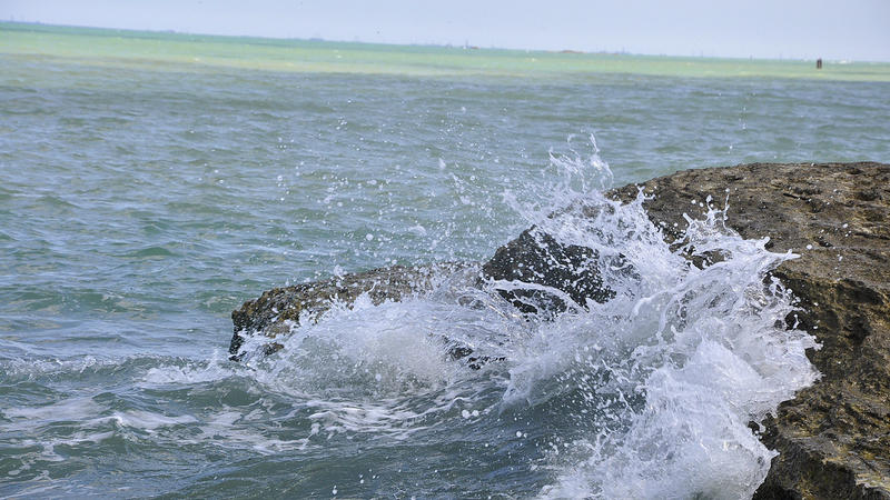
One of the profound features distinguishing the Caspian Sea from other large inland basins is the fact of its sea-level significant fluctuation. Caspian Sea level fluctuation value is estimated within the 15 m range during the last 3000 years based on paleo-geographic, archaeological and historical evidence. Monitoring of the Caspian Sea level fluctuation was established by academician C. Lents in Baku in 1837. During this monitoring period, the highest sea level (-25.2 m) was observed in 1882, and its lowest level (-29.0 m) was observed in 1977. It is seen that during this observation period sea-level drop was measured at 3.8 m. It is noteworthy, that there were several rises of the sea level over the cumulative sea-level drop. 2.5 m rise of the sea level observed during 1978-1995 has resulted in the sea level mark measured at -26.5 m.
There are contradictory points of view associated with the comprehension of a driving mechanism causing sea-level fluctuation. Nevertheless, it should be noted, particularly, that most of the geologists adhere to the idea of dominant climate impact, that is, the main reason for the sea-level fluctuation is a climate factor. No doubt, that geologic and anthropogenic factors should also be taken into account. Climate factor influence is observed on the Caspian Sea water balance income (run-off of the rivers flowing into the Caspian Sea and atmospheric precipitation falling over the sea surface) and discharge evaporation from the sea surface). Sea level change occurs as a result of this balance distortion, that is, in cases when rivers run off and atmospheric precipitation dominates then the sea level rises, and vice versa.
Owing to the fact that the sea level fluctuation basically depends on the climate processes as well as the impossibility so far to forecast climate variation, therefore long-term sea-level fluctuation forecast is impossible too. All previously done prognoses on the point appear to be just stochastic.
NATURAL RESOURCES
Resort and recreation environments
The Caspian coastal environment is very propitious and wholesome for the recreation and health of people. This area is known for sun and long sandy beaches. All these natural resort and recreation opportunities provide convincing evidence of advantages over the famous Caucasian Black Sea coastal areas. Just for such reasons in 1983, the Cabinet of the Ministry of the Soviet Union issued a decree « On the establishment of an all-union resort basis within the Caspian Sea coastal area » in order to develop resort infrastructure within the coastal areas of Azerbaijan and Daghestan. A 680 km-long coastal area was suggested to be wholesome for resort and recreation infrastructure in Azerbaijan.
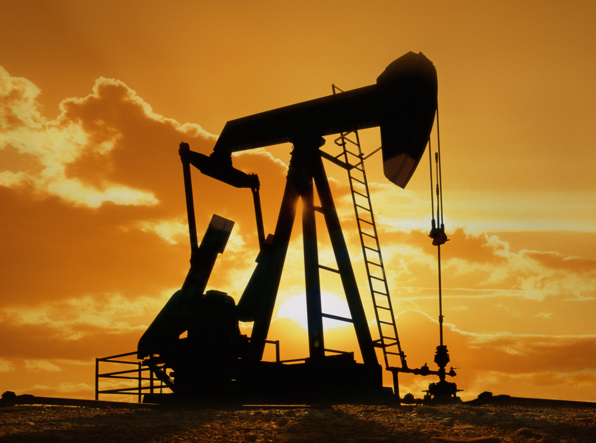
Moreover, Azerbaijan coastal area has a tremendous opportunity for tourism business development. The first tourism facilities were established in Baku already in 1958 and « Khazar » tourism camp was founded within Khudat region in 1963. Currently, Caspian coastal areas are the dominant recreation zones for the Azerbaijan people. Orchard and suburb zones are widespread along with the Caspian coastal areas, particularly within the Absheron Peninsula. At the same time, it should be noted with regret that Caspian sand beaches and mineral water springs located in this area along with the medical mud and other propitious natural resources are being used inexpedient and irrationally.
Hydrocarbon resources
The first oil borehole was drilled in the shelf area of Azerbaijan in 1920 — only 38 years after exploration of hydrocarbons was started in Pennsylvania, USA. In the middle of the 19th century, the exploration of hydrocarbon resources has started in the Caspian Sea. In 1913, the Russian Empire yielded 83% of total oil production from Azerbaijan that held first place in oil production worldwide in the 20th century. The highest level of oil production in Azerbaijan (23 M tons) was achieved in 1941. 10,000 tons of oil were produced annually within Azerbaijan offshore sector. Competent experts evaluated Caspian region hydrocarbon potential around 18-20 B tons. Proven hydrocarbon reserves are estimated as much as 10 B tons, of which 3 B tons within the Azerbaijan Caspian sector.
The region has also other mineral resources such as sow-cut-stone blocks used in civil construction, as well as gems and diversity of salt minerals.
Biological resources
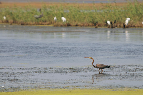
The Caspian Sea contains wealth as well as diverse and invaluable biological resources. Its diversity is represented by 1,809 species and groups. 1,069 of them live selfconsistently, 325 are parasites and 415 are vertebrates. Relic sturgeon species still reproduce themselves and constitute the world’s gene pool and the major livestock, and therefore deserve particular attention. Currently, the Caspian Sea represents the inland sanctuary for all those species in the world and yields 90% of the global sturgeon production. Nowadays, the Caspian Sea holds a leading position on the following valuable freshwater species as vobla (Caspian roach) wild carp (Cyprinus carp), pike-perch. Such species as kutum, grey mullet, bream, sprat, carp, perch, Caspian sea-trout, pike are a very good nutrient product and are evaluated to be commercially valuable. All in all, 101 fish species have been listed within the Caspian Sea. The Caspian Sea has relics related to the Tertiary period Sarmatian and Pontian fauna. Caspian seals are a single mammal inhabitant of the sea.
Sanctuaries and habitat areas
Caspian fauna includes 728 species and groups. Rivers lower watercourses and shallow offshore areas are favorable feeding ground and nesting places for waterfowl. According to the Ramsar convention, three sanctuaries were established within the Caspian coastal area for their protection: Gizilaghage in Azerbaijan, Astrakhan — in Russia, and Khazar in Turkmenistan (up to 1994 — Krasnovodsk).
Gizilaghage sanctuary is located in the far south-east of Azerbaijan, in the same gulf of the Caspian Sea, with an area of about 180 ha and was established in 1926. It is divided into large and small Gizilaghage parts. Of 101 Caspian fish species 54 species are habitant of the sanctuary. Caspian Sea-level fluctuation tremendously impacts the gulf-sanctuary hydrology, hydrochemical, and biology environmental features. The following species are typical for the sanctuary: pheasant, red goose, duck, swan, coot, diver, seagull, etc.
The Absheron Reserve was established in 2005.
Hydrographically, the Republic of Azerbaijan belongs to the Caspian Sea basin. The water systems of Azerbaijan (rivers, lakes) were formed over a long geological timeframe and changed significantly throughout that period. This is particularly evidenced by remnants of ancient rivers found throughout the country. The country’s water systems are continually changing under the influence of natural forces and human-introduced industrial activities. Artificial rivers (canals) and ponds are a part of Azerbaijan’s water systems.
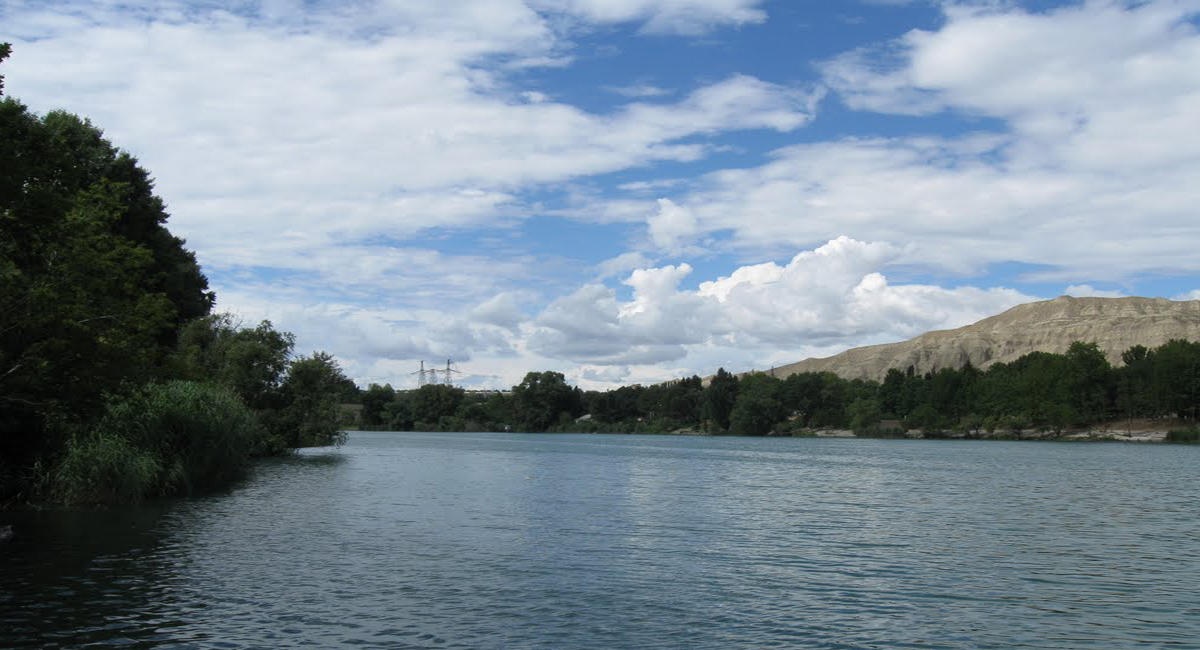
Rivers form the principal part of the water systems of Azerbaijan. There are 8,359 rivers of various lengths within Azerbaijan. Of them, 8,188 rivers are less than 25 kilometers in length. Only 24 rivers are over 100 kilometers long. Kur, Araz, Ganikh (in Alazan), Gabirri (Iori), Samur, Terter, Turyan, Aghstafa, Hekeri, Vilesh, and others are the largest rivers that flow through the country.
The country’s rivers are divided into three groups:
1) The Kur basin rivers (Ganikh, Gabirri, Turyan, Aghstafa, Shemkir, Terter, Khachin, etc.);
2) The Araz basin rivers (Arpachay, Nakhchivan, Okhchu, Hekeri, Kondelenchay, etc.);
3) Rivers, flowing directly into the Caspian Sea (Samur, Gudyal, Velvele, Vilesh, Lankaran, etc.).
Kur and Araz run through the Kur-Araz lowland. The rivers that directly flow into the Caspian Sea, originate mainly from the north-eastern slope of the Major Caucasus and Talysh Mountains and run along the Samur-Devechi and Lankaran lowlands.
Azerbaijan river systems are changing and evolving under the influence of various physiographic factors: climate, landscape, geological structure, soil and vegetation.
The density of the river network increases, then gradually decreases later with higher altitudes. Except for the Talysh region (1.6-2.2 km/sq.km), the river system density is the highest (1-2 km/sq. km) at 1,000-2,500 kilometres, while in the area of the Talysh mountains it peaks at 1.6-2.2 km/sq.km at 500-1,000 km. The average density of the river system of Azerbaijan is 0.39 km/sq.km. The density is even lower than 0.05 km/sq.km in the plains.
The Kur River basin area (86,000 sq. km) up to the junction with the Araz River is smaller than the Araz water basin (101,937 sq.km). The river is still called Kur on the junction because the water level of the Kur is twice as high as that of the Araz River.
Rivers of Azerbaijan can be divided into the three main groups regarding their water flow specifications:
1) perennial rivers;
2) seasonal rivers that flow only during the melting of snow in spring.
3) episodic rivers that flow in episodes after a downpour of rain of flash flood.
These three groups differ from each other for the volume of underwater supply to their streams. Perennial rivers are fed by a constantly flowing baseflow (groundwater). Seasonal rivers are fed by an elevated water table during the rainy period, while episodic rivers are not at all dependent on baseflow.
Like in all other countries, rivers have different feeding sources in Azerbaijan. Most rivers are fed by snow, rainfalls, and groundwaters. Snow is the predominant feeding source for the rivers of the Major Caucasus, while ground waters contribute the most to the water supply of rivers in the Minor Caucasus. The Kur and Araz rivers pass Azerbaijan in their lower and middle courses.
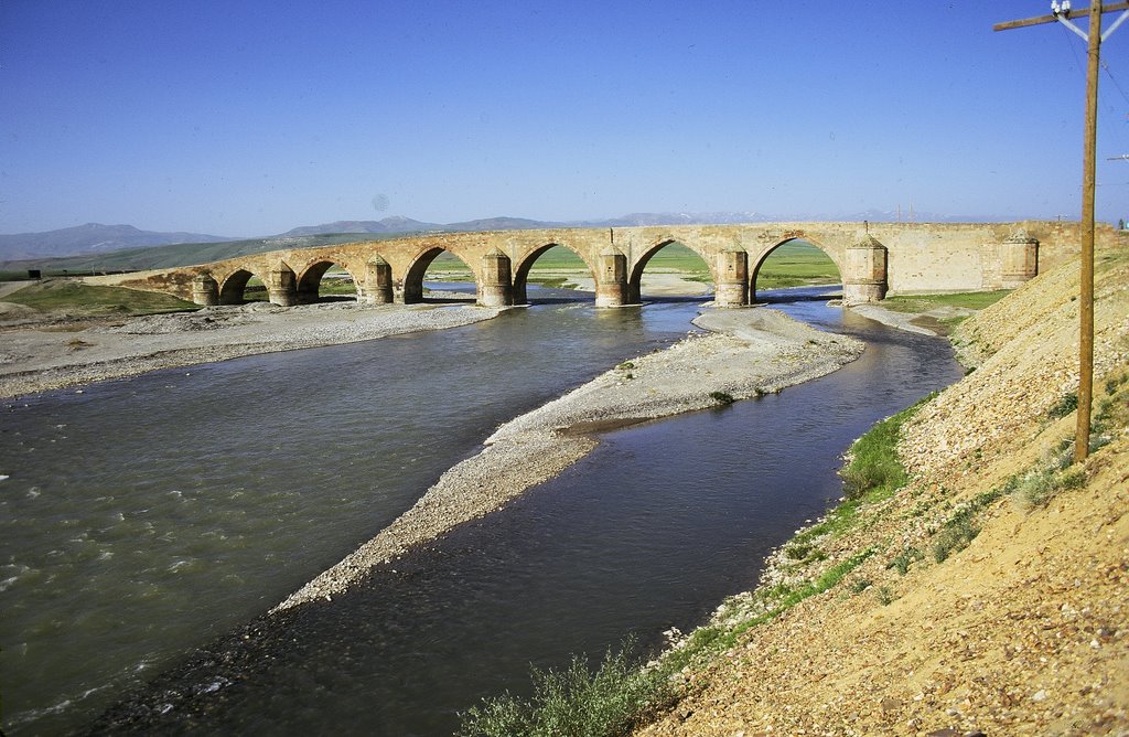
The Kur river is the largest river in Azerbaijan. It stretches for 1,515 kilometers and covers an area of 188 thousand sq. km. The Kur originates from the Hel River in Turkey, passes through Azerbaijan, and flows into the Caspian Sea in the south-eastern part of the country.
The Araz River covers an area of 86 thousand sq. km until its junction with the Kur River. It originates from the Bingol mountains in Turkey at an altitude of 3300 meters. On the whole, the Araz River forms Azerbaijan’s border with Turkey and Iran. It passes through Azerbaijan in its lower 80 kilometers and joins the Kur River near Sabirabad.
These two rivers belong to the group of rivers, flowing at full under the influence of snow and rainfalls in spring and rainfalls in autumn.
Weather produces the greatest impact on the river flow in Azerbaijan. The intensive rise in temperature causes the melting of snow at heights of over 1500. The melting of snow further intensifies after heavy rainfalls of April and May. Snow melts more intensively in the high altitudes (over 2500-3000 meters) from early April through May until June. The melting process influences river flow even in the summertime. Thus, melted snow water, absorbed by the soil, emerges on the surface and raises the water level in rivers. Low river basins (except for those of the Talysh region) are less influenced by the precipitation in spring and summer periods. Winter and autumn rainfalls account for the most part of precipitations in the Talysh region. Rivers are less full of water in summer in Azerbaijan. Heavy rainfalls that may from time to time occur in July and August, lead to floods, causing agricultural damages. Severe floods have been registered in the rivers of southwestern slopes of Major Caucasus Zengezur part. Rivers of the Major and Minor Caucasus mainly flow in hot seasons, while rivers of the Talysh regions flow in colder seasons of the year. Rivers, flowing in hot seasons account for the most part of all rivers (60-80%). Such seasonal flows are difficult for industrial use. On the whole, rivers of the Azerbaijan Republic are divided into two groups, according to their water regime: 1) rivers of the full-flowing regime; 2) rivers of flood regime. Flood rivers are the Lankaran rivers and episodic rivers of Gobustan. Other rivers are included in the first group of rivers.
The complex topography and other natural factors cause a non-standard flow across the country. The flow increases with altitudes and reaches its top at a certain height (2800, on the north-eastern slope of the Major Caucasus, 2000-2200-on its southern slope, and 2200-2400 on the Minor Caucasus). The flow starts to decline from above the indicated height. Due to the orographic specifications of the Talysh mountains, the flow is inconsistent with the average height. It decreases with the increase of altitude in the Talysh mountains, while in Peshteser and Burovar mountains it rises with the altitude.
The full-flowing rivers of the Azerbaijan Republic mainly flow on the southern slope of the Major Caucasus. The average flow of such rivers exceeds 45 cm. The flow falls to 5 cm till the Alazan-Ayrichay lowland. The flow module of rivers of the north-eastern slope of the Major Caucasus 18 cm. The increase of flow with the increase of altitude is relatively uniform in this part of the Major Caucasus. The intensive increase in the module of flow is registered on the area between the Yah mountain chains and the Major Caucasus mountains. (upper Qusar, Qudyal and other rivers.). The Average annual module of flow is from swings that hesitate from 10 to 20 cm. The flow of rivers, originating in the slopes of the Yah mountains, differs from that of the rivers, flowing from the Major Caucasus. The flow increases intensively and reaches from 6 to 18 cm at a height of 1000-2000 meters, due to the high level of precipitation. The flow gradually decreases until the Caspian Sea shore down to 0.5 cm. the flow decreases beginning from the northwest of till southeast of the seaside lowland and reaches zero levels on the Apsheron peninsula.
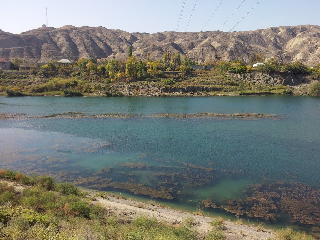
Compared with the Major Caucasus, the flow in the Minor Caucasus is more complicated, due to its orographic complexity and differing location of mountain chains. The highest flow has been registered in the rivers flowing from the slopes of Gamish and Qapidjic mountains (over 28 cm). In the Karabakh plateau precipitation is absorbed by soil rocks, thus turning the region into an arid area, while in some places it bursts onto the surface thus increasing the water level in the rivers. That is typical of the upper Terter, Hekeri and other regions as underwater provides 70-80% of water to them. The flow fluctuates from 0.8 to 22 cm in the southeast of the Minor Caucasus (rivers, originating in the Caucasus mountains) and from 0.5 to 10 cm in the Nakhchivan Autonomous Republic. The flow gradually decreases to a level even lower than 0.5 cm on the plains on the side of Araz. In the Talish region, the flow increases in the direction from the north to south and from the west to east. The flow reaches its peak (over 25 cm ) in Tengerud and Astara river basins in the central part of the region, while it reaches its minimum north of the Vilesh river, as well as in the Lenkeran and Vilesh rivers. Gobustan, Nakhchivan, and Kur-Araz plains account for the lesser part of the water system in Azerbaijan.
Rivers of Azerbaijan carry a large quantity of sediment, the result of erosion in the river basins. The rivers in Azerbaijan are the most polluted rivers in the world. Their average annual pollution rate changes from 0.07 to 9 kg-1 cubic mete per region. It reaches its top on the north slope of Major Caucasus and minimum-on the Karabakh plateau. The surface erosion is intensive in the north slope of the Major Caucasus(100-6800 t/sq/km), and it becomes weaker on the Karabakh plateau (5-10 t/sq.km). The surface erosion in the rivers of the Major Caucasus (0.53 mm) is 13 higher than that of the Minor Caucasus (0.03 mm per year) and Talish mountains (0.04 mm per year).
Hydrological system and its importance
The hydrological system of the Azerbaijan Republic contains 10.3 billion cubic meters of water reserves. These water reserves together with those, entering Azerbaijan from neighboring countries (20.6 billion cubic meters) make up 30.9 billion cubic meters. Each square meter of the country receives 90 thousand cubic meters of reserves, while the annual per capita volume of water reserves total 1270 cubic meters. The basin of the river Kur accounts from most part of the water reserves. The nonuniform distribution of water reserves across the region and around the year hammers the utilization of these reserves and as a result of that, the reserves are not able to meet constantly growing demands for freshwater. The situation requires the regulation of water flow. 60 water reservoirs of the country with a capacity of over 1 million cubic meters account for 21 billion cubic meters of water reserves. Most parts of these reserves are used in different spheres (irrigation, water supply, industry, fishery, etc). The establishment of water reservoirs of the Middle Kur plays an important role in meeting demands for water. Currently, serious measures are undertaken to preserve pure water reserves and to prevent their polluting with communal and industrial wastes.
Canals
The Canals of the Azerbaijan Republic are the main source of irrigation. The canals used for the said purpose extend to 47058.8 kilometers, with canals, used by several farms, accounting for 8580.3 kilometers and those, used only by one farm for 38478.5 kilometers. The amount of 11 billion cubic meters of water is used in irrigation each year. Irrigated area of Azerbaijan totals 1.4 million hectares.
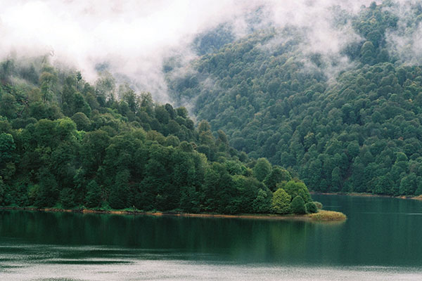
Azerbaijan has a total of nearly 250 lakes. Most of them are small, while Hajigabul, Sarysu, Masazyr, Jandargol, and others are relatively large. The lakes of the middle and high mountain areas (Goygol and Maralgol of the Kurekchay Basin, Major and Minor Alagoller of the Shamkir River Basin) are extremely aesthetically pleasing. The lakes of Azerbaijan have erosion-glacial, erosion-river, tectonic, and abrasive origins. There is a number of standing and salt relict lakes in the Absheron peninsula. In the summer, most of the lakes dry up and become saline. Mountain lakes are used for the purposes of cattle watering, irrigation, fishing (Hajikabul, Sarysu, Aggol, and others), while the saltwater lakes of the Absheron peninsula are used for the production of chemical agents as well as for medical treatment. The lakes of the upland stream of rivers: the Bababat group of lakes, Ganlygol (the Nakhchivan River Basin), Goygol (the Shemkir River Basin), and others have turned into water reservoirs. They supply additional volumes of water to rivers in the summertime.
Reservoirs
Over 60 water reservoirs have been constructed in order to regulate the river flow in Azerbaijan. The formation of these reservoirs is one of the measures that has been undertaken in order to ration the utilization of water and energy resources. The largest water reservoirs (Mingechevr, Shamkir, Araz, and Serseng Reservoirs) are designed to be utilized for various purposes, while most other ponds are used exclusively for irrigation.
Glaciers
Azerbaijan has several glaciers within its territory. They mainly span the Bazarduzu (with an area of 3.62 sq.km.), Bazaryurd (1 sq. km), Tufan (0.51 sq. km), and Shahdag (1.08 sq. km) peaks of the Major Caucasus Mountains. One can also come across other areas of eternal ice that can be found at a height of 4,000 meters above sea level.
The rapid development of all spheres of economics and human activity has led to an increasingly negative impact on the environment, including the inefficient usage of natural resources. As can be seen in many other countries, Azerbaijan is interested in finding solutions to the problems regarding environmental protection and rational utilization of natural resources.
In support of Azerbaijan’s environmental protection goals, a number of important laws, legal documents and state programs, all of which conform to European law requirements, have been developed and approved in order to improve the ecological situation in the country. These measures have been undertaken within the framework of the corresponding state programs to solve the urgent ecological problems at the very foundation of development principles.
The internal resources of the Republic of Azerbaijan are however insufficient in order to resolve many of their environmental problems that have been in dire need for some time now.
The following are the principal ecological problems of Azerbaijan
- The pollution of water resources by way of introduction of contaminated water, including transnational pollution;
- The supply of low-quality water to inhabited regions, the loss of freshwater prior to its delivery to the end consumers, insufficient development of sewer systems;
- Air pollution from industrial plants and transport vehicles;
- Degradation of soil (erosion, desertification, etc.);
- Improper regulation of industry and housing, as well as hazardous solid wastes;
- Decline in biological diversity;
- The decline in forest reserves and fauna, especially fish reserves
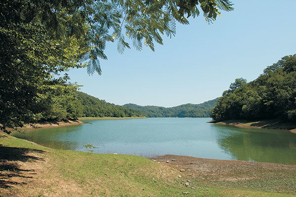
Biological diversity is the sum of all species of microbial organisms, plants, and animals on the face of Earth. Azerbaijan possesses the richest natural reserves among all other Caucasian countries. The nine biomes of Azerbaijan are home to some 4500 species of multicellular plants, accounting for 64% of the plant kingdom of the whole Caucasian region and 24% of that of the former Soviet Union. 168 species of plants out of 600 belong exclusively to the flora of Azerbaijan, while 432 — to the Caucasian flora.
140 rare and endangered species are included in the Red Book of Azerbaijan.
18 thousand species of animals are registered in Azerbaijan. The contemporary fauna of Azerbaijan includes 97 species of mammals, 357 species of birds, nearly 100 species of fish, 67 species and subspecies of reptiles and amphibians, and nearly 15 thousand species of insects.
The Red Book of Azerbaijan includes 14 mammal species (gazelle, leopard, bezoar goat, mountain sheep, etc), 36 bird species (partridge, bustard, shrike, little bustard, spoon-bill, etc), 13 species of amphibians and reptiles (triton, Syrian garlic frog, Esculapus snake), 5 fish species ( eel, trout, Zosterops, etc) and 40 insect species and subspecies (Talysh eodorcadion, Apollo, Talysh Brahmaea, etc.). Such a diversity of biological species is due to the country’s geological history and various climate conditions.
Environmental protection, exploration of nature, and creation of preserves play an important role in the preservation of the country’s ecosystem. Rare and endangered species of animals and plants are protected in specially designed areas.
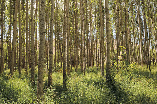
Azerbaijan covers an area of 86.6 million hectares, of which 1213.7 thousand hectares are forests. Forestlands of 989.5 thousand hectares form 1.4% of the total land area of Azerbaijan. There are approximately 0.12 hectares of forestland per capital, which is four times (0.48 hectares) lower than the average figures worldwide.
Forests in Azerbaijan belong to group I for their important degree and are spread differently throughout the regions of the country. One of the specific features of these regions is the availability of various natural resources, such as mineral water, energy, and fertile soil. The forests serve a function that no other natural components can. Forests are the natural matters that promote the stabilization of such important biosphere components as water, air, and soil.
The forests of Azerbaijan (85%) mainly cover the slopes of the Major Caucasus, Minor Caucasus, and Talysh Mountains.
Most of the forests have rather valuable tree types (iron tree, beech tree, hornbeam, lime, maple, etc). The characteristic trees of the forests and their diversity are determined by the climate, soil, and topography of the region.
The forest policy of the country is managed by the Department for Forests Development under the Ministry of Ecology and Natural Resources.
The department takes care of the protection and preservation of forests, restoration and planting of forests, preparation of planting stocks, storage of forest trees and bushes, preservation of forests, and other forestry actions, which includes the efficient and purposeful utilization of forest reserves and related spheres of agriculture. It also works on the improvement of the protection of forest soil, water preservation, a clean environment, sanitarian and hygienic actions, preservation of species of animals in the forests, ensuring biodiversity, the establishment of cultural, scientific, and recreational complexes throughout nature, as well as the protection and expansion of the gene pool in the growth of forest seed.
The Department for the development of forestry controls 34 establishments for regional forest protection and restoration, 3 institutions of forestation, and 3 establishments for forest seeding (The scientific research of forestry institute and the center of the struggle against pests and diseases.).
Since the establishment of the Ministry in March 2001, the number of measures conducted for restoration of forests, forestation, cultivation of planting stock, seed storage, and others has increased.
By decree of the National leader of the Azerbaijan Republic of December 26, 2001, The Ministry of Ecology and Natural Reserves was instructed to develop and submit for consideration of the Cabinet of Ministers of Azerbaijan, the National program for the restoration of fields and expansion of their area through attracting state and regional administrative bodies and scientific societies.
The decree also stipulates for the Ministry to develop a National program for rational use of all the year-round pasture and hayfields, prevention of soil erosion on mountain hills, valleys, and ravines and the salinization of lands in foothill and plain regions for the stable ecological, socio-economic development and the development of cattle-breeding and farming and to introduce is to the authorized body.
The draft program « On forest restoration and expansion », developed by the Ministry of Ecology and Natural Resources for the implementation of the Presidential Decree with certain alterations and additions was approved by Presidential Decree No 1152 of February 18, 2003.
The program stipulated for the restoration of forests and forestation in all regions on the area of 69700 hectares in 2003-2008.
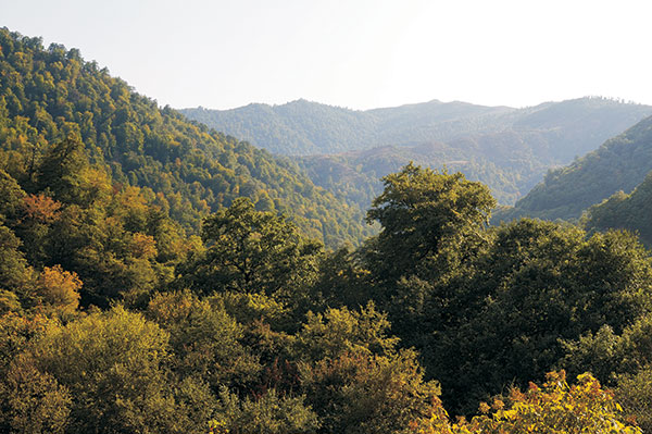
Since the establishment, the Ministry of Ecology and Natural Reserves has initiated large scale projects in the formation of forest preserves in arid areas, tree planting in the outskirts of cities, by the sides of roads and highways, the establishment of new tracks of forests, and restoration of forests by conducting consequent and proper ecological policy beginning from May 2001.
Newly established enterprises for forestation and Enterprises for Forest Protection and Restoration, operating in various regions of the country, conducted activity on forest restoration and planted new forests on the area of 7753 hectares in 2002 and the territory of 8721 hectares in 2003 in frames of the National Program. These indicators are by 1.6-1.9 higher than the volume of work, carried out in 2000-2001 accordingly.
The purposeful actions in the sphere of planting materials creation have been undertaken as well.
Thus, 12 million planting materials and 32 million planting materials were grown in 2002 and 2003 accordingly. The indicator is by 2-5 higher from that of 2000-2001 accordingly.
The forest restoration and forestation area were forecasted to reach 9000 hectares while the amount of planting materials-35 million in 2004. As a result of organizing measures, 40 million planting materials have been created, new forests been planted on the area of 3700 hectares while measures, aiming to assist in the restoration of natural resources have been conducted on the area of 5403.
Forest restoration actions in 10131 ha, forest sowing works in 2746 ha were implemented in 2013. Measures to help the natural restoration of forests were accomplished in 7385 ha.
According to the final reports of 2005, in the last reporting year, reforestation measures were carried out on 9737 hectares against 9500 hectares of reforestation measures. Of this, 3,860 hectares is afforestation. The remaining 5,877 hectares are natural recovery assistance measures. 35 mln. 38 million against the number. pieces of planting material were grown. These figures are 2-2.5 times higher than in 2000-2001 for reforestation measures, and 6-10 times higher for the cultivation of planting material.
In accordance with the requirements of the « National Program on Reforestation and Enlargement », in 2006 the plans and forecasts of reforestation measures were increased to 10,000 hectares. Currently, work is underway in this direction.
In 2013, reforestation measures were carried out on 10,131 hectares, including afforestation and sowing on 2,746 hectares. Measures to support the natural restoration of forests were carried out on 7,385 hectares.
National parks are the public lands or bodies of water of special environmental, historical, and other importance, which bear the status of governmental institutions.
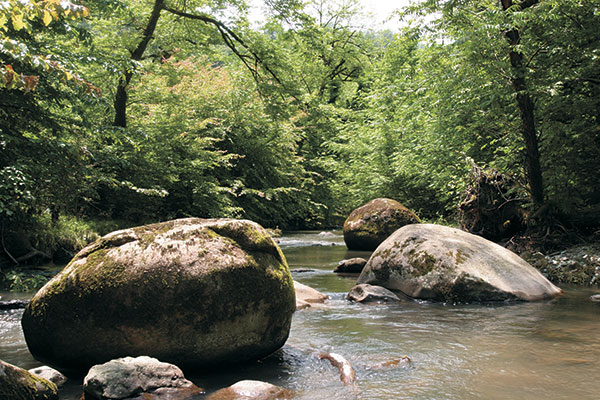
Name: Hirkan National Park
Year of foundation: 2004
Area (hectare): 40358
Location: Within the territory of Lankaran and Astara administrative districts.
Brief description: The Hirkan National Park is in the Lankaran natural region and protects the landscapes of humid subtropics. The Hirkan National Park consists of a valley area of Lankaran lowland and a mountainous landscape of Talysh Mountains. The Lankaran natural region has rich fauna and flora including many rare and endemic species. Flora of the park consists of 1, 900 species including 162 endemics, 95 rare, and 38 endangered species. There is the iron tree, three-thorned acacia (Gleditschia tricanthos), Zelkova, Quercus Castaneifolia, Fircus hyrcanys, etc. There are many endemic are rare animals, particularly, among the representatives of ground mollusks and non-flying insects. Birds’ endemism is well represented, up to subspecies level, while the species level has a relatively poor representation. The main protected objects are the natural complexes of lowland and low mountainous forest areas of the Lankaran natural region, including the unique well-preserved plot of lower forest, the ecosystem of the rare forest of the Hirkan type.
Name: Shirvan National Park
Year of foundation: 2003
Area (hectare): 54373,5
Location: Within the territory of Salyan administrative district as well as Garadagh and Neftchala districts of Baku city.
Brief description: The Shirvan National Park was established on the base of the Shirvan State Reserve founded in 1969 and neighboring areas. The reserve‘s activity is focused on the protection and reproduction of the Persian gazelle (Gazella sulgutturosa), waterfowl birds, and typical plant biotypes of the Shirvan Lowland. The area is 25800 hectares, of which 3500 hectares are water reservoirs. The territory of the park used to be at the bottom of the Caspian and at present it is an accumulative plain, which is 20-25 m below sea level with a slight increase in the relief westwards. In terms of climate, the park lies in an area of moderate warm semi-desert and arid steppe. Summers are hot and dry and winters are moderate and dry. In the park, there are several types of vegetation. The desert type is represented by Halocnemum, Halostachys, and Salicornia formations developed on solonchaks. Halocnemum vegetation occupies about 40% of the territory of the park. The main species is the Halocnemum strobilaceous. The Halostachys phylogenesis has a more complicated structure and a richer species composition than halocnemum. At the tops of the hills, halostachys grows and the slopes are covered by cereals and motley grass from the ephemeral group. Salicornia vegetation has developed in a small area of the central part of the park as a result of wet salines and the high level of groundwaters. As well as Salicornia europaea, there is also rankenive and tonkokhstnik.
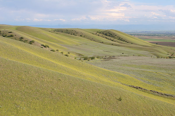
The semi-desert type of vegetation is represented by formations of sveda and ephemeral wormwood. The latter formation, which occupies 40% of the park area, has the richest species composition. Wormwood dominates, and among ephemera 20-25 species are met, including mast cereals: Poa bulbosa, Bromus, wall barley (Hordeum leporinum), etc. Meadow-type vegetation is developed in the park on chals (humid lowerings on the relief). The herbage is two-layered and is formed of Alhagi (first layer) and Aeluropus repens (second layer). In some places, Artemisia and wall barley (Hordeum leporinum) are found. The fauna is poorly studied. Among amphibians there are green toad, Hylidae and lake frog. Among reptiles there are swamp, Caspian and Mediterranean turtles, lizard, water snake (Natrix natrix) and water snake, Vipera lebetina and others. The ornitofauna is poorly studied, but according to the existing data, there is bustard (Otides), Francolinus, little bustard (Otis tetrax), white-tailed eagle (Haliaeetus albicilla), steppe eagle (Aquila nipalensis), peregrine (Falco peregrinus), saker falcon (Falco cherrug) and Pterocletes orientalis. In winter, there are many migratory birds on the water bodies: gray goose (Anser anser), mallard duck (Anas platyrhynchus), pintail (Anas acuta), and others. Among rare mammals species, there are Persian gazelle (Gazella sulguturossa), wild boar, wolf, jackal, jungle cat (Felis chaus), fox, badger, European hare, and others. Persian gazelle (Gazella sulguturossa), Francolinus francolinus, bustard (Otidis), little bustard (Otis tetrax), white-tailed eagle (Haliaeetus albicilla), steppe eagle (Aquila nipalensis), peregrine (Falco peregrinus), saker falcon (Falco cherrug), and Mediterranean turtle are listed in Red Book. The main protected objects are the natural semi-desert complexes of the south-eastern Shirvan, with the world’s biggest population of Persian gazelle (Gazella sulgutturosa) and the water-wading ecosystem, which is a place of nesting, a migration route, and wintering area for many valuable bird species (western part of the Shor-Gel Lake).
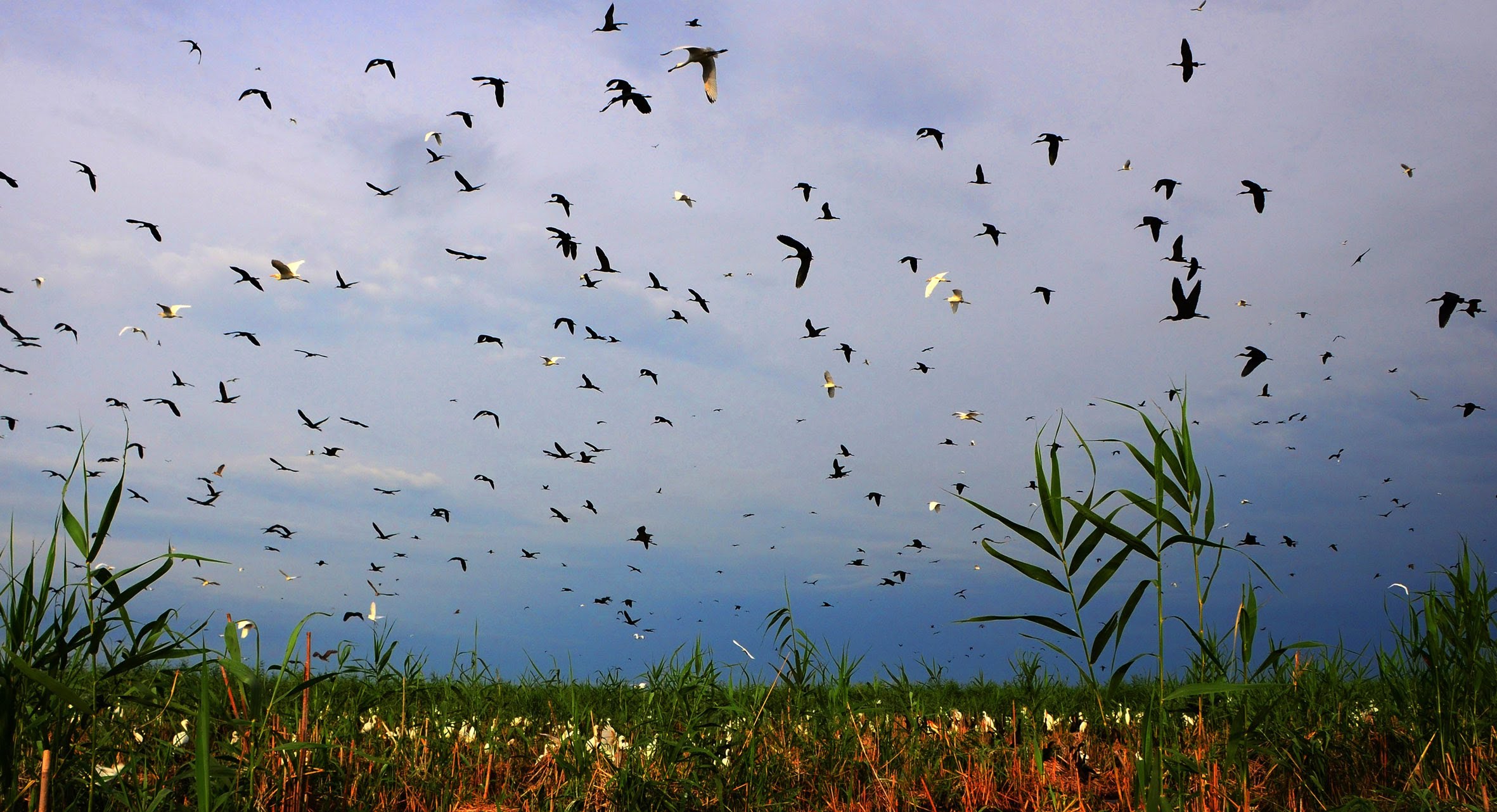
Name: Agh-Gol National Park
Year of foundation: 2003
Area (hectare): 17924
Location: Within the territory of Agjabedi and Beylagan administrative districts.
Brief description: The Agh-Gol National Park was established for the preservation of migrating routes, areas of wintering and nesting of waterfowl and water birds, as well as for breeding of commercial fish species. The area of 4400 hectares covers the water area of Lake Ag-Gel. Lake Ag-Gel (white lake) reserve is situated in the Mill steppe of the Kura-Araks Lowlands, it may be called an “ornithological oasis”: this is not only a reserved area but one of the most important places of wintering in the Republic. The Mill Steppe surrounding the lake is a slightly hilly accumulative plain, where mostly semi-desert and arid steppe type: summer is warm and dry, winter is cool. Twenty fish species inhabit the reserve: pike, erythroculter, mongolicus, carp, and others. Earlier, when the lake was connected with the River Kura, the Ichthiofauna was richer. Among amphibians, green toad, Hylidae, lake trod and others inhabit the reserve. Among reptiles, the Caspian and swamp turtles, common and water grass snakes occur. There are 134 bird species in the orilitofauna of the reserve, including 89 nesting birds. There are more than 30 specimens of Charadriiformes and 24 specimens of Anseriformes. Among the birds occurring here, there are species included in the “Red Book” — Francolinus, white-tailed eagle, white pelicans (Pelecanus onocrotalus), Dalmatian pelicans (Pelecanus Crispus), and others. Among mammals, represented by 22 species, wild boar, coypu and jungle cat (Felis chaus) are common, Unique colonial nesting places of Ciconifonnes and Totimplate birds (Pelecanifonnes) are preserved here, which are of great scientific and practical interest. The main protected objects are the water–swamp ecosystem of Lake Agh-Gol, places of mass nesting, places of rest during migration, and wintering for waterfowl and coastal birds.
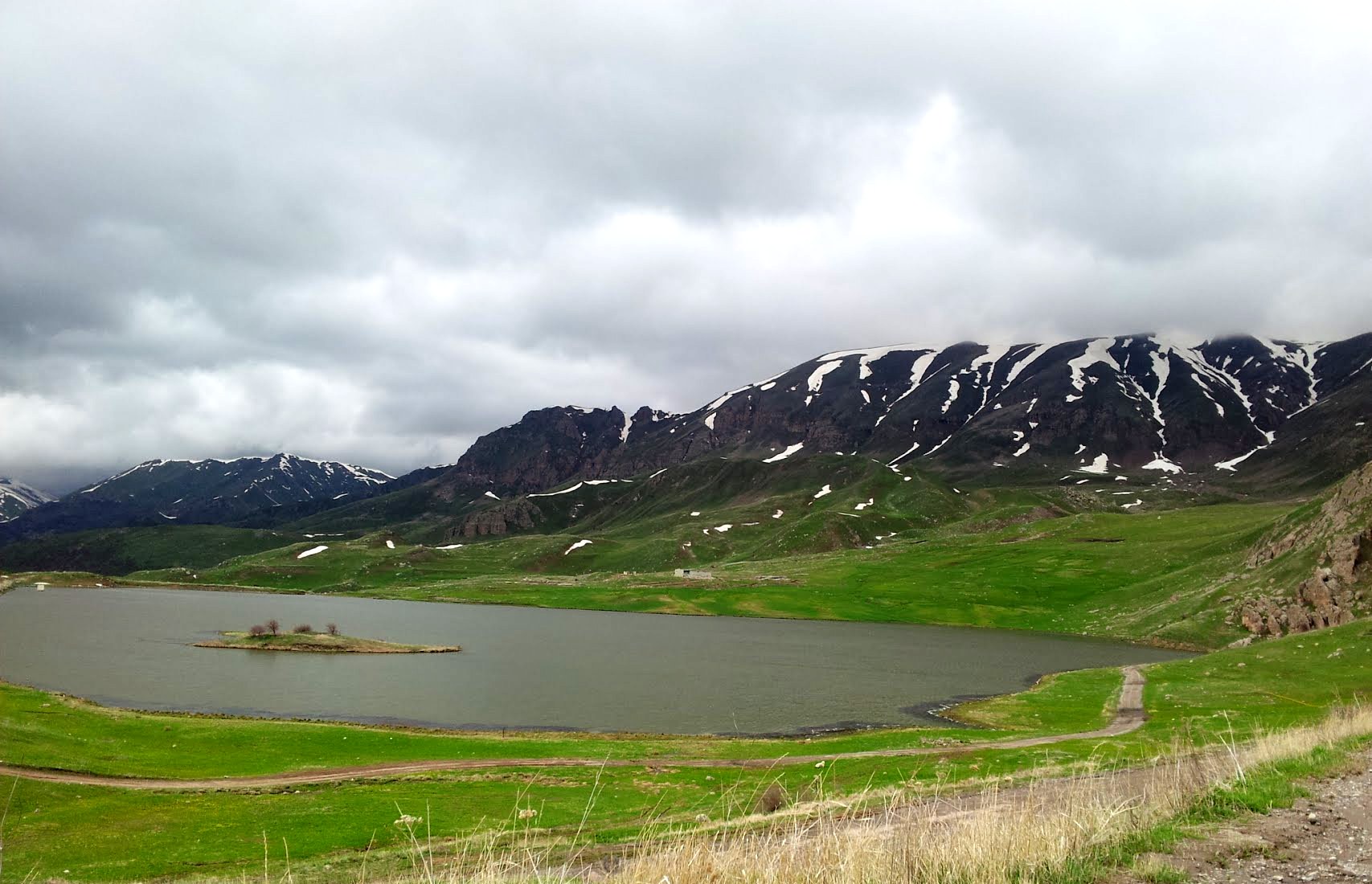
Name: Zangazur National Park named after Academician Hasan Aliyev
Year of foundation: 2009
Area (hectare): 42797,4
Location: Lesser Caucasus, Nakhchivan Autonomous Republic
Brief description: Zangazur National Park was created on 25 November 2009 in an area of 42797,4 hectares on the base of Ordubad National Park named after Academician Hasan Aliyev and Shahbuz State Nature Reserve in the Nakhchivan Autonomous Republic. It was named after Academician Hasan Aliyev who is considered as a founder of ecology in Azerbaijan. Adjoining the National Park is Ordubad State Nature Sanctuary with an area of 27870 hectares. The objective pursued in the creation of Zangazur National Park was to protect different components of the area which has a distinctive climate, terrain, and other physical geographical features as well as various animal species including endemics and species of fauna that are typical to this area. The park is also charged with the task to facilitate environmental monitoring and promote education and tourism. Zangazur’s range of mountains reaching 3200 meters on average is the highest range of the Lesser Caucasus. The highest peak of the range making 3906 meters is located in the National Park. The last third part of the Zangazur range is Soyug Dagh (Cold Mountain) which also belongs to the National Park’s area. The height of Soyug Dagh varies within a range of 2000 to 3000 meters. This part of the mountain slopes down for 12 km to south and west. It comprises steep slopes with precipices and narrow spring valleys. Eroded rocks are widespread here. In Soyuq Dagh, ancient glacial relief declines and finally disappears downwards. Zangazur National Park is a mountainous area. Its climate is generally cold characterized by dry summer. The mean temperature is -30 °C to -10 °C in January and 10 °C 25 °C in July. The annual precipitation is 300-800 mm. The watercourse network of the region is composed of Gilanchay, Vanadchay, Duylunchay, Aylishchay, Ganzachay, Kotamchay, Kilitchay, and Ordubadchay rivers. They are fed by rains and melting snow. The Araz River forms the border with Iran. The landscape of the area varies in type. Mainly, dull brown, grassland dull brown, alluvial grassland, mountainous forest, turf-type mountainous grassland terrains prevail in the area. Nakhchivan Autonomous Republic is a distinguished place in Azerbaijan for the richness of its ornitofauna. There are 217 bird species and subspecies in the region of which 15 species are listed in the Red Data Book. These are Levant Sparrowhawk, great white pelican, dalmatian pelican, white-tailed eagle, lammergeyer, short-toed eagle, great bustard, little bustards, and other birds. Six species of amphibians occur in the area of Nakhchivan Autonomous Republic. Thirty-eight species and subspecies of reptiles are found in Nakhchivan Autonomous Republic. Of them, five are turtles, twelve species, and sub-species of snakes. Mediterranean spur-thighed tortoise, Caucasian pit viper, Trans-Caucasian rat snake are all under protection and listed in the Red Data Book. Sixty-two mammal species and subspecies occur in Nakhchivan. Thirty-two of them are found in the Zangazur National Park and Ordubad State Nature Sanctuary. These are blazilius horseshoe bat, southern horseshoe bat, porcupine, manul, bezoar goat, Caucasian muflon to mention a few. The park is a habitat for a number of carnivorous animals such as leopard, wolf, jackal, fox, striped hyena, badger, wild cat, and other predators numbering 12 species in total. Zangazur National Park is also rich in rare plants, 77 grow in the Park’s area. Iris elegantissima, Himantoglossum formosum, Dorema glabrum, and other plants can be found here. Along with the diverse flora and fauna, the Zangazur National Park is the place where there are a lot of natural and historical monuments.
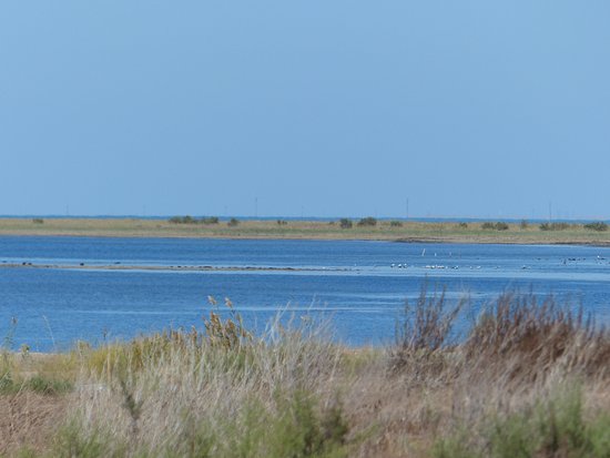
Year of foundation: 2005
Area (hectare): 783
Location: Khazar district of Baku city, Absheron peninsula.
Brief description: Absheron National Park was established on the basis of the Absheron State Nature Sanctuary in 783 ha area of administrative territory of Baku city Khazar district with the decree of the President of the Republic of Azerbaijan dated February 8, 2005. The National Park is situated in the south-eastern end of the Absheron peninsula in the Shah Dili territory. A mild hot climate of semi-desert and dry heathens prevails in the territory. The purpose of the establishment of Absheron National Park is the provision of protection of wildlife, maintenance of rare endangered flora and fauna species, as well as evaluation of existing natural opportunities for ecotourism. More than 50 bird and animal species are encountered in Absheron National Park. Nearly 25 plant species exist in the National Park.
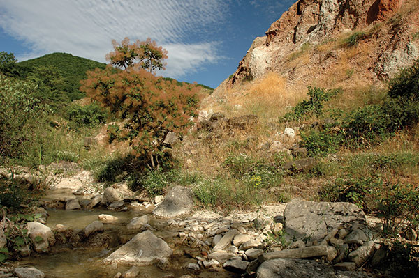
Name: Altyaghach National Park
Year of foundation: 2004
Area (hectare): 11035
Location: Within the territory of Khyzy and Siyazan administrative districts.
Brief description: Altiaghaj National Park was established in August 2004. The National Park is located in Khizi and Siyazan regions. It was created in an area of 11 035 hectares on the base of Altiaghaj State Natural Reserve and adjacent state-owned forest lands. The main objective is the creation of the National Park is to ensure the conservation of basic components of the natural landscape of the southeastern slopes of the Greater Caucasus, the rehabilitation of flora and fauna species, the implementation of environmental education along with tourism and recreation. Brown forest mountainous, humic carbon forest mountainous, steppe grassland mountainous, and other types of terrains are found in the National Park’s area. The climate here is moderately warm and dry both in winter and summer. The largest river in the area is Atachay. Taking its origin at a height of 1870 meters in Dubrar Mountain the Atachay river flows into the Caspian Sea. The major part of the park is composed of areas covered with forests. The main tree species are Caucasian oak, Caucasian hornbeam, oriental beech, ash, and birch. Shrub species occurring in the area include hawthorn, dog-rose, and blackberry. Roe deer, brown bear, wild boar, lynx, raccoon, hair, fox, squirrel, wolf of mammals and pheasant, partridge, eagle, thrush, goatsucker, ring-dove of birds are found in the National Park.
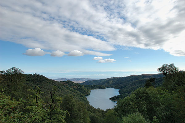
Year of foundation: 2008
Area (hectare): 12755
Olduğu yer: territory of Goygol, Dashkasan, and Goranboy districts.
Brief description: Goygol National Park was established on April 1, 2008, by the Order of the President of Azerbaijan Republic on the base of Goygol State Nature Reserve in the administrative territory of Goygol, Dashkasan, and Goranboy districts. After having the status of National Park, the territory of Goygol State Nature Reserve enlarged from 6739 hectares up to 12 755 hectares. Goygol National Park is located on the North-East part of Lesser Caucasus, on the North Slope of Kapaz Mountain, on 1000-3060 m high from the sea level and encloses medium and high mountain-forest semitones, mountain forest-meadow, subalpine and alpine zones. National Park is called by the name of Goygol Lake. And the reason for that is its transparent water which reflects surrounding green forests and blue sky as a mirror. The principal aim of the establishment of Goygol National Park is protection endemic and endangered flora and fauna species, regulation of the stability of natural complexes, creation of more favorable condition in order to carry out scientific research works, environmental monitoring, ecological awareness of population and development of ecotourism in the tourist potentially areas. Cold climate with dry winter prevails in the area. The annual temperature of the weather wavers between 4-10 degrees. Annual precipitation is 600-900 mm. The longest river in Goygol National Park is the Aghsuchay – the right branch of the Kurakchay. The biggest lake in the area is Goygol – one of the most wonderful and marvelous lakes in Azerbaijan. In 1939 as a result of the earthquake that occurred in Ganca, Kapaz mountain was tumbled down, blocked up the Aghsuchay river, and the beautiful lake – Goygol was formed. There are small lakes, such as Maralgol, Garagol, Zeligol, Aggol, Shamligol and etc. in the area. The main part of the national park has a rich vegetation cover. The mountain-forest, mountain-steppe, subalp, and alpine mountain-meadow vegetation ecosystem are spread in the area. The mountain forests covering 1100-2200 m height have a very rich vegetation cover and contain 80 trees and bush species. The main part of the forests is represented by oriental beech, oriental oak, Caucasian hornbeam, birch, ash tree, sharp-leaved maple, lime-tree of small-leaved trees, Kokh pine of coniferous. Of shrubs, cornel, barberry, dog rose, medlar, spindle-tree, blackberry, of herbs, Caucasian violet, dandelion, bellflower, noble chamomille, fescue, mat-grass and meadow-grass and etc. are met. They are especially spread in subalpine meadows. Goygol National Park is also rich for its fauna. Of mammals, Caucasian red deer, roe deer, brown bear, billy goat, badger, forest cat, sable, lynx, hare, squirrel, fox, hedgehog, Caucasian mole and etc., of birds quail, stock dove, woodcock, bearded vulture, black vulture, Egyptian vulture, eagle owl, owl, swan, black woodpecker, golden oriole, woodlark, mistle thrush and etc. are spread in the area. Rare species – Caucasian red deer and forel fish (in Goygol lake) are protected in the national park. The beautiful and variegated nature, rich flora, and fauna of Goygol National Park will enable to organization and development of ecotourism in the area by attracting tourists and visitors.
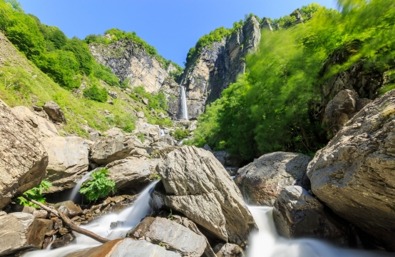
Name: Shahdagh National Park
Year of foundation: 2006
Area (hectare): 115895
Location: territory of Guba, Gusar, Ismayilli, Gabala, Oghuz, and Shamakhi districts
Brief description: Shahdag National Park was established in accordance with the decree of the President of the Republic of Azerbaijan № 1814, dated December 8, 2006. Its territory is primarily 115895 ha. Ismayilli and Pirgulu State Nature Reserves consist of 21014 ha, state forest foundation lands located in the administrative territories of Guba, Gusar, Ismayilli, Gabala, Oghuz, and Shamakhi regions compose 81797 ha and useless summer pastures in mountains situated in the heights of boundaries of those regions compose 13084 ha of the National Park. The territory of the National Park was enlarged 14613 ha with the decree of the Cabinet of Ministers of the Republic of Azerbaijan № 193/S, dated July 8, 2010, hence its territory was reached 130508 ha. The aim of the establishment of the Shahdag National Park is rehabilitation, maintenance, and management of global mountain forests and pasture ecosystems located in high mountainous areas including various endemic and endangered species and transboundary migratory animals, preservation of fertile soil layer, protection, reproduction, and enrichment of fauna and flora species characteristic for the area, as well as regulation of natural complex stability, the offer of all necessary facilities for the implementation of scientific-research works, environmental monitoring, environmental enlightenment of population and provision of development of ecotourism in the territory which has great tourism potential. The height of the National Park territory has substantially caused its climatic diversity, fertility of flora soils, and richness of animal planet. The forests located in the territory are popular with rich, fascinating, and picturesque landscapes. Vertical fluctuation and scatter of relief, complex climate conditions, and soil lay have triggered a pretty great diversity of flora.
Name: Samur-Yalama National Park
Year of foundation: 2012
Area (hectare): 11772,45
Location: District of Khachmaz
Brief description: Samur-Yalama National Park was established in the administrative territory of the district of Khachmaz by the Order of the President of the Republic of Azerbaijan of November 5, 2012. The Park covers 11772.45 hectares given in the appendix land plan of the public forest fund lands in the administrative territory of the district of Khachmaz. The National Park is rich in such herbs as dog rose, garlic, St John’s wort, blooming sally, melissa. Soil types are meadow-forest, chestnut, and light chestnut. Meadows and shrubberies are widespread. Flat forests are encountered as well. The major representatives of the animal kingdom in Khachmaz are a feral pig, raccoon, pheasant, partridge, and so on. Coastal waters are rich in fish. There are thermal and mineral springs. Khachmaz is favorable for hunting and fishing. The Association of Hunters operates here and “Guealan Goelue” Reserve is under the Association.
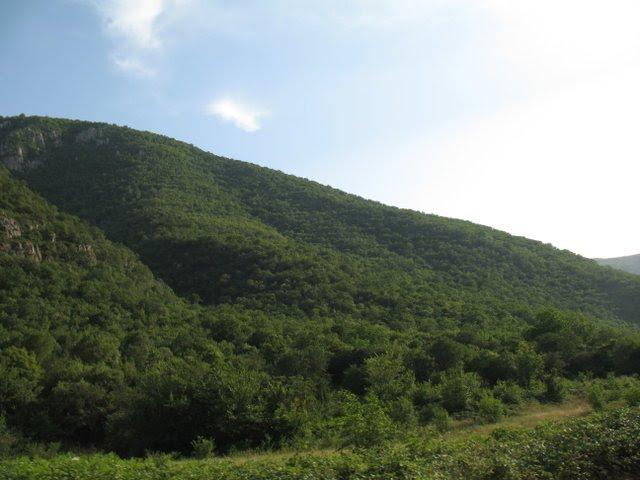
Year of foundation: 1974
Area (hectare): 107
Location: Within the territory of Zangilan administrative district, Basut-Chay valley
Description: The Basut-Chay State Reserve was established for the protection of a unique plane-tree grove. In October 1980, the area of the reserve was reduced by 10 hectares. It is consisting of Quercus Iberica and Caucasian hornbeam, while on the hilly plateau of the left bank, a forest of Celtic Caucasica and Indian Juniper (Juniperus polycarpos), Pistacia, and others are developed. Platan trees have an average age of 170 years; however, there are some real giant trees, which are up to 1,200-1,500 years old. The height of these trees is 50 m with a diameter of up to 4 m. The main protected object is the unique plane-tree grove, which is the biggest in the world. Five settlements were located around the reserve, inhabitants of which traditionally considered this plane-tree grove as their private plots.
Name: Gara-Yaz State Reserve
Year of foundation: 1978
Area (hectare): 9658
Location: Within the territory of Gazakh administrative district, on the bank of the River Kura in the Agstafa forestry
Description: The Gara-Yaz State Reserve for the protection and restoration of the Kura tugay forests. The Gara-Yaz reserve is in the western part of Azerbaijan. Its territory covers the flood lands of the River Kura and the Gara-Yaz Lowland on the left bank of the River Kura. In the region where the reserve is situated, the tugay forest and steppe lowland landscapes are typical. In the past, a continuous line of tugay forest extended along the middle and lower reaches of the River Kura, which was surrounded by forest to an extent of 600 km. The territory of the reserve is part of the quaternary accumulative lowland, sloping slightly to the River Kura. Here the climate is that of moderate warm semi-desert and arid steppe, for which a warm and dry summer and moderate winter are typical. The main protected objects are the biggest tract of tugay forests of the middle reaches of the River Kura and the rare and endangered ecosystems of tugay. Along the river, shrubbery of willow, hawthorn, barberry, Elaeagnus, and others grow.
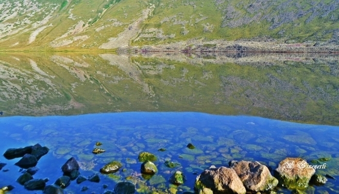
Name: Gara-Gel State Reserve
Year of foundation: 1987
Area (hectare): 240
Location: Within the territory of Lachin administrative district, on the border with Goruss district of Armenian Republic
Description: The Gara-Gel State Reserve was established for the protection of the unique ecosystem of the rare mountain Lake Gara-Gel, which is of glacier origin, and to guarantee the safety of the surrounding natural complex. Lake Ishigli-Gara-Gel is situated at a height of 2, 658 m above sea level in the southern part of the Karabakh volcanic plateau near the foothills of several mountains with a height of 3, 200-3, 500 m. the lake is a relict water reservoir, which was formed in the crater of an extinct volcano. The length of the lake is 1,950 m, its maximum width is 1, 250 m, length of its coastline is 5, 500 m, maximum depth – 7.8 m, volume of water – 10 million m3, area of the lake 13 km2. Water flow is mainly due to melted snow and rainwater, partially spring water. In terms of botany and geography, the Karabakh Plateau is situated between the Caucasian and Armenian-Iran provinces, which determines the specifics of the local flora. The flora of the reserve includes 102 species and subspecies of vascular plants from 68 general and 27 families. The lack of flora is explained by the fact that the reserve covers only the lake, and many rare and endemic species grow beyond the reserve area, but close to its borders. The vegetation of the coastal area of the lake is represented mainly by meadows with the dominance of Trifolium and Tragacantha and Astragalus. The swamp flora and vegetation are limited because of the height of the area. There are only two species of plants in the lake: Polygonum amphibian and Ranunculus. In 1967, a type of Sevan trout, included in the Red Book, was introduced into the lake. The reserve is an inter-republic reserve. It should be noted that adjacent to the borders of the reserve there are areas with rare and endangered species of plants such as Euphrasia, Potentilla, and others.
Name: Gyzyl-Agach State Reserve
Year of foundation: 1929
Area (hectare): 88360
Location: Within the territory of Lankaran administrative district, in the Great Gyzyl-Agach bay
Description: The Gyzyl-Agach State Reserve is situated on the southwestern coast of the Caspian on an area of 88.4 thousand hectares including 62 hectares of water area. It was established in 1929 for the protection and reproduction of wintering and migratory waterfowl, wader, and steppe birds. In 1975, the reserve was classified as being of international significance, mainly as a habitat for waterfowl and coastal birds. The territory of the reserve is an important place for the rest and wintering of migratory birds in the Caspian region, where many bird species from northern Europe stay. A typical feature of the Gyzyl-Agach reserve is the extreme dynamic connection between the variation in the level of the Caspian Sea, the wandering of the Kura and Araks River beds, and anthropogenic activity. At present, the territory of the reserve is coastal lowlands, which are below sea level and with a different set of natural and artificial water reservoirs. The maximum height is in the Kulagin area in the center of the reserve – 24.5 m below sea level; the minimum height varies depending on the level of the Caspian and during the period of the reserve’s existence has ranged from 26 to 29 m; in 1995 it was 26.4 m. At present, the relief of the reserve is characterized by the alternation of low (up to 1 m) ridges and open hollows, and old silty riverbeds. In some places there are separated former riverbeds – akhmazes; for the northern part, Ishores plain lowlands with salines are typical. There are 248 species of birds in the reserve, including Francolinus francolins, grey goose (Anser anser), white-fronted goose (Anseralbifrons), Little bustard (Otis tetrax), Plegadis falsinellus, Platalea leucorodia, Nycticorax nycticorax, Phoenicopteri, Branta ruficallis, peregrine falcon (Falco peregrinus), Pelecanidae, buff-backed herons (Cochlearis cochlearis), pond herons (Ardeola ralloides), swans and others. The rise in the level of the Caspian has resulted in the formation of vast shallow gulfs with rich feeding grounds, due to which the number of wintering waterfowl has increased. The great concentration of ducks and coots on the open areas of the gulfs, pink flocks of feeding flamingos (Phoenicpteri), white clouds of swans, white herons standing alone in the water. Rallidae and numerous other Limicolae and typical features of a winter view of the Gyzyl-Agach reserve. On the migration route along the western coast of the Caspian great flocks of migratory birds feed and rest. Ducks and swans are attracted by the shallow waters that are rich in sub-water vegetation and mollusks. Flocks of geese and little bustard (Otis tetrax) feed in semi-deserts. The mild climate creates favorable conditions for the wintering of hundreds of bird species. In some years 5-7 million birds have wintered here. There are also wild boar, wolf, jackal, jungle cat, badger, otter, fox, and other mammals. There are 54 species of fish in the waters of the reserve: sazan, pike perch, Rutilus frisii kutum, Mugilidae, Salmonidae, and others.
Name: Ilisu State Reserve
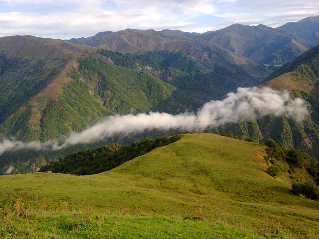
Year of foundation: 1987
Area (hectare): 17381,5
Location: Within the territory of Gakh administrative district, southern slope of the Major Caucasus
Description: The Ilisu State Reserve was established for the protection and restoration of the natural complex of the central part of southern macro-slopes of the Greater Caucasus; the preservation of species of flora and fauna, and the localization of centers of erosion to lessen the threat of mudflows. The relief is formed by a combination of mountain ridges and deep river valleys. The climate is conditioned by the geographical location of the territory, which is protected from the north by the Major Caucasus Ridge, the area’s height amplitude, and the highly indented relief. The favorable climatic conditions (soft winter, mild summer, warm spring and autumn, plenty of precipitation during the vegetation period, absence of prolonged droughts, and strong frost) contribute to the forming of luxuriant vegetation, particularly, forest vegetation. The main protected objects are the natural complexes of the middle area of the macro-slopes of the Greater Caucasus. On the territory of the reserve, there are about 300 vascular plants with more than 90 species of arboreal-shrub type. The flora of the reserve includes medicinal (about 50 species), endemic, rare, and endangered species. The yew-tree (Taxus baccata) and Raddle birch are included in the Red Book. 93% of the state reserve is under broad-leaved forests, where oak, beech, and hornbeam are dominating. Also, there are lime, nut, chestnut, ash, maple, etc. More than 150 species of vertebrates inhabit the territory of the reserve and its fauna is the same as that of the southern slopes of the Greater Caucasus Range. On the territory of the reserve, there are aurochs, deer, chamois, roe, bear, wild bear, marten, and others. Its rivers are inhabited by Forea, Barbus, etc. Amphibians are represented by the tree frog, green and common toad, frogs of Asia Minor and Caucasus. Reptiles are represented by 12 species. The territory of the reserve is inhabited by more than 90 species of birds belonging to 11 orders: black hawk, goshawk (Accipiter gentilis), kite, golden eagle (Aquila chrysalis), Gypaetus peregrinus, bearded vulture (Gypaetus barbatus), black vulture (Aegypius monachus), peregrine (Falco peregrinus), eagle owl (Bubo bubo), long-eared owl (Asio otus), scops owl (Otus scops), Picnae, etc. There are more than 60 species of migrant birds. Six species of vertebrates are included in the Red Book: wood snake (Coluber), golden eagle (Aquila chrysalis), bearded vulture (Gypaetus barbatus), duck hawk (Falco peregrinus), etc.
Name: Turian-Chay State Reserve
Year of foundation: 1958
Area (hectare): 22488
Location: Within the territory of Agdash, Oghuz, Yevlakh, Gabala administrative districts, on the right bank of the River Turian-Chay
Description: The Turian-Chay State Reserve was established for the protection and restoration of arid-arch light forest and other natural resources; and for the localization of centers of erosion at the foothills. The reserve is situated on the spurs of the Buz-Dag Ridge, in the southern foothills of the Major Caucasus, on the right bank of the River Turian-Chay in the Agdash area of the Republic. Its territory lies at a height of 400-650 m above sea level and extends for 35 km from east to west and for 5 km from north to south. The reserve is situated in an area of semi-desert and arid light forests, which mainly consist of pistachio, juniper, oak, having an important soil protecting, water protecting, and climatic significance. In the relief of the reserve lowland mountains dominate with the peaks: Pirsei-Dag (609 m), Nulbon-Dag (437 m), Archan-Dag (476 m), Olmes-Dag (544 m), and others. As a rule, they have steep, in some places denudated eroded slopes, and are separated by deep narrow valleys. The northern slopes are more gentle and covered with forests; the southern slopes are steep and strongly eroded. The general process of wind erosion has developed on the territory of the reserve. On the territory of the reserve, 60 species of trees and bushes grow. The main types of sparsely growing trees are Pistacia, fudian juniper (Juniper polucarpus), prickly juniper (Juniperus oxicedrus), Quercus Iberica, ash-tree, Celtis caucasicus, and pomegranate. Moreover, Quercus Iberica, Populus, willow, alder, Elaeagnus, and other trees also grow in this area. Two dendraflora species of the reserve – Juniperus and pomegranate are included in the Red Book. There are 24 species of mammals and 112 species of birds, 20 species of reptiles, and 3 species of amphibians in the reserve. Among the birds, there are partridge (Alectoris kakelik), Columbia formes, Cercheneis tinnunculus, griffon (Gyps fulvus), black vulture (Aegypius monachus), and others. Among mammals, there are wild boar, brown bear, badger, stone marten, lynx, jackal, European wild cat, hare, and others. Among reptiles, there are Coluber jugularis and Vipera lebetina. Along the former river- beds and channels the Caspian turtle can be found, and on the slopes of the mountain the Mediterranean turtle can be observed, which, as well as the Coluber caucasicus, is included in the Red Book. The main protected objects are the model natural complexes of the Boz-Dag Ridge with the developed pistachio-arch light forests, area of semi-desert, arid, and tugay vegetation. The state of arid light forest on the Boz-Dag is of great concern primary primarily because in spite of the productivity of the majority of tree species, including juniper, the regeneration of these forests, in general, is very slow. The establishment of the Turian-Chay reserve brought -an improvement in the situation with the regeneration of these forests. During the 40 years of the reserve’s existence, the pistachio-juniper light forest has extended its area and the general quality of trees has increased. The replacement of juniper by pistachio has almost stopped. Shrubbery and herbage lave also developed well, considerably reducing the process of soil erosion.
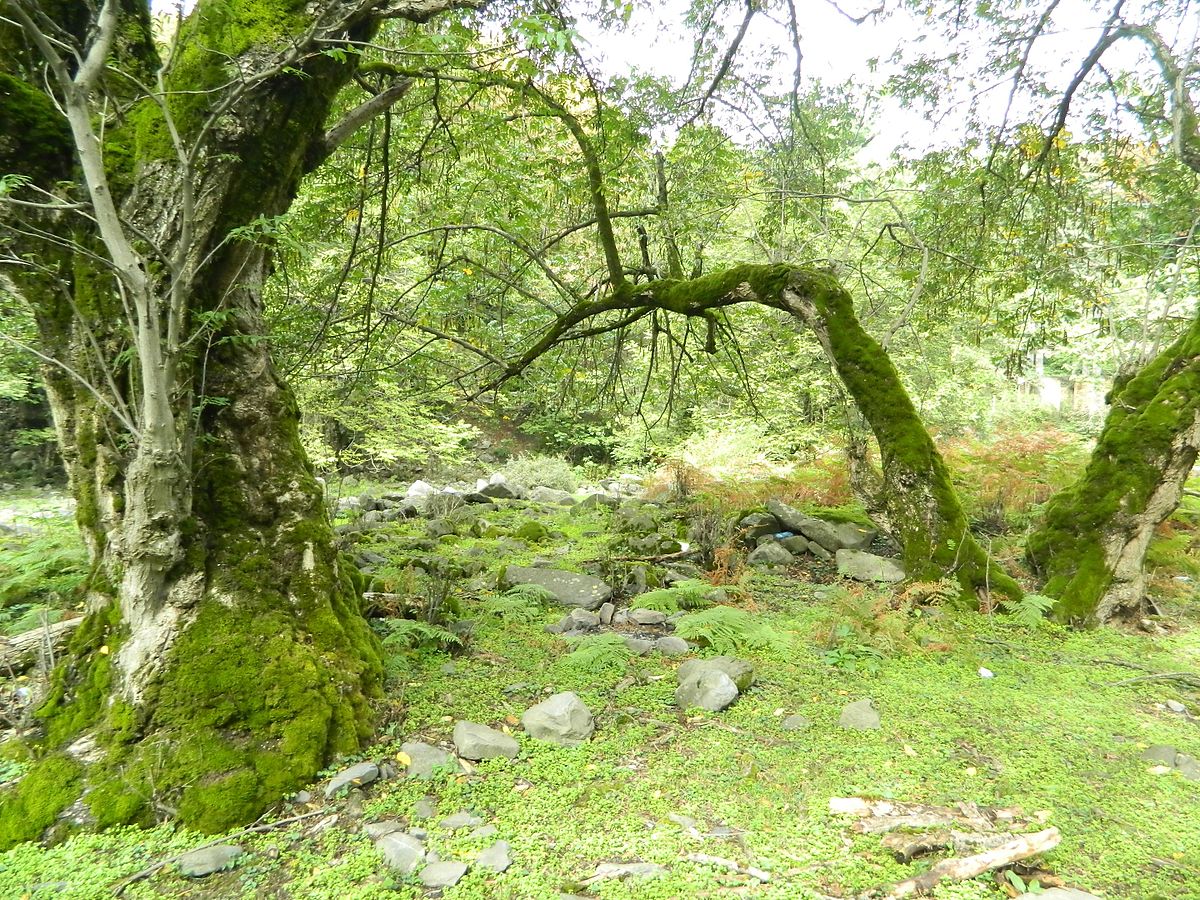
Name: Zagatala State Reserve
Year of foundation: 1929
Area (hectare): 47349
Location: Within the territory of Zagatala and Balakan administrative districts, on the southern micro slope in the middle part of the Major Caucasus Ridge
Description: The Zagatala State Reserve was established on an area of 25218 hectares, including 48 hectares of water reservoirs. During the period of its existence, the reserve has belonged to different organizations and its area and borders have been changed. The reserve is situated at a height of 650 – 3,646 m above sea level. The reserve territory has a complicated relief due to spurs of the major ridge extending to the south and south-east: Agkemal, Katslar, Rochigel, Pichgel, Khalagel, Ruchug, Mrovdag, and others, which are separated from each other by deep river valleys (canyons). Slopes with a steepness of 40-80 m and more occupy an area of more than 450 hectares; slopes with a steepness of 25-40 m prevail. The relief reflects the activity of glaciers and other forms of erosion. The asymmetry of the river basin is typical: the mountain slopes, deep canyons, and valleys are sharply shaped. The Zaqatala reserve was organized with the purpose of protecting and studying the fauna and flora of the southern slopes of the Major Caucasus. The reserve territory is referred to by botanists as the Iberian area of the Caucasus flora province. At the end of the Tertiary period, the forests of this area had a different composition, with a considerable touch of elements of the Hirkan forests, and were much richer than the present ones. The contemporary flora of the reserve has more than a thousand species. Such representatives of ancient plants as rhododendron yellow, Laurocerasus officinalis, Caucasian bilberry-bush, Taxus baccata, maple, Polypodiophyta, and others are preserved on this territory. The main forest–forming species of the reserve – Fagus Orientalis, as well as Quercus Iberica and Corylus colurna are also referred to as ancient plants. The representatives of rare plants: Taxus baccata, apple tree, ash tree, birch tree, cherry tree, pear tree, and others are observed as well. The fauna of the reserve is rich in species composition. They are Dagestan aurochs, chamois, red deer, roe, brown bear, fox, badger, Mustela nivalis, pine marten and stone marten, lynx, squirrel, and others. There are 104 species of birds, including some birds of prey: long-eared owl, golden eagle (Aquilla chrysaetos), Cerchneis tinnunculus, Neophron percnopterus, griffon (Gyps fulvus), bearded vulture (Cypaetus barbatus), black vulture, and others. There are some rare, specially protected species of birds: bearded vulture (Gypaetus barbatus), golden eagle (Aquilla chrysaetus), peregrine (Falco peregrinus), Tetraogallus, Accipiter badius, which are registered in the Red Book.
Name: Korchay State Nature Reserve
Year of foundation: 2008
Area (hectare): 4833,6
Location: Within the territory of Goranboy District
Description: By Decree No 2745 of the President of Azerbaijan Republic dated April 01, 2008, in the administrative area of 4833.6 ha of Goranboy Korchay State Natural Reserve was established. The main purpose of the establishment was the preservation of Bozdagh natural landscape, rare and endangered animal species. The land cover consists of ordinary and light brown, partly alluvial-meadow soils of different degrees. The landscape consists of the plains, hills, and low mountains (Bozdag) areas. Semi-desert and dry steppe climate with dry winters dominate in the area. Vegetation consists of wormwood plant groups, plants of the river deposits, ephemerides. The natural landscape of these areas is of great importance for animals and birds. From animals that were included in the « Red Book » gazelle and partridge can be noted particularly. From mammals, gazelles, hares, foxes, jackals, wolves, birds partridge, etc. are spread here.

Name: Eldar pine-tree State Reserve
Year of foundation: 2004
Area (hectare): 1686
Location: Within the territory of Samukh administrative district.
Description: The Eldar pine-tree State Reserve was established to preserve the genetic heritage, biological diversity of ecological systems, unique forests of Eldar pine trees. The pine trees growing here are 100-120 years old and 2-6 m high. Fauna in this reserved area is not very variable – among animals, only hares inhabit here and among birds – partridges. Eldar pine tree is included in the Red Book of Azerbaijan Republic.
Name: Shirvan State Natural Reserve
Year of foundation: 1969
Area (hectare): 6232
Location: Within the territory of Salyan and Neftchala administrative districts
Description: The reserve was established in a part of Bendovan State Nature Reserve for the purpose of protecting and increasing the number of gazelles and water birds. The area of the reserve was expanded to 25.8 thousand hectares in 1982. Water reserves account for 3.5 hectares of the area. The reserves are characterized by rich ornithological fauna. Rare and valuable birds nest and winter in the swampy areas. The biggest part of the reserve was transferred to the Shirvan National Park in 2003 and the area of the reserve currently totals 6232 hectares. Shirvan National Park was established by a decree of the president of Azerbaijan on July 5, 2003, and thus the area of the reserve remained changeless.
Name: A group of mud volcanoes of Baku and Absheron State Nature Reserve
Year of foundation: 2007
Location: Baku and Absheron peninsula
Description: A group of mud volcanoes of Baku and Absheron State Nature Reserve was established in 2007. Azerbaijan is known as a unique and classic region of the development of mud volcanoes on the Earth. More than 300 mud volcanoes out of 800 on the planet are located on the east and the bordering area of the Caspian Sea. Most of the mud volcanoes were spread in Baku and the Absheron peninsula and some of them considered a natural monuments. With full firmness, Azerbaijan may be called the land of volcanoes and these volcanoes are our national and natural wealth. For natural appearance and characteristics, 23 mud volcano was given a status of the geological natural monuments, in order to organize reliable protection of the mud volcanoes in the Ministry of Environment and Natural Resources » The Scientific Coordination Council on Mud volcanoes « was established with the participation of specialists of the National Academy of Sciences.
Name: State Game Reserve of Barda
Year of foundation: 1966
Area (hectare): 7500
Location: Barda and Aghdam
Description: The State Game Reserve of Barda established on the base of the Ayridjan protected area, which had existed since 1930 on forestry lands. The main purpose of the area is the preservation and restoration of the number of Phasianus, Francolinus and hare. This protected area is referred to as a fauna-type area.
Name: State Game Reserve of Sheki
Year of foundation: 1964
Area (hectare): 10 350
Location: Within the territory of Sheki administrative district, at the basin of the River Ayrichay, between the roads Yevlakh-Sheki and Sheki-Oghuz.
Description: It is referred to as a fauna type of protected area, and serves to protect and restore the number of Pheasants (Phasianus) and other valuable birds.
Name: State Game Reserve of the Glinani (Clay) Island
Year of foundation: 1964
Area (hectare): 400
Location: Within the territory of Garadagh district of Baku city.
Description: The State Game Reserve of the Glinani (Clay) Island was established on an island in the Caspian Sea near the Apsheron Peninsula. It is referred to as a fauna type of protected area and serves to protect migratory and wintering waterfowl birds, sea-gull colonies, and Caspian seal rookeries.
Name: State Game Reserve of Bandovan
Year of foundation: 1961
Area (hectare): 4930
Location: On the border of Salyan and Garadagh districts.
Description: The State Game Reserve of Bandovan is referred to as of the fauna type and has been established for the protection and restoration of the number of Persian gazelle (Gazella sulgutturosa), waterfowl birds, and Little bustard (Otis tetrax). It borders the Shirvan National Park. In its fauna and flora, it is similar to Shirvan park.
Name: State Game Reserve of Gerchay
Year of foundation: 1961
Area (hectare): 15 000
Location: Within the territory of Khanlar and Goramboy administrative districts.
Description: State Game Reserve of Gerchay was established for the protection of the population of Persian gazelle (Gazella sulgutturosa).
Name: State Game Reserve of Lachin
Year of foundation: 1961
Area (hectare): 21 370
Location: Within the territory of Lachin administrative district (border with Armenia).
Description: The State Game Reserve of Lachin Создан was established for the preservation and restoration of the number of bezoar goat (Capra aegagrus), Caucasian brown bear, wild boar, and hare.
Name: State Game Reserve of Gusar
Year of foundation: 1964
Area (hectare): 15 000
Location: Within the territory of the Gusar administrative district.
Description: The State Game Reserve of Gusar was established for the preservation and restoration of the number of grey partridge (Perdix perdix), pheasants (Phasianus), roe, wild boar, and hare.
Name: State Game Reserve of Shamkir
Year of foundation: 1964
Area (hectare): 10 000
Location: Within the territory of Shamkir administrative district.
Description: The State Game Reserve of Shamkir was established for the preservation and restoration of the number of pheasants (Phasianus), Francolinus francolins, partridge (Alectoris kakelik), waterfowl birds.
Name: State Game Reserve of Zuvand
Year of foundation: 1969
Area (hectare): 15 000
Location: Within the territory of Lerik and Yardimli administrative districts.
Description: The State Game Reserve of Zuvand was established for the protection and restoration of the number of pheasant (Phasianus), partridge (Alectoris kakelik), roe, wild boar, Transcaucasian brown bear, leopard and rare reptile species.
Name: State Game Reserve of Ismailli
Year of foundation: 1969
Area (hectare): 23 438
Location: Within the territory of Ismailli and Gabala administrative districts.
Description: The State Game Reserve of Ismailli was established for the protection and restoration of the number of Caucasian red deer, chamois, goat, roe, wild boar, Transcaucasian brown bear, marten, Caucasian black cock, Tetraogallus and others. The flora and fauna are similar to those of the Ismailli reserve.
Name: State Game Reserve of Gubadly
Year of foundation: 1969
Area (hectare): 20,000
Location: Within the territory of Gubadly and Lachin administrative districts.
Description: The State Game Reserve of Gubadly was established for the preservation and restoration of the number of Caucasian brown bears, bezoar goat (Capra aegagrus), wild boar, roe, and others.
Name: State Game Reserve of Small Gyzyl-Agach
Year of foundation: 1978
Area (hectare): 10 700
Location: Within the territory of Lankaran administrative district, in the middle and south parts of the Small Gyzyl-Agach bay.
Description: The State Game Reserve of Small Gyzyl-Agach was established for the protection and restoration of the number of wintering, migrating, and wintering waterfowl-wader and coastal birds, including rare and endangered species. It borders the Gyzyl-Agach reserve and has similar flora and fauna.
Name: State Game Reserve of Gyzylja
Year of foundation: 1984
Area (hectare): 5135
Location: Within the territory of Gedabey administrative district, in the area of the Gyzylja forestry.
Description: The State Game Reserve of Gyzylja was established for the protection and restoration of natural complexes on the eastern slopes of the Minor Caucasian Ridge, also for the restoration of the number of rare and endemic species of plants and animals.
Name: State Game Reserve of Dashalty
Year of foundation: 1981
Area (hectare): 450
Location: Within the territory of Shusha administrative district, in the outskirts of Shusha city.
Description: The State Game Reserve of Dashalty was established for the preservation of the unique natural complex and landscape of the Minor Caucasus. Since 1992 it is under occupation and was severely damaged during military operations.
Name: State Game Reserve of Arazboyu
Year of foundation: 1993
Area (hectare): 2,200
Location: Within the territory of Zangilan administrative district.
Description: The State Game Reserve of Arazboyu was established for the protection and restoration of the unique natural complexes of the Araks tugay forests. At present, it is under occupation and is only on the verge of complete degradation.
Name: State Game Reserve of Gabala
Year of foundation: 1993
Area (hectare): 39 700
Location: Within the territory of Gabala administrative district.
Description: The State Game Reserve of Gabala was established for the preservation of forest landscapes on the southern slopes of the Major Caucasus Ridge and the restoration of the number of rare and endangered species of flora and fauna.
Name: State Game Reserve of Gakh
Year of foundation: 2003
Area (hectare): 36 836
Location: Within the territory of the Gakh administrative district, on the border with the Ilisu State Reserve.
Description: The State Game Reserve of Gakh was established for the protection of endangered species of animals.
Name: State Game Reserve of Garayazi-Agstafa
Year of foundation: 1964
Area (hectare): 11 970
Location: Within the territory of Agstafa administrative district, in the area of Garayazi forests.
Description: The State Game Reserve of Garayazi-Agstafa was established for the protection of forest landscapes, animals, and birds. There are deers, wild boars, wolves, foxes, and hares.
Name: Hirkan State Nature Sanctuary
Year of foundation: 2005
Area (hectare): 2252
Location: Lankaran and Astara
Description: Restrictions: Hunting and fishery of protected fauna species Conservation values: Endemic species and unique flora and fauna Hirkan Public Game Reserve were established in December 2005 within 2252 hectares on the basis of forest fund in administrative territories of districts of Lankaran and Astara. The key goal is the preservation of forests adjoining Hirkan National Park, the routes of migration of unique and endangered animals included in the Red List of the Republic of Azerbaijan, the integrity of ecosystem and biodiversity in those areas. Important species Leopard, a large number of endemic species, sub-tropical forests, Ironwood.
Name: Zagatala State Nature Sanctuary
Year of foundation: 2008
Area (hectare): 6557
Location: Zagatala and Balakan
Description: Zagatala Public Game Reserve was established in November 2008 within 6557 hectares on the basis of summer pastures, forest fund of the forest conservation and restoration agency of Balakan district in administrative territories of districts of Zagatala and Balakan. The key objective is coverage of the unified ecosystem in the areas neighboring Zagatala Public Reserve, protection of biodiversity, the routes of migration of unique and endangered animals.
Name: Arpachay State Nature Sanctuary
Year of foundation: 2009
Area (hectare): 68 911
Location: Districts of Sharur, Kangarli, Babek, and Shahbuz
Description: Established upon the decree of the Supreme Assembly of the Autonomous Republic of Nakhchivan of June 22, 2009. Purpose: conservation of nature complexes or their components, to keep an ecological balance. Location: territories along Dereleyi Range (administrative territories of districts of Sharur, Kangarli, Babek, and Shahbuz). Area: 68911 ha. Vegetation: juniper, Himantoglossum formosum, iris. Animals: leopard, polecat, bezoar goat, moufflon, Caspian snowcock, bearded eagle.
Name: Rvarud State Nature Sanctuary
Year of foundation: 2009
Area (hectare): 510
Location: Lerik region
Description: Rvarud Public Game Reserve was established by the order of the Cabinet of Ministers of the Republic of Azerbaijan of October 2, 2009, within 510 hectares in the district of Lerik.
Name: Ordubad State Nature Sanctuary
Year of foundation: 1969
Area (hectare): 27 869
Location: Ordubad region (Nakhchivan M.R.)
Description: Established in July 1969 in Ordubad district of the Autonomous Republic of Nakhchivan. 12131 hectares of administrative territory of Ordubad district was declared a national park upon the order of the President of the Republic of Azerbaijan of June 16, 2003. The Game Reserve covers 27869 hectares. The goal is to preserve such unique and precious animals in the area as bezoar goat, chamois, rock squirrel, wolf, jackal, fox, turaj, partridge, pheasant, quail, wood-pigeon. Important species Black francolin, Chucar, Wood pigeon, Quail, Pheasant, Bezoar goat, Marten, Wolf, Jackal, Fox, Leopard.
Name: Arazboyu State Nature Sanctuary
Year of foundation: 2005
Area (hectare): 9118
Location: Nakhchivan AR (Districts of Sederek, Sharur, Kangarli, Babek, Julfa, and Ordubad)
Description: Established on September 23, 2005, upon order of the Speaker of the Supreme Assembly of the Autonomous Republic of Nakhchivan. Purpose: conservation of nature complexes or their components, to keep an ecological balance. Location: territories along Araz River (administrative territories of districts of Sederek, Sharur, Kangarli, Babek, Julfa, and Ordubad). Area: 9118 ha. Vegetation: Araz oak, celtis, iris. Animals: curly-feather and pink pelicans, spoonbill, bearded eagle, cane cat, manul cat.